THE IDEA
I had never been to Yosemite before, so I wanted to make my first time worth something. I didn’t have to research for long before I found dozens of reviews calling Yosemite’s Panorama Trail one of the most scenic and must-see of the park. The 8.5 mile trail was marked “challenging” on most websites, so I could think of no word other than “grueling” to describe the round-trip version of this trip I had conjured on my own.
GETTING THERE – 1:45 a.m.
My alarm was set for 1:45 a.m., and I was out the door by 2:00. This was a late Friday night/Saturday morning for San Francisco, so I wasn’t surprised to see a number of drivers out around the city. Once passing through Oakland, though, it was smooth sailing. Around 4:00 I hit highway 120, which I knew would take me all the way to the West gates of the park, so I stopped for gas, coffee, and donuts. It probably only took me a little over an hour to reach the entrance of the park, making a grand total of 3 hours from my start in SF. However, and I’m glad I had called the park ranger in advance for this tip, I drove for 1.25 hours within Yosemite before reaching my destination, Glacier Point. As she reminded me the day before, it’s a big, big park.
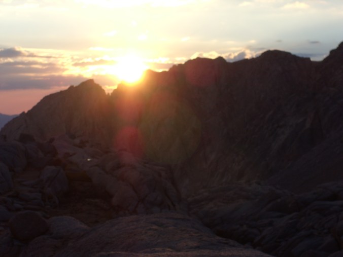
I reached the Glacier Point parking lot at 6:15, and enjoyed the dawn on the steps of the large stone amphitheater carved into the side of the hill, overlooking Yosemite’s granite walls and Half Dome at the center of it. The sun started peeking over the hills at 6:30, and I soaked in the rays like a smile for a couple of minutes before beginning my journey.

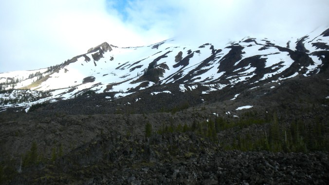
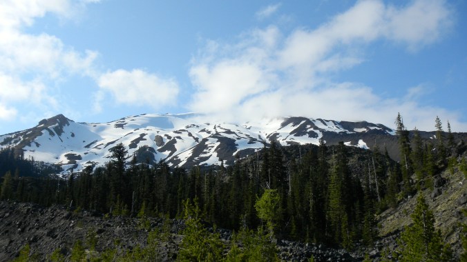
First 10 minutes of day break, descending the Panorama Trail from Glacier Point
SUNRISE START – 6:45
I opted to take the road less traveled for this trip. By beating the crowds with a sunrise start, I hiked for nearly 4.5 hours alone and uninterrupted. Since Glacier Point is around 25 miles and a couple thousand vertical feet outside of Yosemite Valley, it’s a much more popular afternoon destination for hikers than morning. So in this planning, I walked against the first crowds I encountered in the later morning coming up from the Valley, and again walked the opposite direction of hikers in the afternoon who were descending from Glacier Point. The direction and timing were perfect for a solo adventure, if not a completely delusional undertaking.
DESCENT
It’s counter-intuitive to begin a day hiking down the side of a mountain, rather than up it. In fact the early morning descending slope went against everything that my body was prepared for. That being said, it was a nice hike down, and a warm day even at 7:00 a.m.
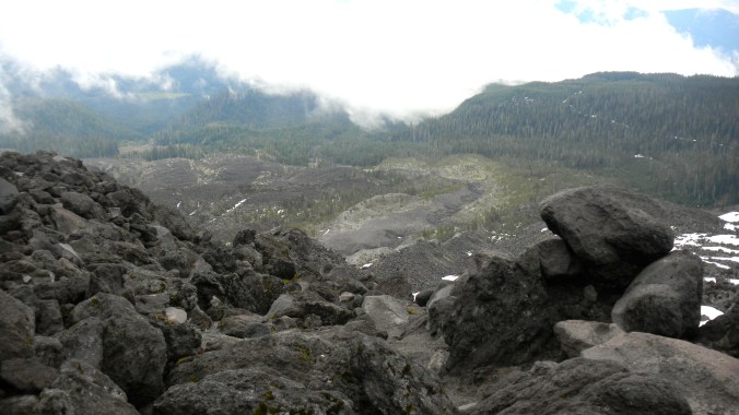
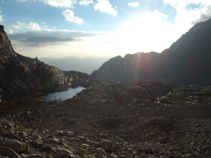
Throughout the entire day, it was easy to stay on track. Each trail was clearly marked, and there were numerous intersections that allowed me to check my distance about every two miles. After the first 2.5 miles, I saw the large granite slabs that surround Illilouette Fall, and crossed a wooden footbridge to the only uphill section going this direction. Keeping my eyes peeled for the lookout spot I’d read so much about – and which makes this trail so unique – I soon saw the unmarked grey path in a little less than a mile. This path that veers to the left off of the main drag takes you to Panorama Point, which was hands-down the most beautiful view I saw all day.

Overlooking Panorama Point
I continued down the traditional Panorama hiking route, past Nevada Fall and Vernal Fall. The top of Nevada Fall offers another vantage point to look out across the park, and walking down the steep, crooked steps that parallel Vernal Fall gave me a cool break from the sun with its shadowed slopes and mist coming off from the waterfall. I read that these were two of the most impressive waterfalls in the park.
Now, note: The small stone steps that line Vernal Fall barely allow 2 bodies to pass through or past each other, so things get bottlenecked here pretty easily. But really, the only point that was inundated with crowds was once I reached the Valley floor, which was packed with people starting the hike up.
TURNAROUND – 10:30-10:50
The trail runs into road at the Happy Isles Trailhead, where I found a shuttle stop for the Valley’s free transportation. There was a snack stand that wasn’t open yet, so I began walking about a half mile to Curry Village hoping to find food. Alas, I did not, and sat on a boulder on the side of the road for a snack and a quick break before I started back up.
ASCENT
A mile past the Happy Isles Trailhead, the path splits left up the Mist Trail and right up the John Muir Trail. These are equidistant in length and meet back up in just about a mile, only difference is avoiding the slower hikers on the steep slopes of the Mist Trail. I did run into a couple of thru-hikers who were following the entire 221-mile John Muir Trail from Yosemite National Park to Mt. Whitney. They were pretty clean looking, so I had to imagine that they were following the traditional north-to-south route.

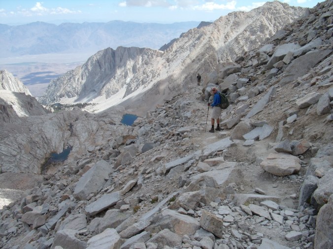
John Muir Trail to top of Nevada Fall
My time down and my time up were nearly identical, 4 hours either way. In the morning I had taken my time to venture off of the trail for the detours mentioned above (Panorama Point, Nevada Falls), and in the afternoon I had significantly slowed my pace and doubled my number of stops for rest and water. By the end of the day I had drunken almost all of the three liters I had brought with me.
END – 3:00
The last four miles of this trail were grueling, if not for the afternoon heat intensifying, but for the psychological torment of ending a day-long hike headed uphill, rather than down. But finally, over 19 miles and 6,100 elevation gain later, I made it to the top, much sweatier and more sunburnt than when I’d started.
QUICK STATS
- 17 miles (with no detours) – 19.5 miles for me
- Estimated 5,000 elevation gain
- 8 hours