Four Volcanoes, Five Days, and Endless Tacos: Climbing Mexico’s Highest Peaks

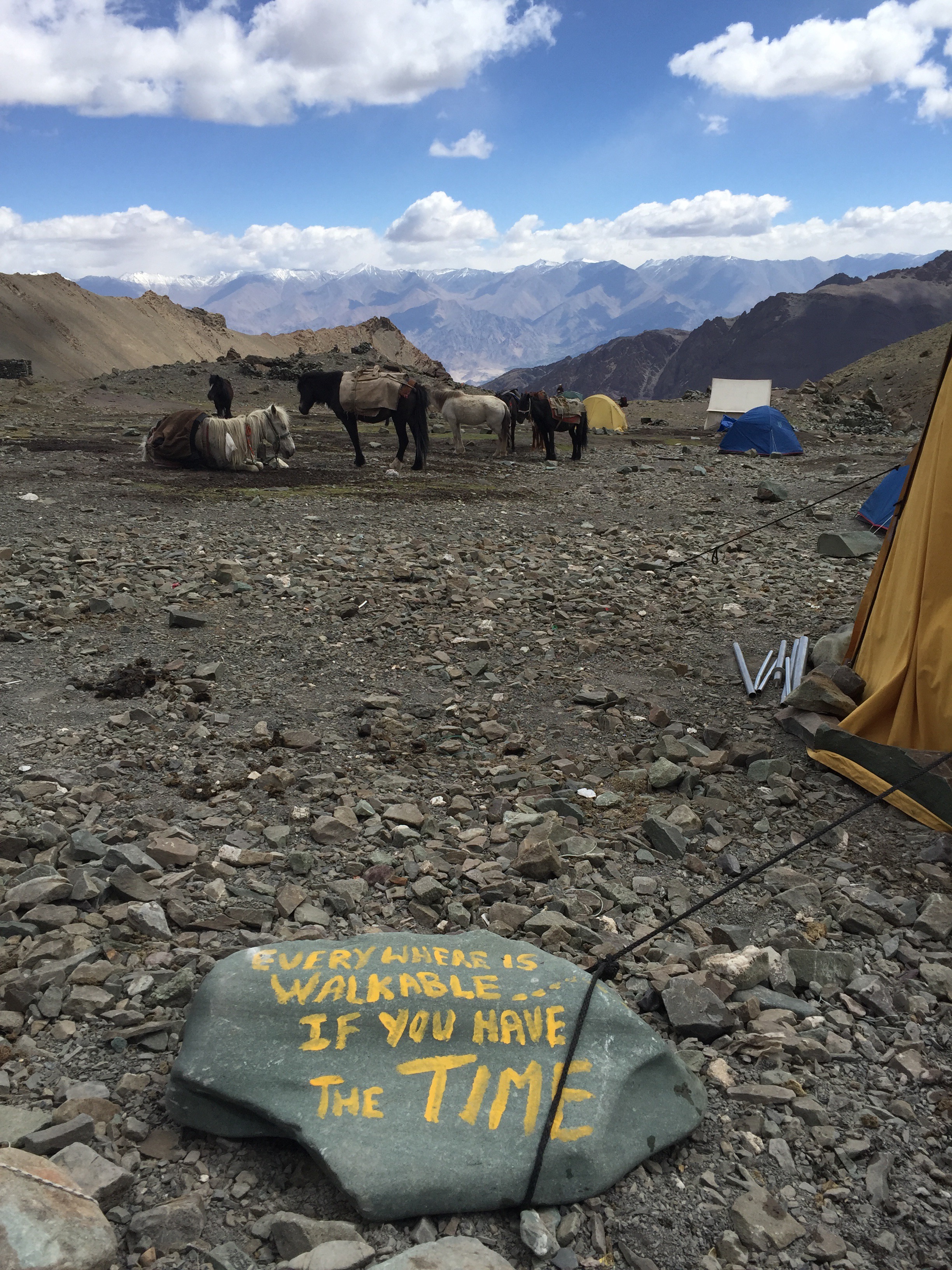
Last week I had the privilege and pleasure of joining a group of mountaineering friends in Mexico on one of the toughest climbing programs I’ve ever participated in. What I expected to be a typical acclimatization-then-climb schedule turned out to be anything but that. Our international team sought to summit a series of 15k, 14k, 17k, and 18k foot volcanoes over the course of a working week. Crazy? Yes. Doable? Surprisingly, yes.

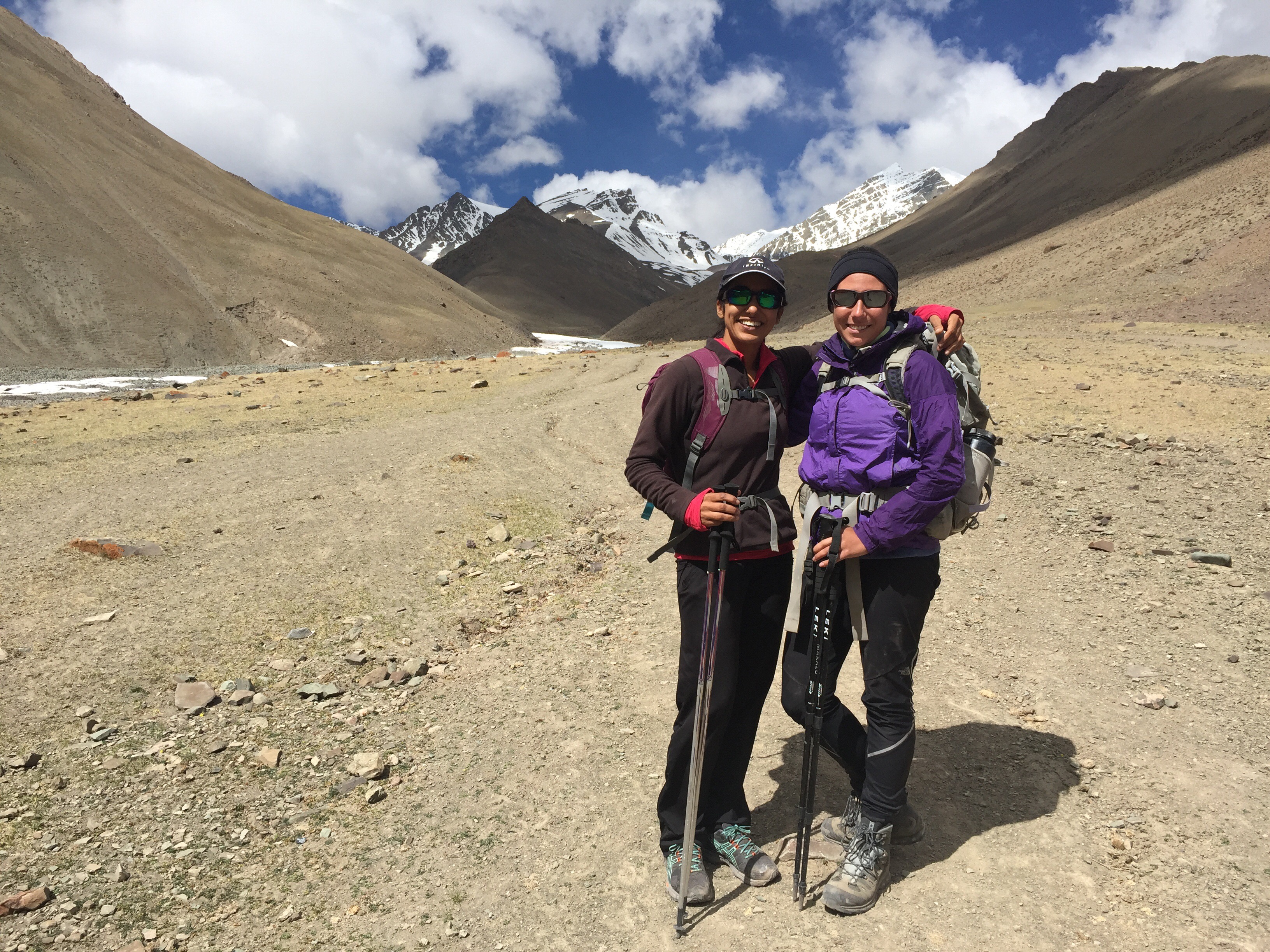
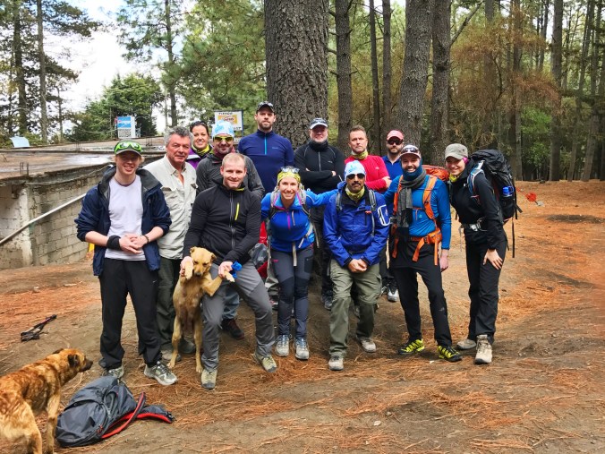
The 13 of us came from every corner of the world: Norway and England, Canada and the United States, even India. We had varying levels of mountaineering experience under our belts, from seasoned Everest-summiters to first-time climbers. But most importantly, we all shared a positive attitude and were bursting at the seams with excitement over this incredible adventure.

Here’s a walk through our high-intensity, high-altitude itinerary of four volcano climbs in five days.

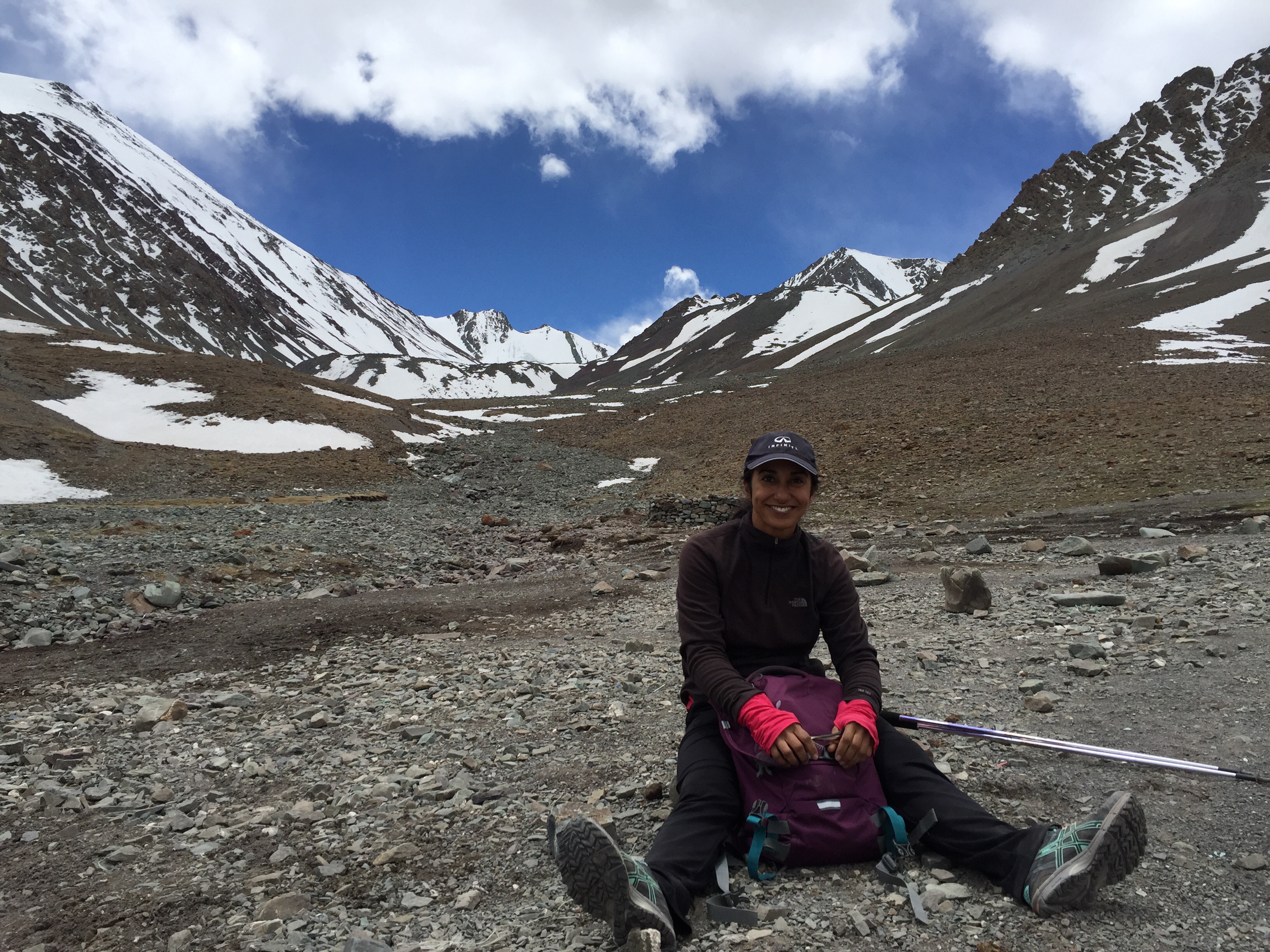
  1. Nevado de Toluca (15,354’)

Overview: 6 miles + 1900 feet elevation gain

IMG_8168

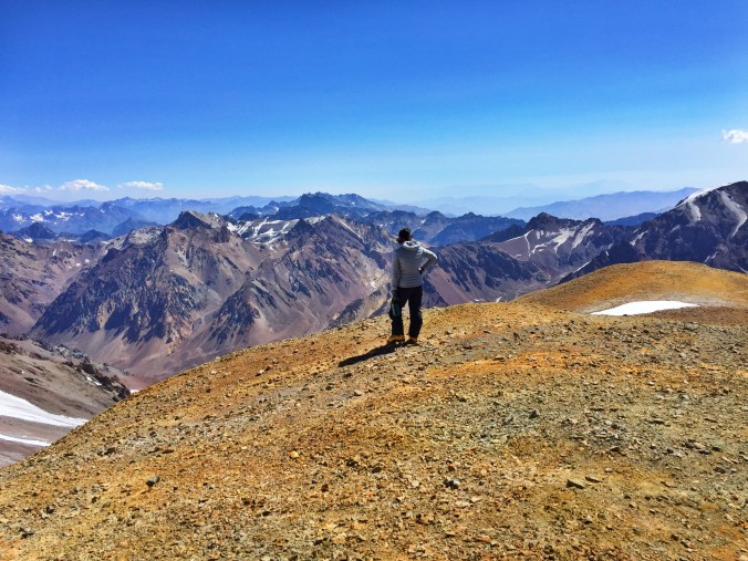
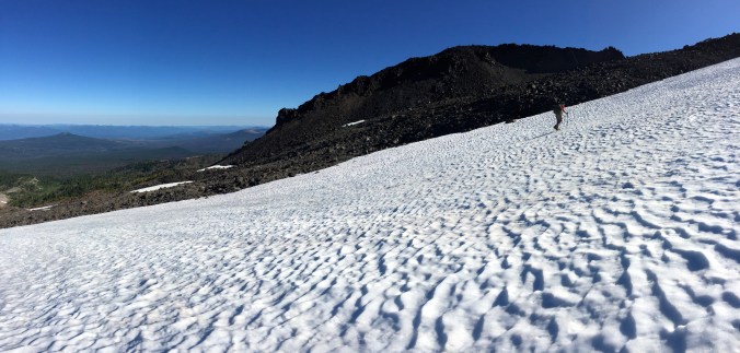
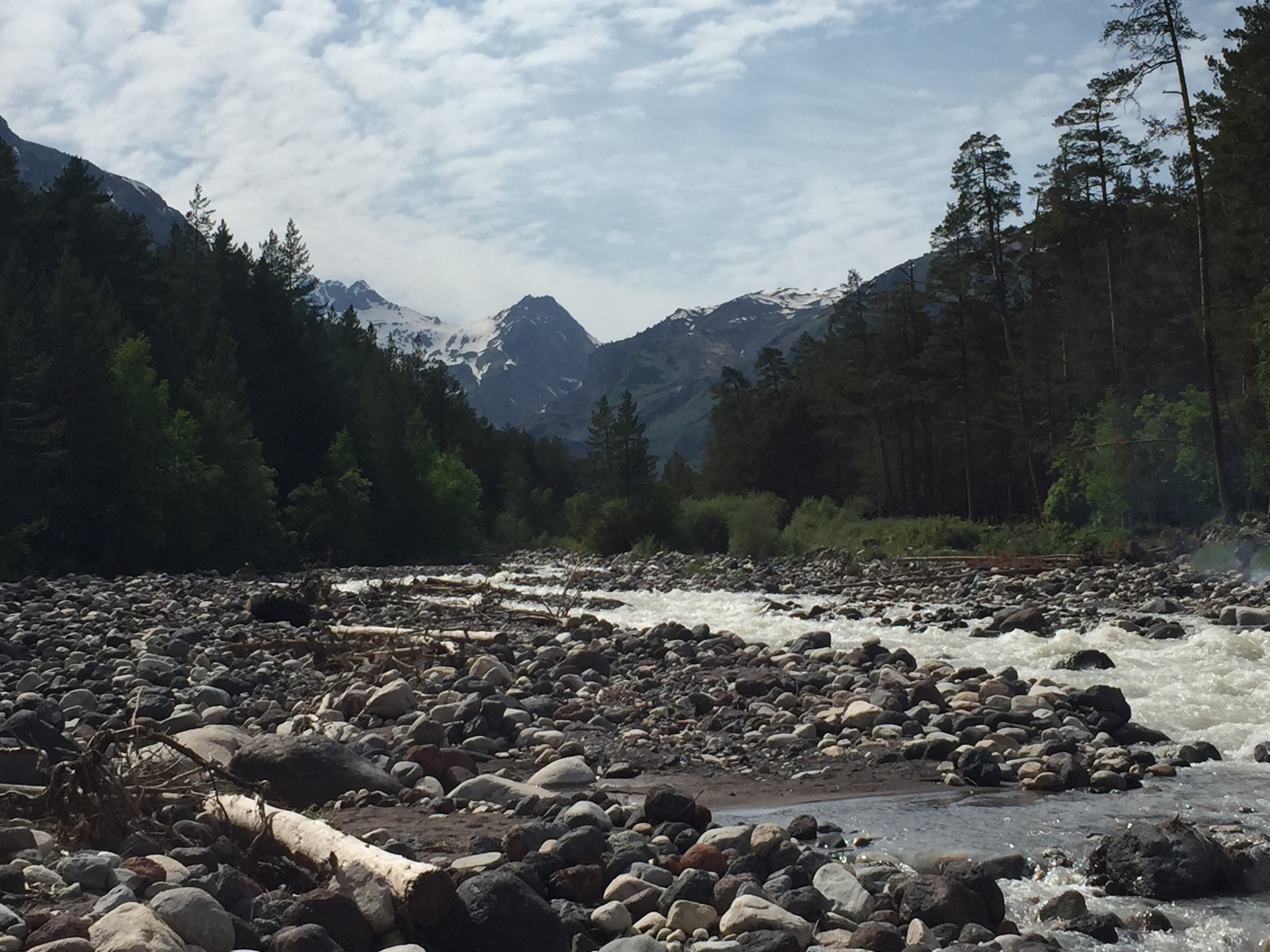
The Nevado de Toluca National Park is touted as a family-friendly, crowded weekend getaway for local Mexicans – which, by all means, it is. But the imposing summit of Toluca casting down on the sibling lakes of Laguna de la Luna and Laguna de la Sol draws in a different crowd… the type that like to get their hands dirty and fingernails gritty on sharp, steep granite and climb their ways to the top.

We moved fast, spending about an hour on the park’s designated trails before reaching a class 2 or 3 scramble (American grade) that led us up another hour to the summit. Being mid-March, we were just weeks away from Mexico’s wet season and saw the weather changes full force on each of our climbs. Afternoon snowstorms were to be expected.

At the end of our first day, we were all feeling a little more sore than expected, but still stoked for the days to come. We heeded our leader’s warning: It’ll only get tougher.

  1. Malinche (14,636’)

Overview: 7 miles + 3700 feet elevation gain

IMG_8263

Our climb in La Malinche National Park reminded me of everything I learned about mountaineering on Central Oregon’s volcanoes – including insane amounts of scree.

But far before we hit scree, we enjoyed hiking through a classic Mexican jungle scenery, with thick wooded forests that had tropical canopy tops. We followed a trail for what felt like endless miles until we breached the tree line and set our sights on the summit of Malinche. Everyone appreciated today’s straightforward climb, as there was no guessing which way to go: All slopes point to up.

After everyone celebrated a teammate’s birthday on top with a gigantic Mexican cake and candles (you can’t make this up), we began the long, slow journey down. It was during this relentless descent of our second day that the group began to understand that our weeklong program wasn’t a typical guided itinerary.

My best piece of advice for Malinche hikers: Stick around after your climb to visit the restaurant at base camp / parking lot area, and trust the hostess to tell you what’s good that day.

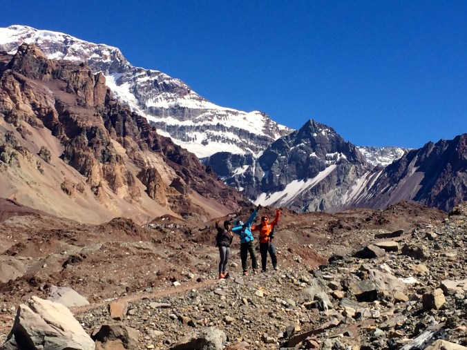
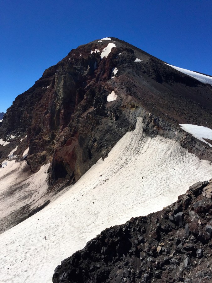
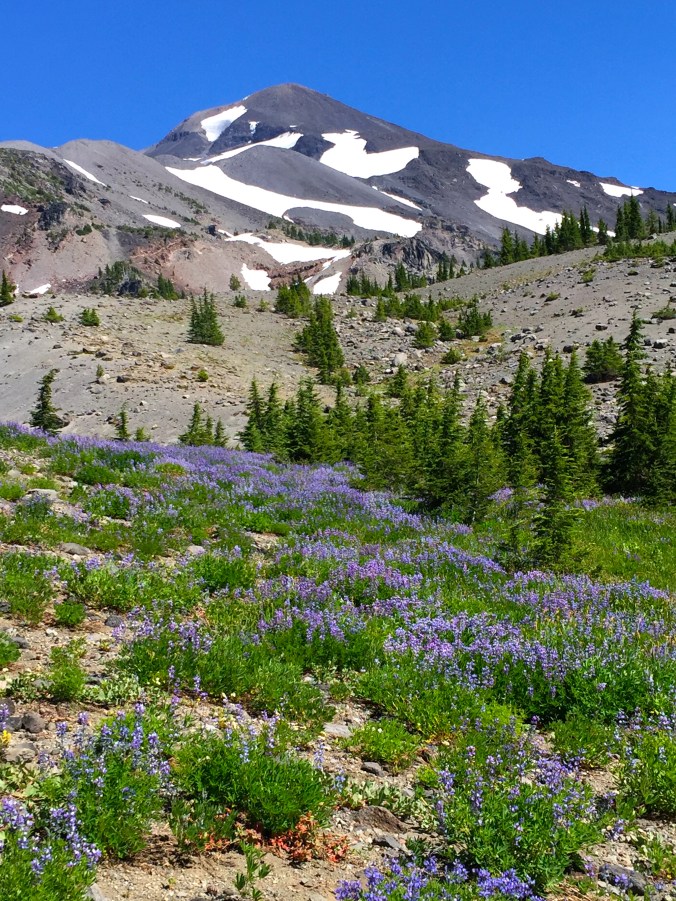
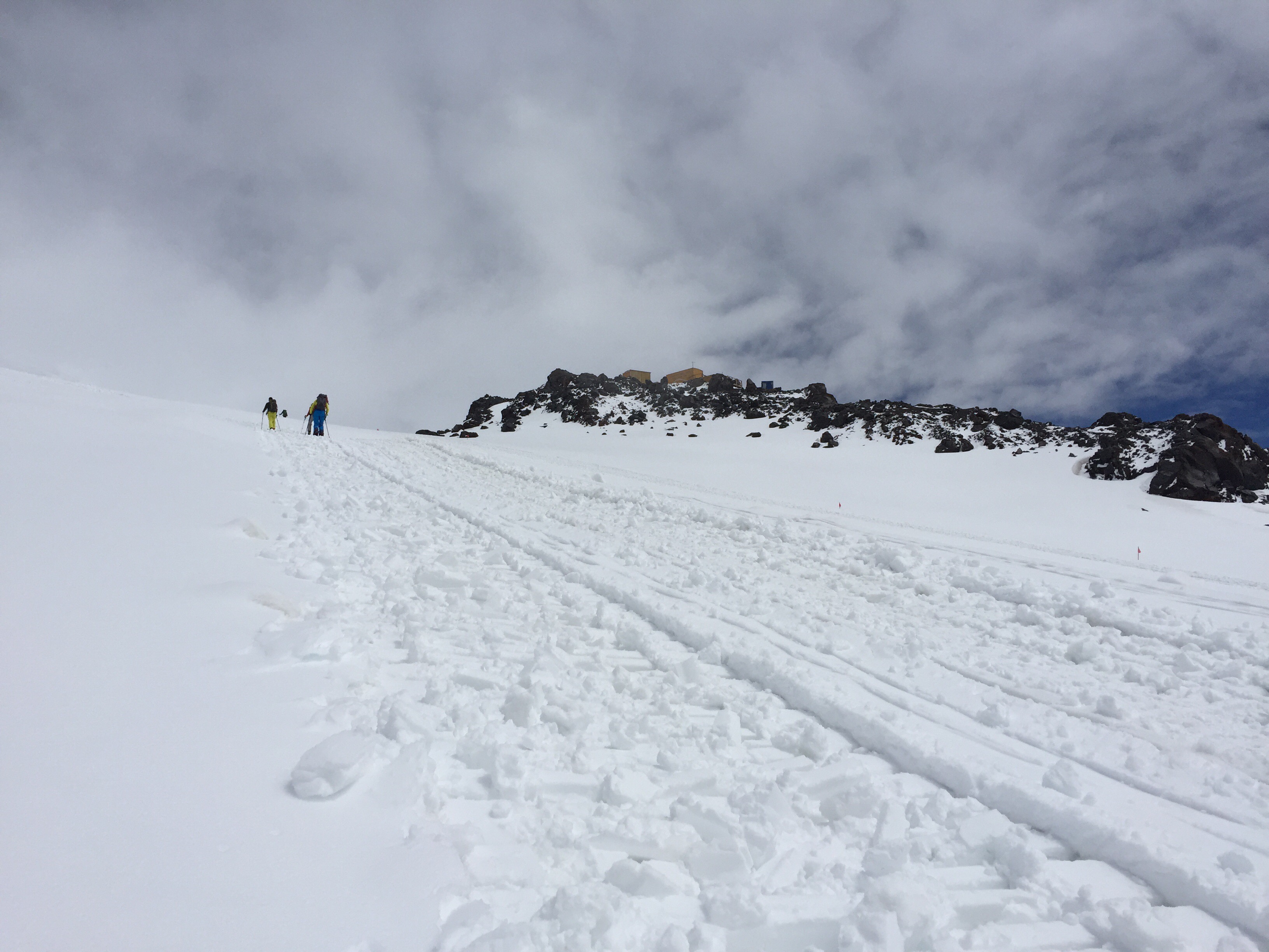
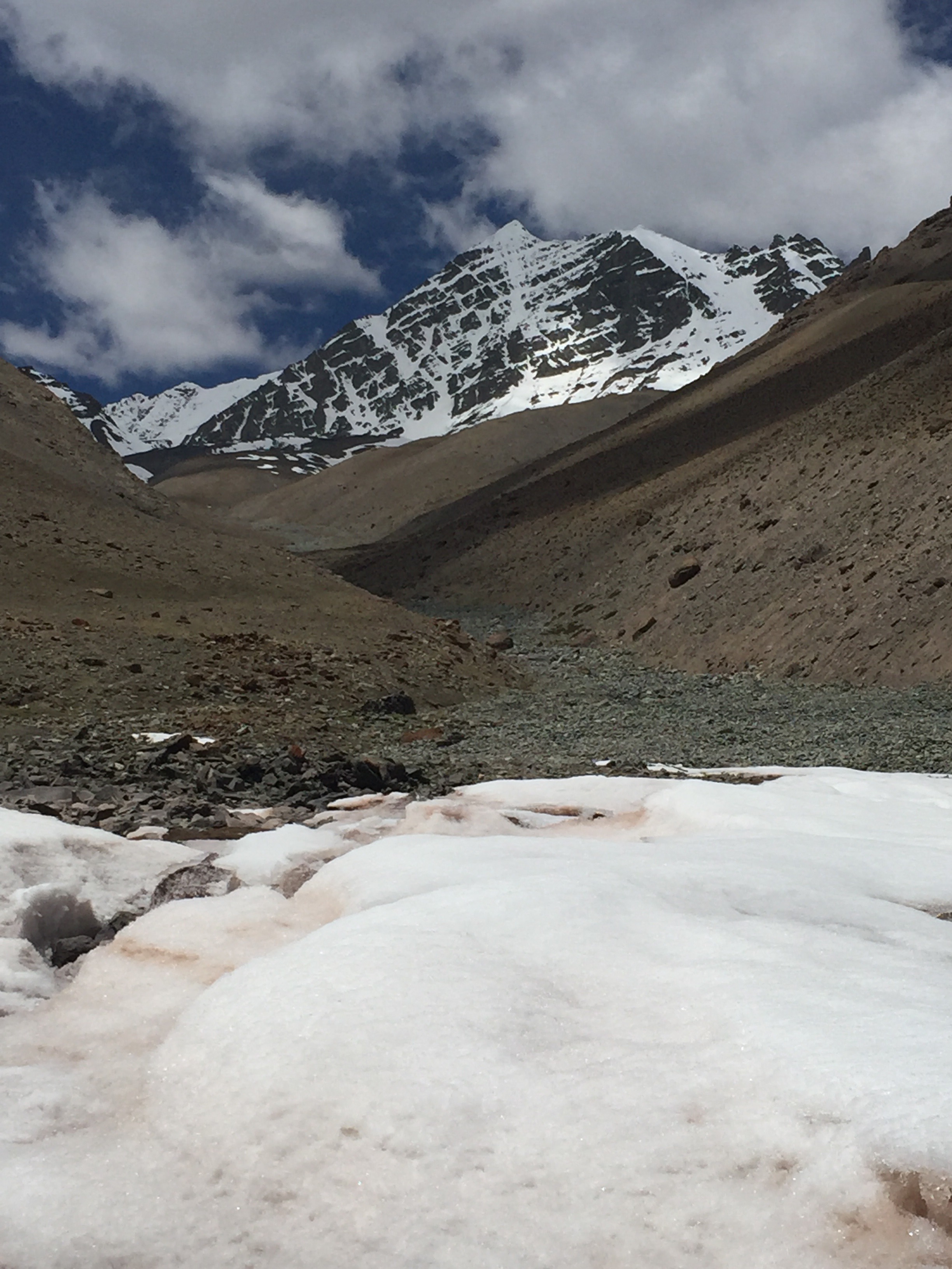
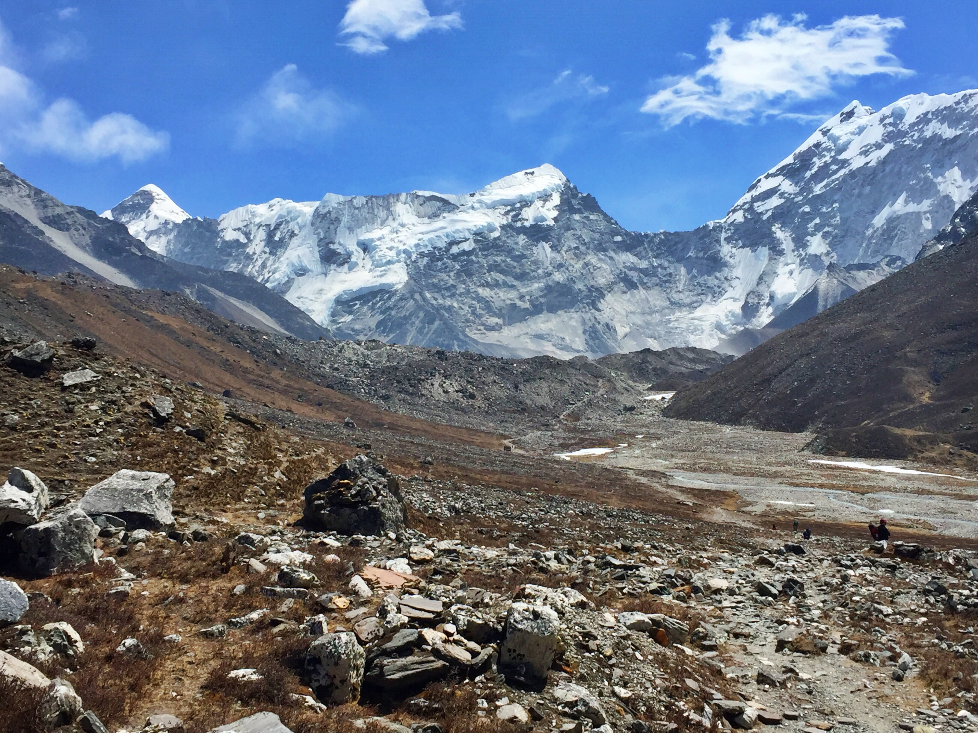
  1. Iztaccihuatl (17,159)

Overview: 6 miles + 4200-5500 feet elevation gain

IMG_8309

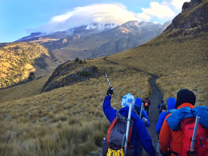
In the car on the way to the Iztaccihuatl and Popocatepetl National Park, our local guide told me that he was especially excited for today’s climb because he’d never before had clients who had wanted to do it in a single day. This was not a good sign.

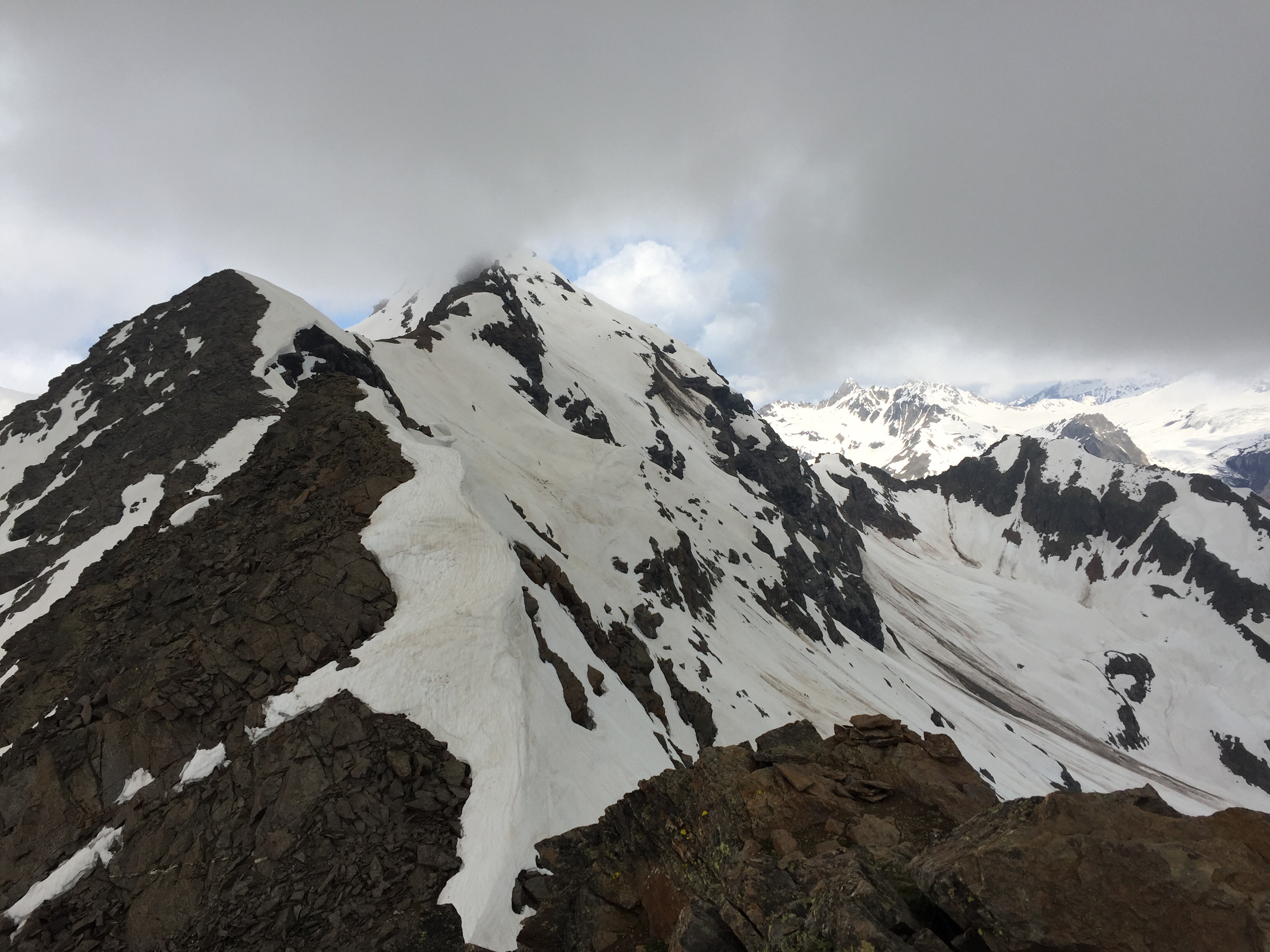
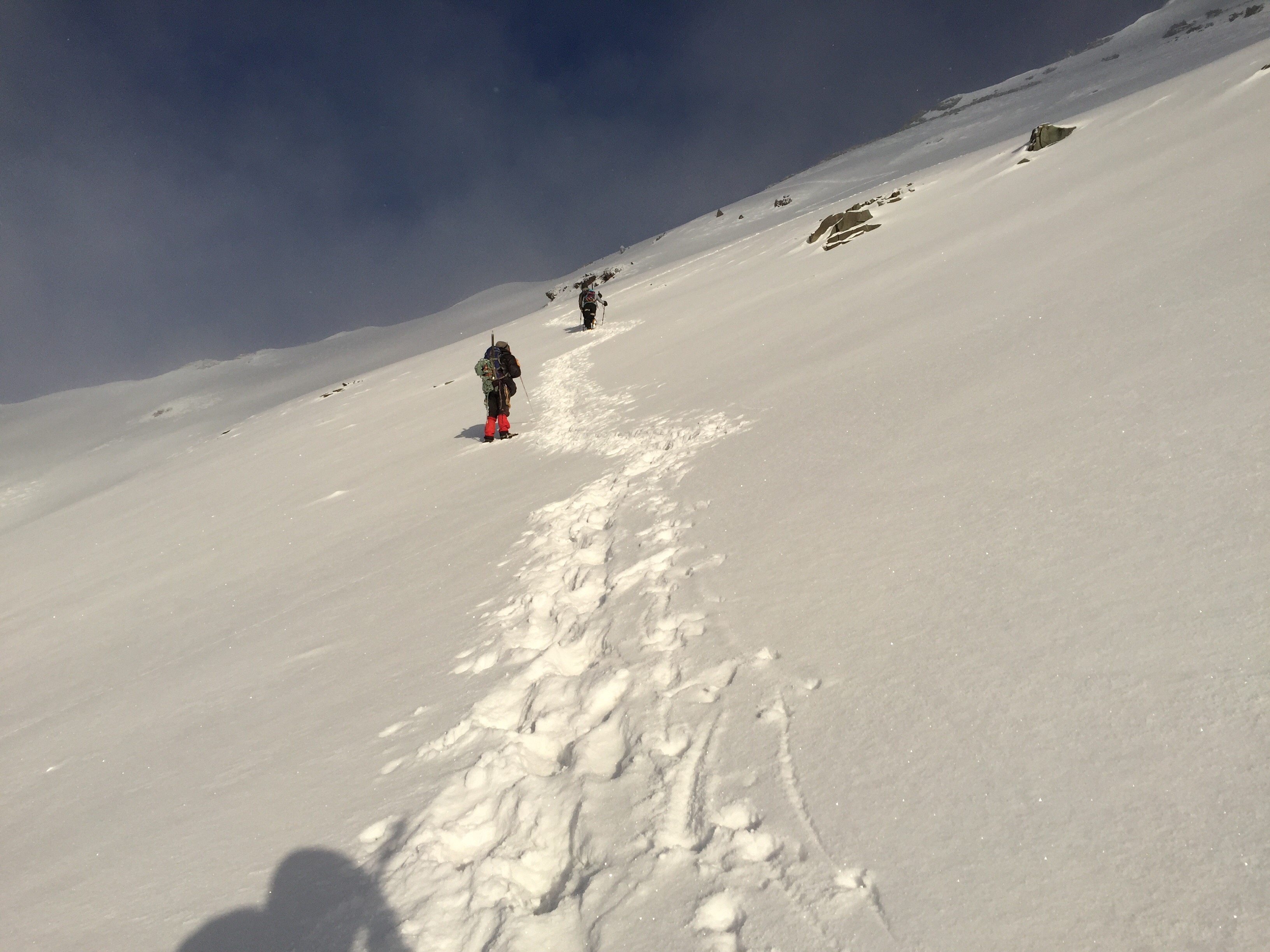
Truthfully, the opposing Izta and Popo volcanoes were some of the most breathtaking and scenic mountains I’d ever seen before, but I was having a tough time enjoying their beauty while agonizing over the day’s climb. This route isn’t quite as straightforward as point A to point B. Izta has as many as seven official summits, but our course demanded we ascend and descend three of these, with as much as 300 feet of elevation gain and loss in between. That number may not sound so intimidating at sea level, but after 4 hours and 4k of scree at 17,000 feet – it’s a little more daunting.

Weather again turned on us this day, leaving those who made the summit suffer through a windy whiteout on the way back down. At the end of the day, we did all but crawl back to the car, grateful beyond our years that the following day would be full of rest (and more tacos).

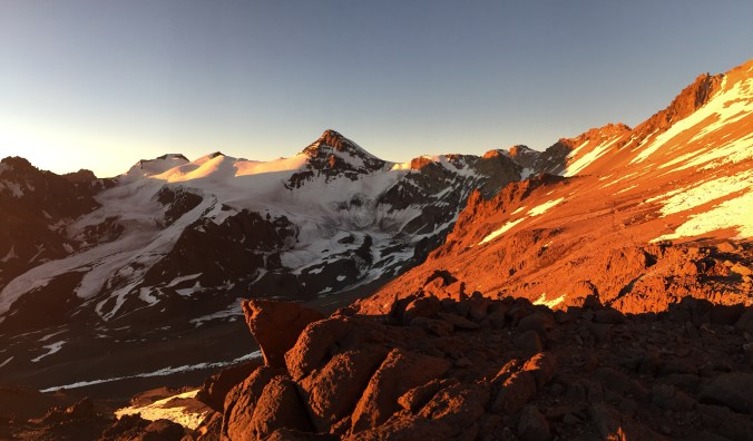
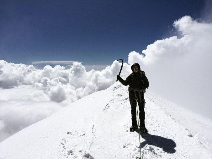
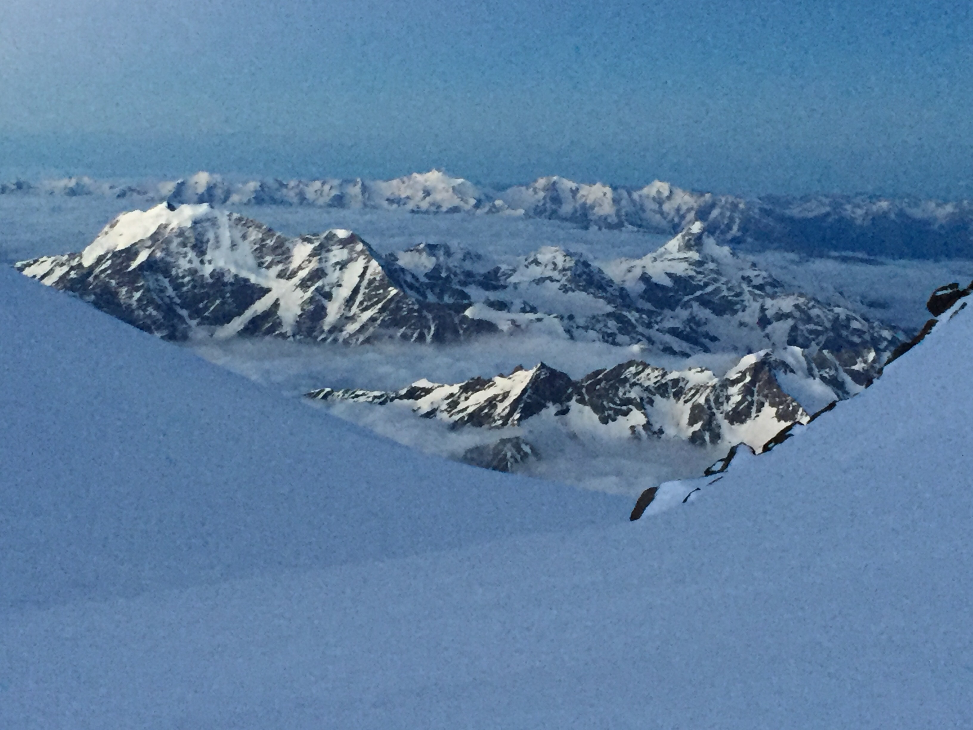
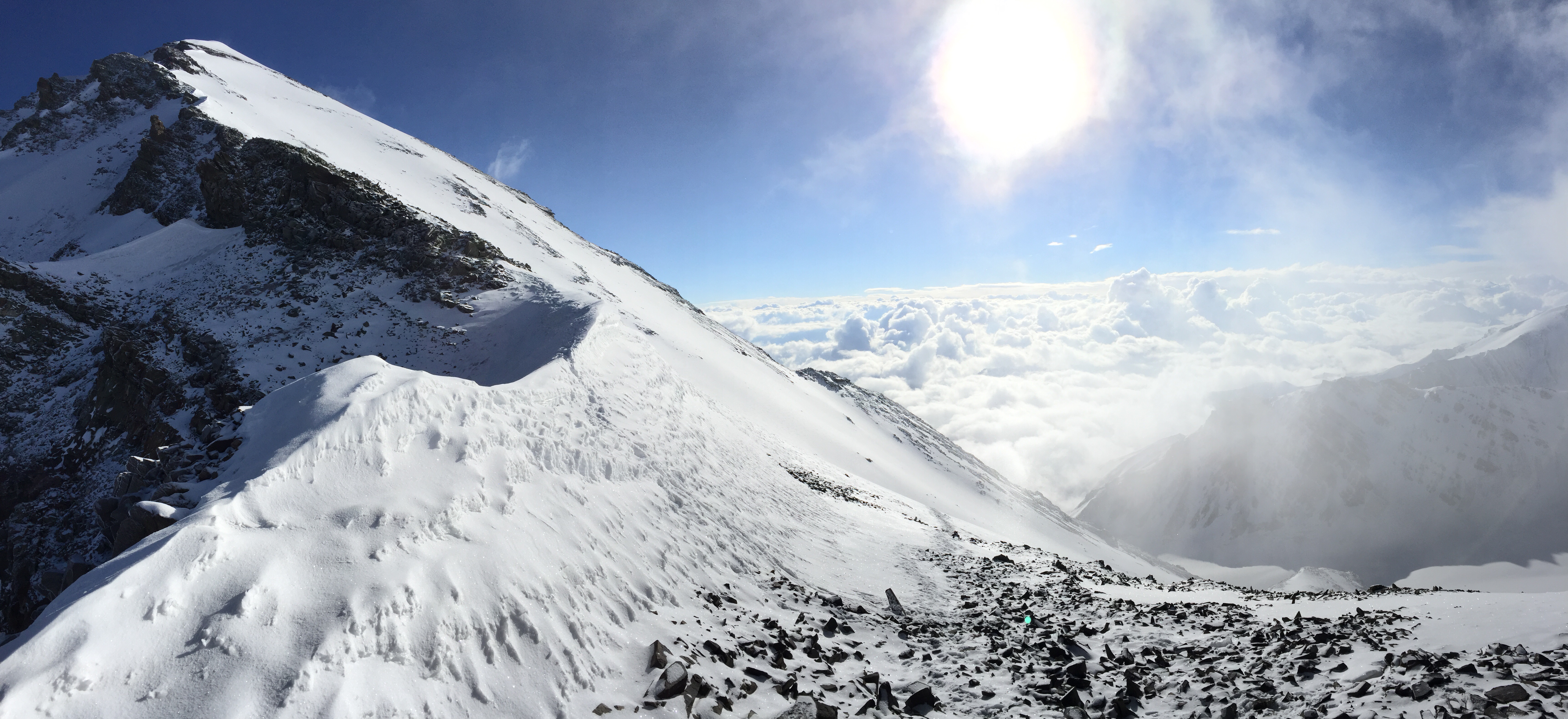
  1. Pico de Orizaba (18,491’)

Overview: 4 miles + 5000 feet elevation gain


IMG_8390

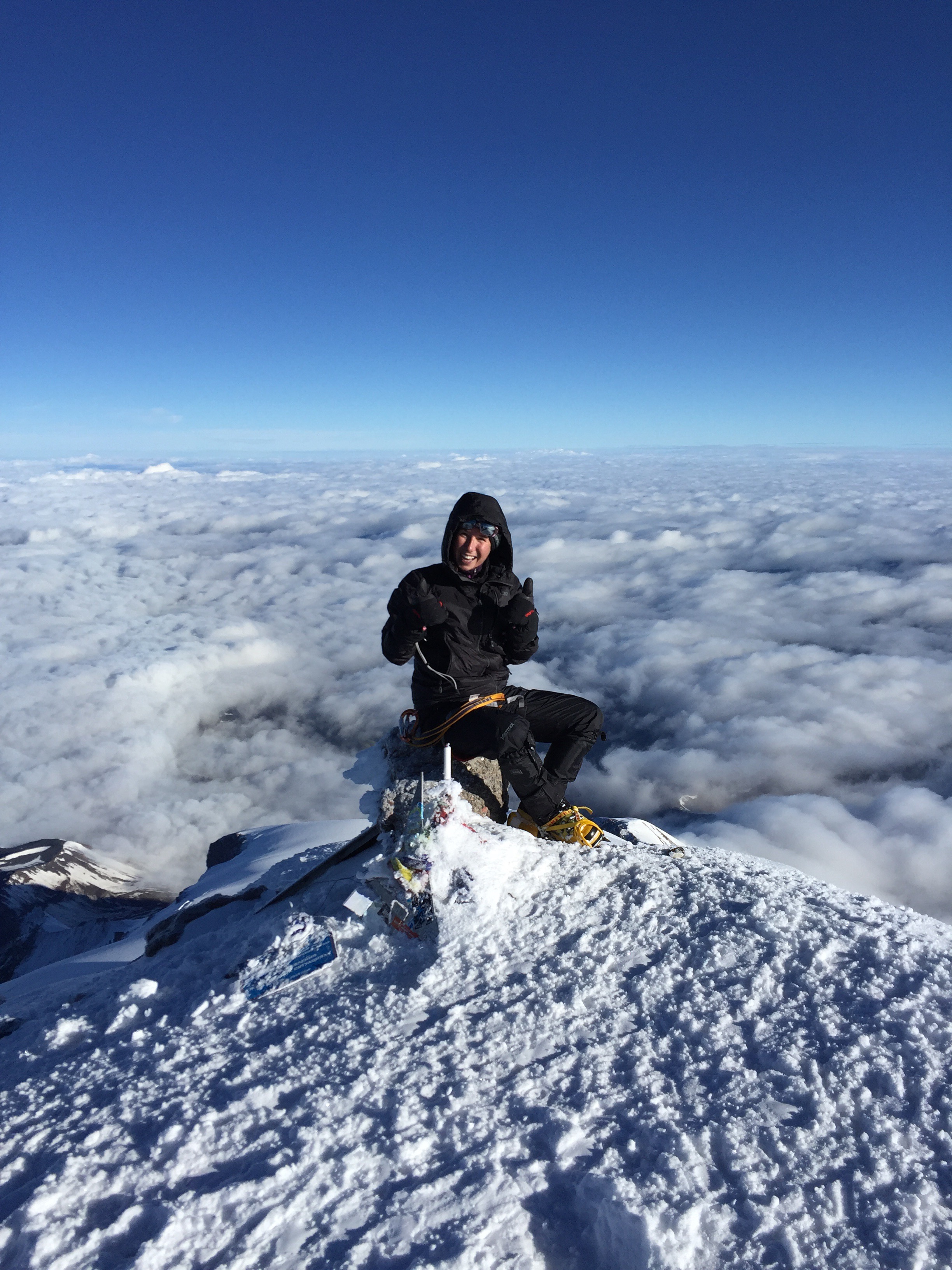
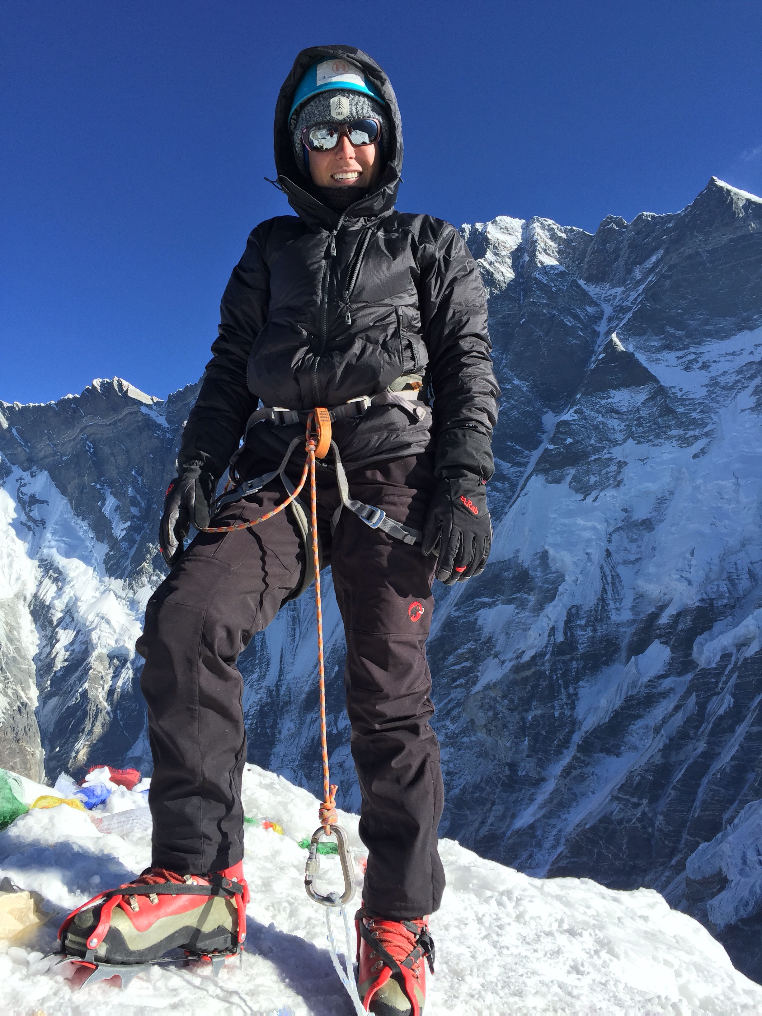
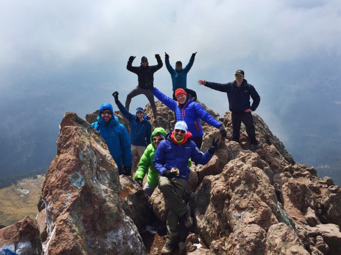
This is what we all came here for: The chance to stand on top of Mexico’s highest peak, and the 3rd highest peak on the North American continent: Pico de Orizaba. Out tough acclimatization days, and rigorous itinerary, had all been designed so we could reach this one goal.

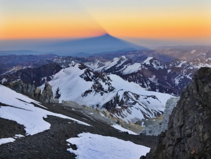
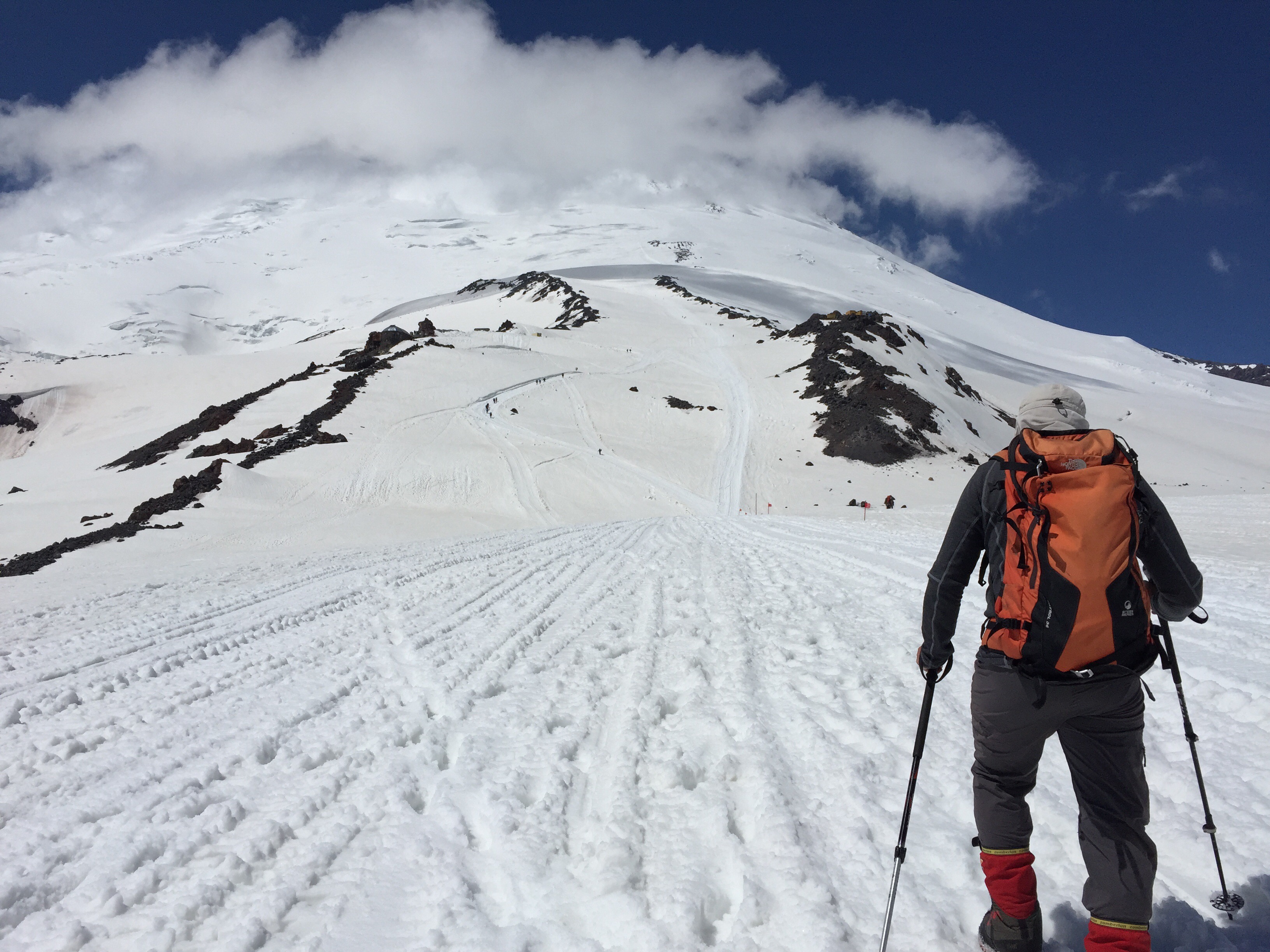
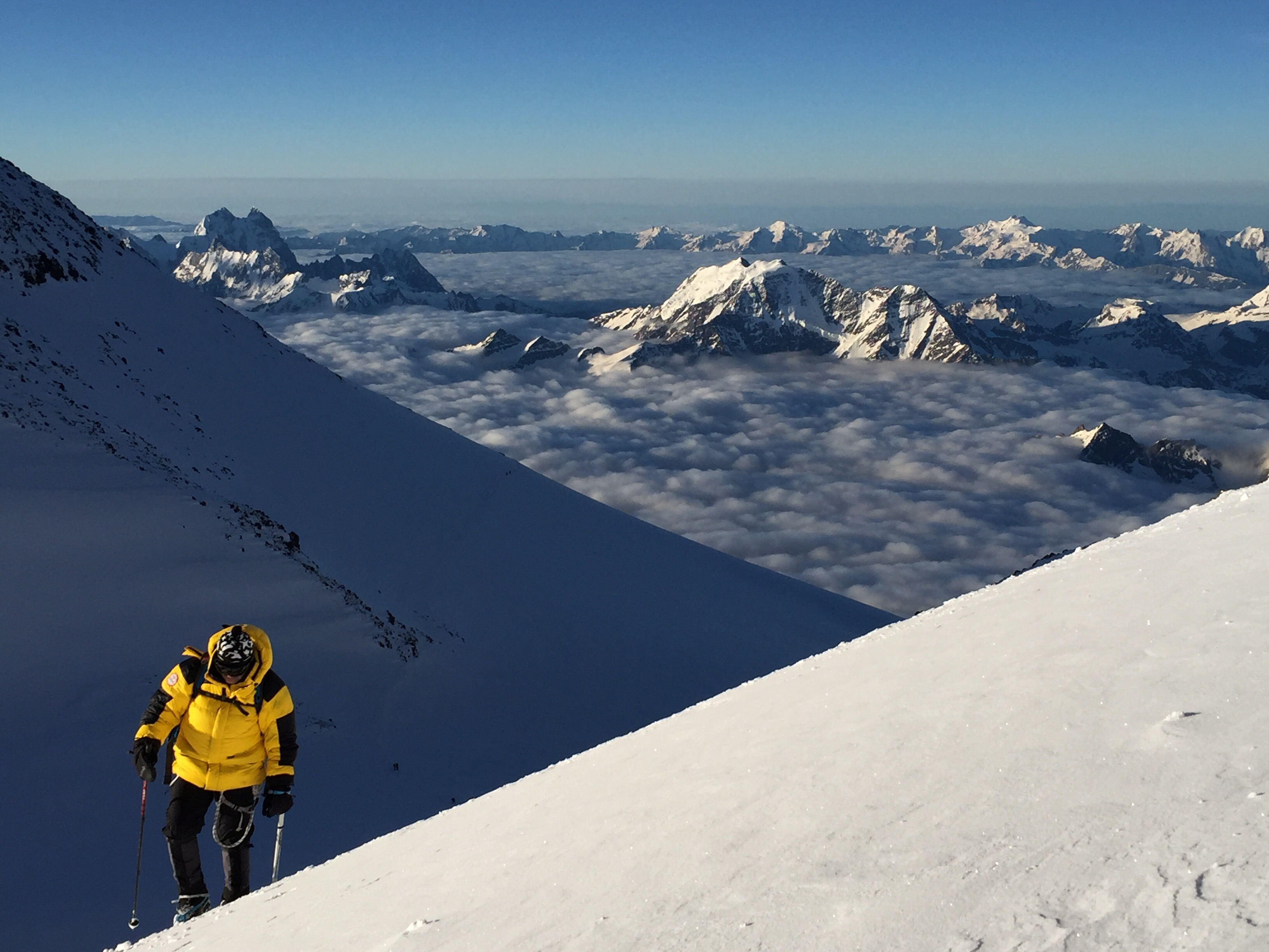
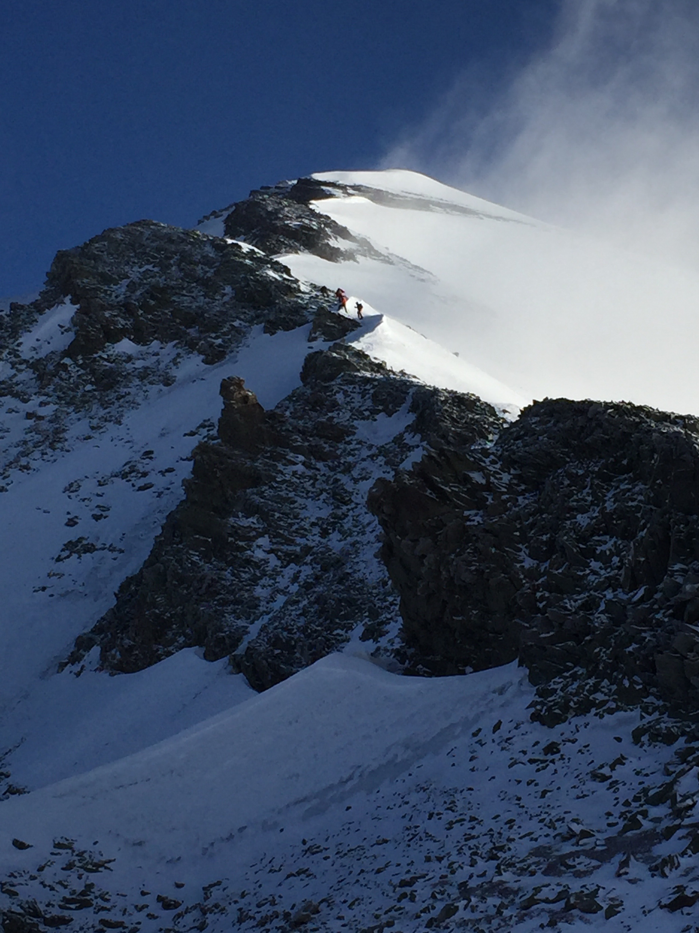
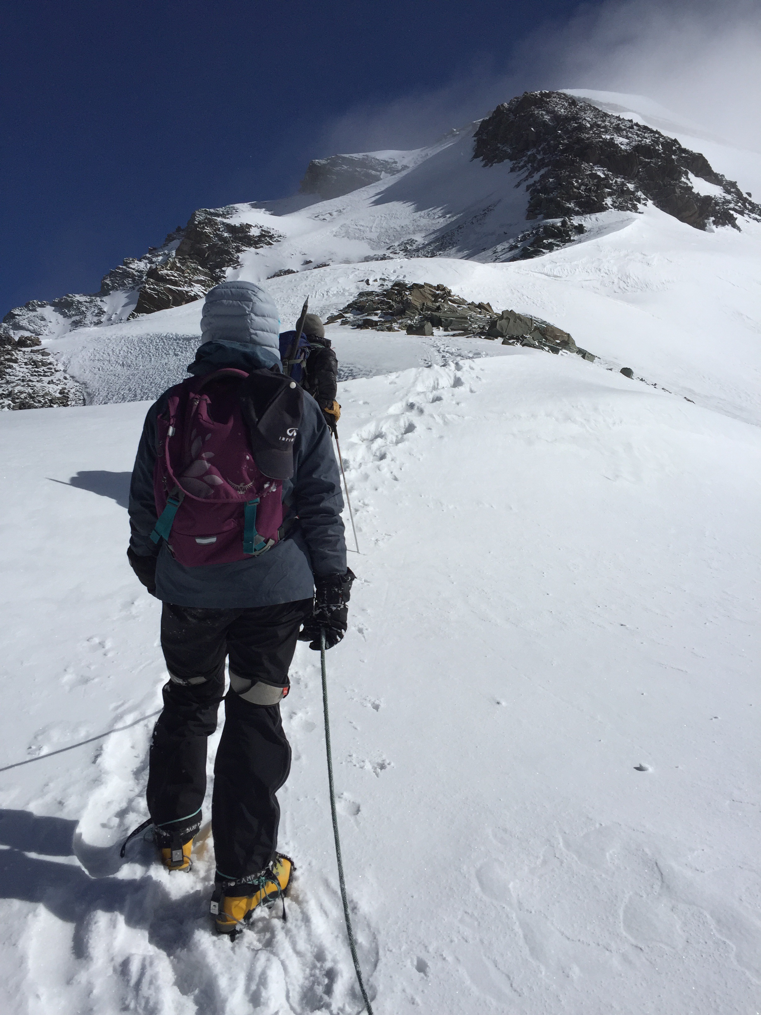
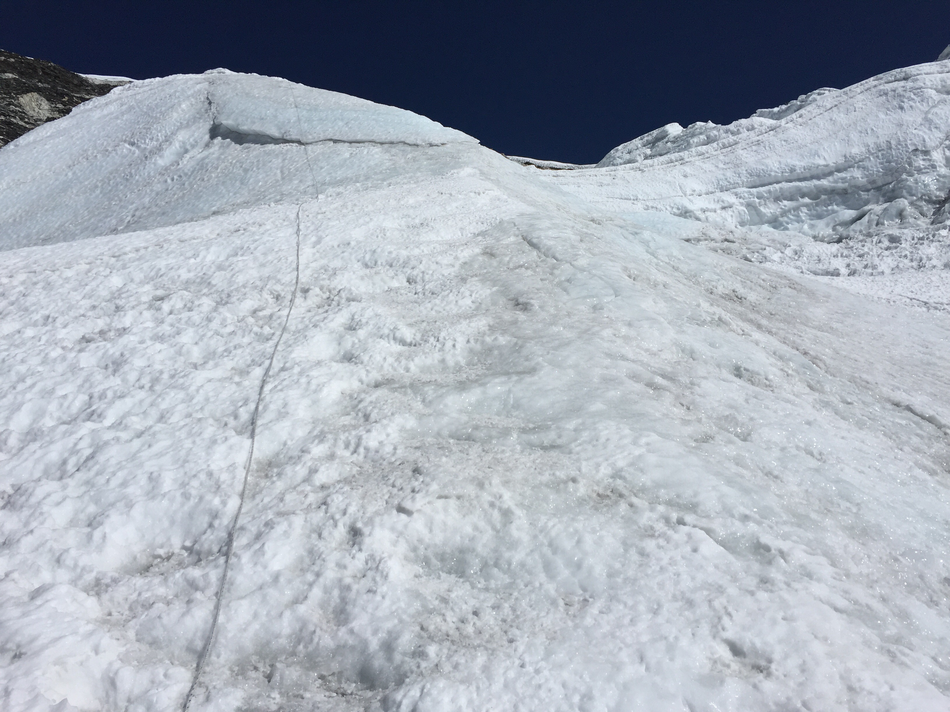
Today was where most of us finally got within our comfort zone, with crampons strapped to our boots and ice axes leashed to our hands. Since we’d been acclimatized, we slept in the town of Tlachichuca and took off towards the mountain in a 4×4 to start hiking at 5am. Fresh snow caked the ground and warmed us up, and we all shared a spectacular sunrise on the North Face’s infamous Labyrinth, just an hour away from the glacier.

After spending hours with our heads down, focused on the tedious task of navigating across snowy rock fields, the landscape suddenly opened up and we found ourselves at the base of the glacier. Finally, we could see our end goal: the summit of Orizaba. But just as soon as we began celebrating, we were greeted by a harsh warning from a local guide… the top was much farther off than we thought.

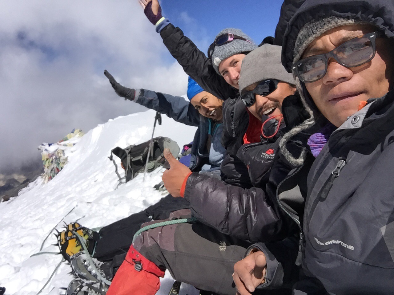
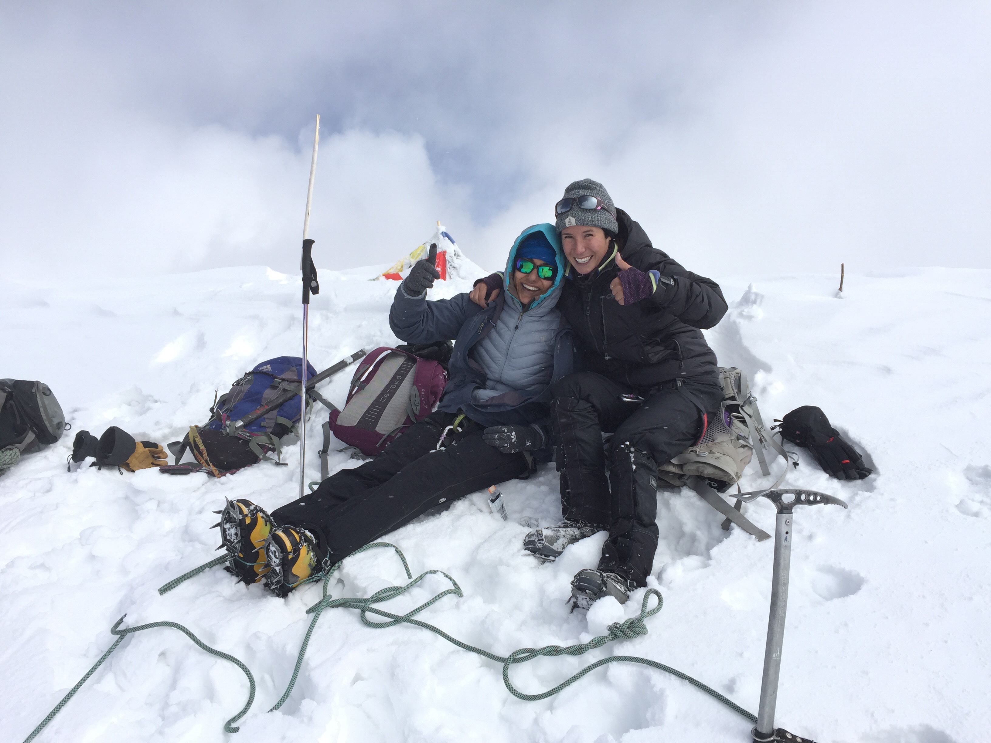
And so we began the long, arduous slog up the 45-degree snowfield laden with blue ice and hidden crevasses. A few in our group darted up quickly, without seeming to feel a single effect of the high-altitude atmosphere. Others took their time, carefully following the 2-point rule, anchoring their axe or boot with every step. But eventually each of us made our way up the mountain in splendid time, with the last summiters topping out just 6 hours after we hit the trail. It was a breathtaking, head-splitting moment for many, and an incredible achievement for all.

Orizaba provided all of us with an awesome mountaineering challenge, for both the seasoned and beginner climbers in our group. We got lucky with crystalline snow conditions and a bluebird sky morning. Everyone successfully avoided crevasses, as well as falls or other injuries. It was by all means a perfect day, on the perfect mountain, with the perfect group of people.

IMG_8248

At the end of the day, we hiked over a marathon’s worth of miles, climbed over 16,000 vertical feet, and ate no fewer than ten million tacos.

We shouldered our way through uncomfortable cold and slight injury setbacks and we ended nearly every day with a smile and hearty cheers. And most importantly, we did it all without killing each other.

If it’s possible to do something, it’s possible to do it bigger and better – which is just what we’re planning for next year! Here we come, Ecuador 2018!

Never Too Late to Learn

One month after my father’s 67th birthday this year, he will embark on a weeklong Introduction to Mountaineering Course in the North Cascades.

I am absolutely psyched for Dad’s decision. He and I got into climbing together, we were each other’s inspiration and only experience with the sport. Then a few years ago I signed up for the same mountaineering class that he will take, and my obsession with alpine climbing took off. I started to travel to climb, and I’ve been dedicating a lot more time to local peaks in the last few years. I’m stoked to hear that Dad is catching up to me, and I’m already mentally mapping out the rest of a summer full of tougher (and higher) peaks together.

My father is a practical man. He has tangible, measurable motives he wants to achieve in this class: Learn the navigational and compass skills we never studied before, practice rope techniques on mixed ice and rock, and most importantly – prepare for a late summer climb of Mont Blanc in France, the tallest peak in Western Europe.

But there are even more equivocal reasons why Dad is taking on this impressive objective. Here are a few.

GEDSC DIGITAL CAMERA

Dad and I on our 2012 climb of Mt. Whitney.

There’s only so much you can learn from an armchair

Dad and I are avid nonfiction readers. Over the years, we’ve collected no less than three dozen mountaineering books telling of feats and tragedies across the world. Invariably each holiday season, our Christmas tree is littered with new stories from either famed climbers or first-time writers. We’ve also managed to devour every single climbing movie and documentary that we could stream on Netflix. We absorb these facts, and learn these lessons second-hand, and he’s ready to put them into practice.

Plus: it feels great to get out of your comfort zone once in a while. Pushing your boundaries, both mentally and physically, is part of the drive that keeps us human. Through his experience with mountaineering so far, my dad has learned how to find comfort in the uncomfortable, and be okay with getting a little sweaty and dirty from time to time.

dscn1429

Our first glaciated peak climb, Mt. Adams.

Learn new skills and brush up on old

My father and I have been mountaineering for eight years now. We started with an annual hike every summer after I graduated high school and moved out of my childhood home – it was our “us” time.

Our first big feat was South Sister, the 3rd-tallest mountain in Oregon, the first hike we’d ever needed trekking poles on. The next year we attempted Middle Sister, 5th-tallest in the state, and were turned around for our own poor navigational skills. That third summer we picked up two pairs of crampons and ice axes for our first real climb of Mt. Adams. Helmets and harnesses came shortly thereafter, on ascents of Mt. Shasta and Mt. Hood, respectively.

We sort of just fell into the sport, without any deliberate planning for our future as climbers. Which is why it makes sense to me why my dad wants to backtrack and take a course to cover the fundamentals of mountaineering and backcountry safety. He’ll get to fine-tune the glacier travel and step techniques we’ve been practicing for years. He’ll learn how to read a slope for avalanche danger, and follow a ridgeline like a handrail to descend safely in whiteout conditions. He’ll get to learn the basics, and so much more.

“I’ve got to get smart about this stuff if I’m going to keep doing it,” he told me.

img_3872-1

Trekking to Everest Base Camp, with Mt. Everest visible behind us.

He’s just getting started

I haven’t yet touched on what some people will see as the biggest wow-factor to my dad’s decision to further his mountaineering education: His age.

My dad is strong. He was raised a farmer, and carries that hard workmanship mentality through all of his professional and recreational projects. When he sets a goal, he works towards it. When we plan a climb, he trains hard.

On all of our previous climbs, he has been by far the oldest climber on the mountain. Those first few years he and I together made two of the least experienced people attempting whatever mountain. But over the last near-decade of climbing, we’ve been getting stronger, and smarter, and tougher when it comes to the goals we set and climbs we chase. My father in particular has a never-ending curiosity as to how far he can push his limits, and he’s always willing to “give it a shot” without holding himself to too high of expectations. He has many great qualities, and one of them is in fact his age.

img_4141

Dad trekking in the Nepal Himalayas.

I have no doubt that my dad will enjoy his weeklong alpine education course, that he’ll kick ass on Mont Blanc, and that he won’t let anything stand in the way of living the life he wants to lead.

Finding Patience and Pride at 22,841 feet on the Summit of Aconcagua

“I feel drunk right now,” Nina groaned. She was wobbling, her balance impacted by the increasing elevation, though each teetering step continued to propel her up towards the summit at the rapid speed of 250 vertical feet an hour.

Hanne hiked quietly, deliberately placing one step in front of the other, occasionally looking up towards the summit with a glowing grin plastered across bright red cheeks. I kept meaning to remind her to cover her face with her buff as the sun gradually showed its strength on her fair Norwegian skin, but then my thoughts would float skyward.

We’d been hiking up the same gully for (seemingly endless) hours. The summit was so close we could practically reach out and touch it, and I knew that Nina – one of the strongest women I know, an ultra marathoner and mountain runner – was no doubt dreaming of jogging on up as she did her local LA peaks. However, our hands were tied by the high altitude’s oppressive demands. Even if we could move any faster, it wouldn’t be smart or healthy for our body’s acclimatization. Just as on the rest of this entire trip, we were forced to move at a snail’s pace.

This was a real test of patience for all of us.

img_7736

Neighboring peaks of Aconcagua shot at sunset from our first high camp.


For the first time in my life, I experienced what high-altitude mountaineers describe in books, speeches, and tales from higher places. My breath lagged, my legs adopting the weight of concrete blocks. Every step strained my muscles, every sharp inhale seemed to do the job of half. I moved the slowest I ever have on a hike or climb, and somehow my spirit still soared.

I was functioning very well for such a high altitude. I’ve summited three other peaks near the 20,000 foot mark and always felt fine and strong, but this was new territory. The extra 2,800 feet on Aconcagua was significant enough to demand my full attention, and every foot I moved higher on summit day, I felt my strength challenged.

Of course, there’s a lot more that goes into the physical challenge that mountaineering inflicts on your body. A lot of it is unseen.

img_7882

The shadow of Aconcagua stretches over the horizon at sunrise.

Summit morning

It’s 4am when we hear the familiar clank of stoves and shovels as our guides wake up to begin melting snow for breakfast. The three of us clients lay stiff in our sleeping bags, afraid to move just an inch in case the chilled air could leak into our perfectly warmed cocoons, while Miki, Charlie, and Ulises brave the cold. Our valiant guides had already melted 60 liters the night before, to ensure every climber would have enough liquids to get them through the night and the entire summit day. Each of them were strong, selfless, and big reasons as to how each of us remained healthy and happy throughout our expedition.

As to be expected, not one of the three of us really slept that night. Our high camp Colera was at 19,586 feet, two hundred feet higher than the summit of Kilimanjaro. Miki was right about one thing; it was a lot more comfortable squeezing three women into our two-person tent, the body warmth at least made our last evening more bearable.

But that’s not why we had tripled-up. We were warned that a solo inhabitant wouldn’t have the body weight to hold the shelter down in case of high winds. Our guides had dealt with a similar situation before: Chasing a willowy female client down the mountain as her tent catapulted her, body and all, past camp and towards a steep drop-off.

Besides, we were teeming with excitement, eagerness, and just a little bit of anxiousness for what the morning would bring. None of us quite wanted to get our hopes up.

img_7790

Killing time in the dining tent at 18,200 feet, where we were camped for three nights.

Two days before

The wind is too strong to entirely stand up, so we half walk, half bear crawl from sleeping tent to dining tent.

A howling 70 mph gust goes by, and we scramble to reinforce our shelters with 20, 30, and 40 pound rocks. Each of us is slowly, numbingly losing feeling in the tips of our fingers, toes, and nose as the temperature plummets with the lowering barometric pressure. We try to resist calls from Mother Nature, dreading the contact of wind on delicate skin, leaning against a small frozen rock more for the emotional comfort rather than any real wind block.

We’ve already spent two nights at Nido de Condores, our intermediate high camp at 18,241 feet. We’re behind schedule, using up our extra weather days for their very intent. Every day we see bluebird skies: The forecast doesn’t predict any precipitation; this is a dry, clear, yet deadly windy storm. With gusts reaching 100km at our current elevation, we can’t imagine what climbers up high were experiencing.

img_7795

Nina looks out over Argentina’s Andes mountain range on an acclimatization hike.


A few of the friends we’d made at base camp are turned around from their summit attempt, and we feel for them, in part because we’re all thinking the same thing: The longer we spend here, expelling energy at such a high elevation, eating our food reserves, and waiting for a last ditch chance for the weather, the lower our chances are for our own summit attempt.

We’d accepted this possibility, our most probable outcome at the moment, getting ready to spend our third night at Nido when Miki asks to meet with us.

“There’s been a change in the weather forecast. There’s a small summit window opening up in 36 hours,” he tells us. “Do we want to try our luck?”

16003010_10154836894030429_5422082491474114746_n

Photo courtesy of Hanne Lund Danielsen.

Sunrise

We’d been walking about an hour – or was it two? My watch was bundled underneath layers of jackets and gloves, and I was using the slow onset of dawn to measure time, as well as our progress.

It had been a beautiful morning so far, with a gentle wind (or “kiss from the mountain” as Miki insisted), and everyone seemed strong. We reached the broken down Refugio Independencia (20,930 ft.) just as the sun was making its final rise over the horizon, brightening up everyone’s faces and spirits. There had to be a dozen teams at this pivotal point in the climb, more climbers than any of us expected. We soaked up the rays, forced down some food, and lathered on sunscreen before strapping on our crampons and setting up the slope again.

We breached the ridge above Independencia and got a full view of our next few hours across the Great Traverse. Some of us thought it looked simple, some said it seemed like it stretched on forever. I stared out at this section draped in shadow as a gust of westward wind blasted us and had one thought only: Looks cold.

img_7520

The impressive South Face of Aconcagua looms down at us from Plaza Francia (13,300 ft).

Two weeks before

“I’m boiling alive,” Hanne complained, fanning herself with a baseball hat. She was wearing shorts and a thin t-shirt and looked more comfortable than I felt in my long pants and long sleeves. I hate coating my body in sunscreen even more than I hate the heat.

The Argentinian summer heat was oppressive at our Confluencia Camp (11,300 ft). We’d come up from the trailhead the day before at the mouth of the Horcones Valley (9,678 ft.), and we were already feeling like we’d never cool off from the desert climate’s wrath. Our bodies sticky from sweat, we lamented that we still had two and a half weeks before our next shower.

Our journey was just beginning. We had just started the ritual of massive hydration, not-so-secretly competing with one another to see who was drinking the most liquids throughout the day. Even so far away from our summit attempt, we were still counting down the days to the top and maximizing our chances of success down to every minute detail.

Even though we’d seen the mountain from a distance at the very entrance to Aconcagua Provincial Park, it wasn’t until that second day at Confluencia when we really got to understand what we’d signed up for. An acclimatization hike to Plaza Francia (13,287 ft.) brought us to an absolutely breathtaking view of the south face of the mountain, peering up nearly 10,000 feet – almost two vertical miles – to the summit we’d all flown across the world for.

I think we joked to each other about the heat, and the hydration, because all along we all really knew that things would get a lot less comfortable up high. But we still had a long way to go.

img_7832

Our descent on summit day, racing the sunset back to camp after 7pm.

The final slog

The long, undulating and gradual traverse led us to La Cueva (21,817 ft.), or The Cave, at the base of a large rock wall. Here, climbers gather strength and enjoy their last break before the final summit push, all while facing the objectively most difficult – and most dangerous – part of our day.

The Canaleta is the steepest section of the entire climb, beginning from the base of La Cueva and stretching up just a few hundred feet short of the summit. When dry, the Canaleta is plagued with deep scree that backtracks climber’s progress nearly two-fold. Sections reminded me of the volcanic ash I was so familiar with climbing back home on Mt. St. Helens, South Sister, Mt. Adams: One step up, two slides down.

We were lucky. Because of the last week’s storm, we greeted the hard-packed snow and ice that covered the Canaleta with gratefulness.

So here we were, with Nina’s restiveness, Hanne’s stoic march, and my haggard breaths slowly inching us towards our goal. Our guides Miki and Charlie coached us mentally just as much physically, as the impatience of the preceding two weeks crept up on us and I fought the urge to race ahead.

Finally, minutes blended into moments, and we were greeted with flashes of brightly colored parkas, national flags, and a decorations adorning the summit cross. We’d made it to the top.

img_7830

Nina, Hanne, and myself on the summit of Aconcagua (22,841 ft).

It’d be easy to say that our hard work and perseverance paid off. From the months spent training at home, to the days of load-carrying to camps. But I think that we owe the real credit to the mental battles each of us faced. Fighting through the internal protests of: “I’m too cold,” “I’m too tired,” “I’m not cut out for this.” Breaking the opposing mental walls of agony and boredom, seeing past the easy way off the mountain and silently suffering through the discomfort. I credit our success to our patience on acclimatization days, bad weather days, and mornings we were too cold to leave our tent.

We wouldn’t have shown up if we weren’t physically fit enough for the task at hand, but we wouldn’t have succeeded if our mental and emotional strength didn’t stand up to the challenge. Patience is similar to pride, gratefulness, and joy in that it can be invisible… but they’re the most valuable things we carried with us once we left that summit.

img_7879

Photo taken from a load-carry acclimatization hike. Aconcagua marks the third continent, and fifth summit, that Nina and I have tackled together.

2017 Goals! My New Year’s Resolutions to Adventure More

The last year has been a whirlwind of international travel, more than a few successful summits, and weeks-long treks through some of the most beautiful mountain ranges in the world. I saw and did way more in 2016 than I’d ever expected, so my goals looking towards the New Year are more focused – and more local.

One huge difference in 2017 is my focus towards running. The six months I spent hiking and climbing last year left my legs stronger than they’d ever been before, and completely unfit for running. The adjustment back to a quick pace has been a long and gradual one, but the first adventure goal on my list (first full marathon) is sure to kick my butt into gear.

Things I WILL do:

Things I’d like to do:

  • Mt. Hood Winter Ascent: This goal depends on how long winter lasts, and whether I can rally a climbing partner to join me. Any takers?
  • Take a ski mountaineering course, ice climbing course, and more ropes courses at an indoor gym. Ski touring and ice climbing is something I’m totally unfamiliar with, and I’d like to learn more about avalanche safety and crevasse navigation before setting off on a winter ascent of Adams, St. Helens, and other more remote volcanoes.
  • Run the Zion Traverse (50 miles, 6500 ft. elevation)
  • Run the 8000 meter challenge (40 miles, 12000 feet elevation), also known as the SoCal Triple Crown
  • Ragnar Trail Run Relay: Mt. Rainier
  • Explore the Tetons National Park, climb Grand Teton (13,770 ft.)
  • Explore Yellowstone National Park, run the Yellowstone Half Marathon
  • Explore the Colorado 14ers and backpack, climb, or run

Things I’ll table for 2018 or beyond:

… and I’m sure that as the year goes on, so will my list 🙂

Comment below if you’re interested in joining me on any of these adventures!

7 Tips for High Altitude Hiking

As seen on The Outbound Collective.

High altitude hiking is one of the most challenging and rewarding outdoor activities that you need to add to your summer adventure list right now. From the Rocky Mountains to the Sierras, to international treks up Kilimanjaro and in Nepal, hiking at high altitude gives you a unique and unforgettable look at some of the most desolate places in the world.

Like any extreme adventure, while you’re picking out the perfect camera to bring and dreaming of your quintessential summit sunrise, you’ll need to prepare accordingly and remember these tips for a successful high altitude hike.

The truth is, there’s no real way to train for high altitude other than being there yourself. So above all else, make sure you have the chance to acclimate, hydrate, and prepare for the time of your life.

img_4141

1) Understand the risks of high-altitude hiking

Do some general research on the differences between Acute Mountain Sickness (AMS), High Altitude Pulmonary Edema (HAPE), and High Altitude Cerebral Edema (HACE). Understand what a “sick person” at altitude looks like, and be prepared to take action if you or members of your team experience these symptoms.

  • AMS is the most mild form of altitude sickness and unfortunately feels very similar to a hangover. You may experience a headache, nausea, or feel exhausted… If you notice any of these symptoms, heed warning that they could predict a larger risk to HAPE or HACE.
  • HAPE occurs when liquid seeps into your lungs, and feels like you just had the wind knocked out of you. You may also cough up a frothy foam, which means it’s time to turn around and descend as quickly as possible.
  • HACE causes confusion and incoordination. If your speech is slurring and you find yourself stumbling, you are close to death and an immediate descent is imperative.

img_3342

2) Fitness is key

Do your training hikes with a weighted pack. 40 lbs. at sea level is going to feel a lot heavier (try double) once you venture above 10,000 feet. You’ll be giving yourself a break in the long run if you stuff your backpack with water, weights, or other heavy objects when you train at home.

Run stairs and hills. The calf-burners and glute-tearers you feel when hiking and running work completely different muscle groups. Switch up your workouts by adding as much elevation as you can. Training in San Francisco? Do sprints up steep hills or staircases. Stuck in a flat desert with no uphill training ground? Hit the gym and spend some time on the stairmaster. No matter where you are, there’s no excuse to not having the right physical preparation.

Get as high as possible beforehand. If you have easy access to a mountain range, slowly build your body up to higher elevations, gaining 1,000 ft. each training weekend. Starting small is also fine, too – doing aerobic exercises above 3,000 ft. will still adjust your body to working with less oxygen in your blood.

img_3466

3) Fuel yourself

It may be difficult to remind yourself, but you’ll need to be prepared to eat and drink more than usual at high altitude. Your muscles are burning energy more quickly, and your body will need more calories and H2O to properly function. This is no environment for diets: Load your pack up with sugar and carbohydrate-loaded snacks like jerky, chocolate, hard candies, and other high-calorie treats.

4) Prepare to brave the elements

Naturally prone to sunburns? Then don’t skimp on the SPF when you’re at high altitude. Sunshine, wind, and temperature reach their extremes up high. Bring the right gear and prepare to pack total face protection from the sun, wind-resistant and waterproof clothing, and extra hand warmers, thermal gloves, and wool socks to guard your body against the inhospitable mountain environment.

5) Bring first aid backups

It’s impossible to predict how your body will be affected by high altitude before you go. If it’s your first time ascending thousands of vertical feet, play it safe and carry along an altitude aid. One of the most popular altitude medications, Diamox, is commonly prescribed for treks above 8,000 ft. Be sure to also pack ibuprofen, cough drops, and over-the-counter indigestion pills in case things get less than pleasant.

img_3374

6) Know your limits

Visit your doctor before embarking on a trek in the mountains. Make sure you don’t have any lingering illnesses or undiscovered ailments that may hinder your success up high. Most importantly, be prepared to turn around if you’re not feeling well. An annoying headache or minor chest pain could be the symptom of something much worse, and you don’t want to test your body’s ability to self-preserve when you’re miles far and meters high away from safety.

7) Take it slow

Don’t rush your way out of a successful trip. Your body will naturally feel slower at high altitude, so go along with it. Nothing can truly prepare your body for the thin mountain air other than actually being there – so when you do get your chance – take your time and enjoy the adventure.

img_3878

10 Extreme Summertime Experiences in the Chamonix Valley You Can’t Miss

Chamonix is the world’s capital of extreme sports. It is the birthplace of mountaineering. And it is full of crazy, adventuresome people who are drawn to its vibrant and eclectic culture from around the globe.

If you’re planning a trip to the Alps, don’t miss these 10 things to do in the Chamonix Valley.

img_5728

1) Take the Aiguille du Midi Cable Car to Stunning Heights

Ascend this world-famous cable car to the highest museum on earth at 12,605 feet. According to the official Chamonix Tourism website, the Aiguille du Midi receives almost half a million visitors every year – and for good reason.

The Aiguille du Midi Station is also one of Chamonix’s popular starting points for multiple mountaineering routes, including those shooting for the summit of Mont Blanc (more info below).

img_5680

2) Rent a Bike and Cycle Chamonix

The stunning backdrop, challenging grades, and world-class accommodations make the Alps one of the most popular places for road biking in the world. Chamonix in particular caters to cyclists with limitless rental and gear shops, not to mention its draw for the Tour de France every year. One of the most popular and accessible routes for road biking is the Col des Montets route, a half-day excursion from Chamonix central.

If you’re looking for something a little more rugged, mountain biking in Chamonix is a must-do for adventure seekers. Most cable cars and ski lifts accommodate bikes, making it all the more easy to pick up a map and hit the trail.

3) Visit the Mer de Glace

Translated as “Sea of Ice,” the Mer de Glace is the largest and longest glacier in France and just a quick daytrip out of Chamonix using the Montenvers Train. From the train station, visitors can walk across the glacier, through an ice grotto, and even follow a trail all the way back to the valley floor. This is another popular place to practice mountaineering skills and climb all the way up to the cozy mountain house of Plan de l’Aiguille.

img_5697

4) Go paragliding

There isn’t quite a more thrilling way to see Chamonix than by flight. On a clear summer day you’ll see dozens of paragliders coasting along the valley walls above you.

Visit the Tourism Center for more information on paragliding. Or, if you’re brave and experienced enough, see what it’s like to paraglide off of the top of Mont Blanc.

img_5740

5) Try Out Ice Climbing, Rock Climbing, or Classic Mountaineering

Because of its convenient accessibility, guide options, and limitless routes, Chamonix is the perfect place for climbers of all experience levels to explore the mountains. Both beginners and avid alpine mountaineers will find high-altitude routes suited just for them.

If you’re interested in rock climbing, check out the Aiguilles Rouges range to the north of the valley (like the Aiguille du Crochues route). For a more intense ice climb or to enjoy a classic mountaineering experience, visit the south side of the valley on the Mont Blanc Massif (like the Aiguille du Midi-Plan route).

img_5586

6) Trek the Tour du Mont Blanc

If you have the time, completing the Tour du Mont Blanc is the ultimate way to experience trekking in the Alps while seeing the evolution of culture and scenery through France, Italy, and Switzerland.

Eat and drink your way through 3 countries, 100+ miles, and 33,000+ vertical feet over the course of 6-12 days. The wilderness alpine environment and cozy mountain villages create the perfect balance between an exhilarating outdoor adventure and a safe, enjoyable experience.

7) Enjoy Classic Savoyard Cuisine

This list wouldn’t be complete without a nod towards Chamonix’s famous gastronomical charms. Savoyard food is rich in potatoes and cheese, the staples for some of their most popular dishes of fondue, tartiflette, and of course, French onion soup. Pair with a glass (or liter) of Savoie wine for a truly deluxe experience.

img_5710

8) Hike to Lac Blanc

If you’re looking for a short hike to fill you time on a rest day between an adrenaline-fueled schedule, Lac Blanc can provide a relaxing and scenic break. At an elevation above 7,000 feet, this high-altitude lake sits in a picture-perfect position below skyscraping mountains and across from Mont Blanc for panoramic views of the entire valley. You won’t want to forget your camera on this trip.

9) Try a White Water Sport like Canyoning, Rafting, or Riverboarding

Jump, slide, and rope your way down waterfalls and through alpine pools on an epic canyoning trip like nothing you’ve seen before. Or try white water rafting in a mountainside Alps environment – glacial cold water included.

If neither of those get your heart racing, kick it up a notch and don a wetsuit, flippers, and a helmet for the ultimate white water extreme sport: Riverboarding (known as hydrospeed in Europe). Having difficulty picturing this? Click here.

img_5800

10) Climb Mont Blanc

Chamonix-Mont-Blanc bears the name of Western Europe’s tallest mountain for a reason. While not officially one of the Seven Summits, reaching the top of this peak is a noteworthy and challenging effort.

The Compagnie des Guides de Chamonix is the oldest, largest, and one of the most reputable guide companies in the world – let alone France. Trust them for your summit attempt and you’ll be in good hands.

Middle Sister Summit Climb (10,047 ft.) via Renfrew Glacier

If you’ve been anywhere near Central Oregon, you’ve seen the Three Sisters Mountains dominate the skyline. Each of these volcanoes exceeds 10,000 ft. and are some of the highest peaks in the state of Oregon. Though they are truly considered sister peaks to one another, each has unique climbing routes that require varying physical conditioning and gear.

Note: Some (crazy) people actually climb all three in one day. Check out this local man who completed the total traverse in 6 hours & 39 minutes.

Middle Sister is navigationally in the middle of the three, is the shortest of the three, and is quite literally in the middle in terms of difficulty of its North Sister and South Sister counterparts. This route requires good knowledge of route-finding and backcountry travel as the bulk of the day requires off-trail traversing and good navigational instincts.

img_5842-version-2

This post describes a western approach from the Obsidian Trailhead (for a good description of the eastern approach, check out this article on Summitpost). This trailhead is easy to find, right off of the historic Highway 242, just plug it into Google Maps. You need to acquire an Obsidian Limited Entry Area Permit before you go – only 30 hikers/day allowed on this trail. Call, email, or visit the McKenzie Ranger Station to do so.

Background: I’ve been up this mountain three times now (summiting once) and still don’t know which precise route I’d recommend. It’s all up to personal preference and interpretation. There are camping opportunities available at Glacier Creek and other areas along the PCT, but we chose to complete this in a one-day trip.

img_5872

You have a couple options starting out on the Obsidian Trail (#3528).

First option: Take a left after about 3.5 miles at Glacier Way (#4336), which will take you right to the start of an “unmaintained climber’s trail” sign and up the Collier Glacier.

Second option: Take Obsidian Trail all the way to a T-junction at the Pacific Crest Trail.

  • Go left (north) here to reach the “unmaintained climber’s trail” sign and continue towards the Collier Glacier on your right (our ascent).
  • Go right (south) here and follow a dry stream bed up a colorful, flowered valley towards the Renfrew Glacier on your left (our descent).

Whichever way you go, you’ll be directly facing both North Sister (to your left) and Middle Sister (on your right). Aim for the saddle between the two.

Pro tip: Use your crampons early on. The rock is incredibly difficult to navigate; you’ll save a lot of time by doing as much snow + glacier travel as possible (take it from this guy and this guy).

img_5843

Some people complete both mountains in one climb, often camping overnight in the saddle between the two, but it should be noted that North Sister’s summit requires difficult class-4 climbing where a rope and helmet are mandatory. Furthermore, North Sister is infamous in Cascade climbing for its rotten and crumbly rock – you should expect plenty of loose rock and rockfall should you attempt this climb.

Once you reach the saddle between North and Middle, continue to your right by scrambling and bouldering over razor-sharp volcanic rock. Once you reach Middle’s ridge, you should find a faint climber’s trail that leads you up the final 800 feet to the summit. Parts of this climb are super sketchy with vertigo-inducing exposure. Like the rest of the climb, it’s easy to get off-trail, so go slowly and think ahead when visually planning your route.

img_5844

Looking up Middle Sister’s ridgeline to the summit. You can see a hiker coming up the snowfield on the left, which is the eastern approach.

From the top you have close-up views of South Sister, Broken Top, and Mt. Bachelor to the north, and North Sister, Mt. Jefferson, and Mt. Washington to the south.

img_5848

After ascending the Collier Glacier (slightly right looking down), we decided to descend via the Renfrew Glacier (directly below Middle Sister’s summit ridge). We wore our crampons down until the snowfield ended, and followed a large natural gully for a few miles until we eventually hit the PCT again. It was tough to find our location, even with compass and map, but we turned right and in under 2 miles joined up with the Obsidian Trail intersection again. Bear left, and continue 5.5 miles to the trailhead parking lot.

img_5874

Overall: Incredibly strenuous day, mostly due to boulder-hopping and route-finding, but an awesome and exhilarating undertaking for the truly adventurous.

Solitude at the Summit of Europe’s Highest Peak: Mt. Elbrus (18,510 ft / 5,642 m)

The tallest mountain in Europe is as unique as any other of the Seven Summits, tucked away in a small ski village of Elbrus on the border of Russia and Georgia. 
High seasons in the dead of winter and heart of summer attract Russian tourists and families, locals selling fur, jam, and sweets, plus a host of climbers from every corner of the world come to fulfill a huge mark off their bucket list.

Cheget Village


When I arrived at our hotel (based at 6,880 ft / 2,100 m), a stretching 3-hour drive from the small Mineralnye Vody airport, I discovered I was the only solo climber of their 60+ guests. I quickly made friends with larger expeditions who offered me tips, shared their perspective of the mountain’s current conditions, and invited me on day hikes.

Exploring the upper valley on my arrival day

I organized this trip through Pilgrim Tours, as part of their Lite Package, and I followed their suggested 8-day acclimatization schedule – which by all means was very speedy. This schedule allowed me a full three optional summit days – which is exactly what I was looking for. 

I spent my arrival day orienting myself around the villages, picking up food for day hikes, and securing rental gear for my nights on the mountain. I got my first taste of traditional Russian cuisine in our hotel’s dining room, a dish that would soon become all too familiar: mayonnaise-drenched salad, thin brothy soup, and a plate heaped with some kind of meat and potatoes.

Typical Russian traffic jam, en route from the airport


Day 1: Acclimatization hike up Mt. Cheget (11,815 ft / 3,601 m)


The Semerka hotel was conveniently situated in Cheget village, at the base of Mt. Cheget. I fought off hard suggestions to take the chairlift up to 3,005 meters, cutting off around 600 meters and two hours of elevation gain, and instead began the hike from the base of the mountain.

The single-seat chairlifts up to 3,000 meters

Cheget marks the border between Russia and Georgia, hikers need to carry their passports in case approached by Georgia border police


I was surprised to learn that most people take the chairlift shortcut, though I understood the reasoning to spend as much time up high as possible. Groups who cut off the first half of this climb would have more time to relax and adjust to the summit height of 3,600 m.

View from the summit of Cheget Peak

A second view from the summit


I sped up the trail after an early breakfast and reached the top in just under three hours. The views of the Caucusus mountain range were absolutely spectacular, with Mt. Elbrus looming to my side. Clouds shifted in and out of the sun all morning, hiding and then revealing this stunning scene.

Elbrus peeked out of the clouds on my descent

I spent about a half hour up top, mostly because I wasn’t completely sure whether I had reached the true summit. Two sister peaks rise up just ahead of Cheget, making me question whether I should be scrambling down the steep rocky path to follow their lead. After some in-depth photo journalism efforts (and further cross-checking these photos with other guides and Google images), I happily determined that I had in fact made it to the summit of Mt. Cheget.

One last view of Elbrus before retreating to Cheget Village


Day 2: First day on the mountain, acclimatization hike and overnight at Old Barrels (12,460 ft / 3,800 m)


This morning I took off right after breakfast and navigated my way up three separate chairlifts until I was on Elbrus proper. My first night I stayed at the Old Barrels, a hut that’s made itself infamous by outdated decor and less-than-first-world toilets.

Cable car ride up to the Barrel Huts


I’m here to shatter the rumors: I LOVED the Barrel Huts! The owner was the sweetest man who spoke a handful of English words – and who made sure I felt set up and at home. I ended up actually getting an entire hut to myself, whether from my early season arrival or a lack of popularity, I’m not sure. 

My hut slept six, much more comfortable than bunks

Here are the important details: The beds are wide, long, and seemed clean enough. There’s plenty of storage under each bed, along the walls, in cabinets, and in a mud room up front for shoes and gear. Each bed comes with a mattress, so don’t make my mistake of renting a sleeping pad. The kitchen is separated into two rooms with two sets of stoves, which (despite what I was told in the village) are absolutely open for guests to cook their own meals. Finally, and maybe most important, the toilets weren’t bad at all. Maybe Nepal numbed my sensitivity to this issue, but I was perfectly placated by the wooden room with a hole in the ground. It was absolutely, perfectly clean.

View from Old Barrel #3


Minutes after I pack away my things I meet a group with Adventure Peaks from the UK who eagerly invite me to join their afternoon acclimatization hike. We have tea and biscuits before setting off, their leader announcing to us that earlier in the morning a man had died on the mountain of a heart attack – heavy news to digest on our first night here.

Our hike goes smoothly and I feel strong and acclimatized, despite having only spent one day above 3,000 meters and no night yet at altitude. We hike upwards for two hours and take a break, where we watch the weather turn rapidly, and sprint back just in time to narrowly avoid a violent sleet storm. I’m laying on my sleeping bag in the hut when I hear the wind howling, and suddenly the entire building is rocking back and forth to the wild gale. A member from the UK team later tells me lightning actually struck one of the electric towers above our huts, causing a huge explosion. Then, two hours later, the clouds part to reveal a glowing sunset over the horizon. Things change quickly around here.

World’s most scenic toilets


Day 3: Acclimatization hike to Pastukhov Rocks (15,400 ft / 4,700 m), overnight at Pilgrim Tours huts (12,800 ft / 3900 m)


My Russian guide Brad had been living on the mountain for a while, shuffling clients up and down the summit, so he suggested not beginning our first day together until 10am. I spent my morning packing up from the Barrels and moving into Pilgrim Tours’ private huts, where I appreciated the nice upgrade and free meals.

Ascending our way up to Pastukhov Rocks

Brad tells me it’ll take us 3-4 hours to reach the bottom of the Pastukhov Rocks (13,700 ft / 4,200 m), a 500 meter long landmark of Elbrus’ south face. Instead, it only takes us 2.5 hours. Our goal was the bottom of the Rocks, but feeling good and accomplishing that early, we walk to the top before calling it a day.

Waving down at my bunkmates

Back at the Pilgrim Tours huts, I’m reunited with friends from South Africa and am placed in their last remaining bunk. Their group is on an expedition with Adventures Global, headed up by its founder Ronnie Muhl. I owe a huge thanks to these guys for their generous tips, encouragement, and all-around splendid company.
Day 4: Summit day up Elbrus’ West peak (18,510 ft / 5,642 m)


I wake up before 1am to the sounds of the 18-person Danish team finishing breakfast and gathering the rest of their gear. My “breakfast,” a nervous shoveling of food into my mouth and gear onto my body, ends just before 2am when Brad and I walk out to the main snowfield to meet the snowcat.

Our snowcat is carrying four other climbers and delivers all six of us to an (ever so slightly) even ground at 5,000 meters. We must have arrived by around 2:30am, where Brad and I dart ahead of the others to begin the climb. Brad breaks trail all morning long: we are the first people on the mountain.

Flickering lights from 1,200 meters below

The slope is steep at points, especially the traverse from the main snowfield to the saddle between both West and East peaks. The fresh snow has our feet slipping often; we place our weight – and trust – in ice axes pierced into the uphill slope. Far below, we can see the sparkling lights of the huts and chairlifts.

The Caucasus Range over the first rays of light


We take a break at the saddle where two young Norwegian guys catch up with us, and we all enjoy a few sips of liquids and a bites of food before heading up the steep summit slope – just two hours from our goal. 

Walking up from the saddle


The four of us slowly made our way up to the final summit mound, rejoicing in the early-morning solitude and the joy of having such a special spot to ourselves.

The slow slug up to the final summit

This is what it feels like to reach one of the Seven Summits!


The first person to sit atop the summit that morning!


On our descent we passed dozens of groups on their way up the mountain. All had chosen to follow the path that Brad had cut hours before. His new route had skirted around a typically-used slope laden with fixed ropes; so we didn’t even use our harnesses at all.

A beautiful kind of hard work

Looking back up at Brad’s new route


In the end, we arrived back at the huts by 9:30 in the morning – just 7 hours after we’d begun our walk in the early hours of the morning. The hellos, hugs, and second and third breakfasts all blended together before I made my way back to the village for a well deserved shower and assessment of sunburn damage. 

All in all it was a great trip and I owe a huge amount of my success to the perfect break in weather – teams just before and after our summit day weren’t so lucky. I’m so grateful to be able to walk away from Russia with another one of the world’s highest peaks reached, and one more of the Seven Summits checked off my list.

Scraping the Sky in the Indian Himalayas: Stok Kangri summit (20,182 ft)

One of the best things about my hiking and travels so far have been the people I’m able to meet up with along the way. My great friend Nina and I have climbed some of the highest peaks in Washington, California, and Nevada together – and so our next natural course of action was to take on an international peak. Without really meaning to, this trip completely fell into place on its own. The surprise and excitement I felt when we discovered we’d both be across the world in the Himalayas at the exact same time was indescribable.

Downtown Leh, India


After years of hearing about Leh’s stunning scenery, Nina and her parents planned a family vacation to one of the northern most cities in India, and she pitched me on the side project she’d had in mind: climbing the 20,182 ft Stok Kangri. While her folks got to explore a new part of their home country, I got a chance to visit my third Himalayan country and reunite with a great friend for another high-altitude adventure.

A perfect view of Stok Kangri from Leh


The high-altitude Leh valley sits perched at an altitude above 11,000 ft., begging a full, relaxing rest day and plenty of liquids upon arrival. The blend of Indian and Tibetan restaurants, religious sites, and colorful architecture kept me plenty busy on my first day here.

Prayer flags overlooking Leh


My second day in Leh was spent hiking the town’s surrounding hills, including a short hike up to the palace overlooking the valley. Even this 200 meter ascent was challenging after flying in from Kathmandu, I could feel the altitude change in every step.


It was a short hour-long jump across the Leh valley to the trailhead where we’d start our journey. We were accompanied by an expedition group (luxurious by all other standards) which consisted of our lead guide Rimzin, our cook and co-guide Dorje, plus a handful of ponies and pony men to escort us up through our camps.

Our ascent through the Kangri valley was long, gentle, and pleasant as we watched the greenery make way for towering rock spires that guided our way up.


Though there were only a few other groups on the mountain so early in the season, a tea tent set up at our first camp was up and running, brewing tea and offering food to reenergize hikers.


At high camp, we dump our backpacks in an explosion of clothing, gear, snacks, and emergency supplies to prepare for summit day. After two short acclimatizing days we’re prepared to ascend over 4,000 ft. to one of the highest altitudes either Nina or I have ever been to.


11:30pm rolls around sooner than we’d expected and we’re greeted by our guide Rimzin and a huge thermos of coffee. Nina and I force down some porridge, don our harnesses and ropes, and set off around 1am.

The snow falls softly around us as we begin our trek, a strange blanket that warms us in our first hour. Our steps are made clumsy and awkward by large double-plastic mountaineering boots that will only seem to serve their purpose once we reach the hard-packed snow that will require us to put on our crampons. 


The hours before the sun rises stretch on endlessly, compounded by a howling wind and biting cold. We wear every layer we’ve brought as the icy snow slaps our faces and we trudge slowly skyward.


When day starts to break and we see the blackness of the east smolder into ash, and then into a bleak white light, our hearts lift. Still walking in silence, I can feel the words each of us are suppressing: cold, wind, weather.

There is only one group of climbers ahead of us this morning and we follow their bobbing headlights up the glacier. Once we’ve reached the top, at the bottom of the ridge that will guide us straight to the summit, they are already well ahead of us grappling with the complicated ice-and-rock scramble.


Breaking at the ridge, even with the sun fully out, Nina and I are the coldest we’ve ever been. She shakes uncontrollably, lips and teeth chattering a pale blue and so we slap each other’s hands to spur blood circulation. Rimzin actually takes my feet out of my boots, unzips his parka, and sticks both feet in his underarms. We’re warmed, fueled, and hydrated, and continue up the sticky ascent ahead.


The 500 meter-high ridge line has us grappling up icy rocks and treacherous drops on either side for nearly two and a half hours. We take a few slips, take even longer breaks, and watch the weather turn from bad to tolerable to worse to bluebird clear.


After nine hours, we finally reach the summit and soak in the thin air above 20,000 ft. To our right we see sprawling desert mountains speckled with snow, while straight ahead the towering ice-laden peaks of the Himalaya stretch on forever. We spend less than a half hour snapping photos and fighting the persisting wind before returning down.

All-smiles summit team

High spirits at high altitude!


Descending, as always, feels endless. It takes us almost as much time to retreat off of the ridge as it did to go up. Once we have firm feet on the glacier we find a spot below the rocks to take off our crampons and glissade, cutting off at least a little of our time. However, at this point we realize Nina is suffering from some pretty serious altitude sickness and our walk slows to a crawl until we return safely to base camp.


14 hours later, we emerge from our tents feeling accomplished, sore, and already absolutely exhausted thinking about the long day ahead of us – returning to the trailhead. The day is tiring but thankfully, uneventful, and we make it back to the cars and our hotels unscathed.

One last look up at Stok Kangri


Whichever was tougher – the weather, the cold, or the altitude – is to be determined, or in fact, may never be. All I know is no matter how battered either Nina or I came out of this adventure, there will be another one waiting for us just around the corner.

Climbing to 20,305 ft.on  Imja Tse (Island Peak): An Adventure Into Himalayan Mountaineering

Dad gives me a longer hug than normal when setting off from Island Peak base camp. He and our guides walked me up to the 16,400 ft camp and left around noon so they’d be safe in the lodge after a grueling and windswept three hour walk.
 

Imja Tse is the farthest peak to the left, peeking out among the Khumbu hills

 
This trip came together only the day before when I got the thumbs-up from our lodge owner that my climbing permit from Kathmandu was secured. I had heard about Island Peak before and was interested in climbing it, but didn’t think it would work within our schedule or budget. As luck would have it, we only had to adjust one day of our three week trek to fit in the climb.
I’m camping and dining with a group that is headed to Everest in a few weeks. If I get nothing else from this climb, it’s all made worthwhile by getting to talk to these ambitious, sharp, and fun people hoping to summit the world’s tallest mountain. Their plan is to make a “high camp” at 6,000 meters (that’s 20,000 ft), just below the summit, beneath the tall, intimidating vertical ice wall that awaits climbers on their final push. They’ll acclimatize there instead of the dangerous and unstable Khumbu Ice Fall, and use the wall to practice climbing techniques.

  
Base camp is a wind tunnel at the top of a long valley which ensures every one of your belongings will be covered in dust before you’ve even unpacked in your tent. Unfortunately we have had two choppers try to land here today to pick up ill climbers who couldn’t reach the top. We aren’t sure the state of the rescuees but hear that they are simply exhausted – so the rest of us discuss whether this is a desperate situation, or just a really expensive ride home.
After lunch we jump right into training. My guide Dawa takes me to two connecting ropes up a ridge and refreshes me on the art of ascending with a jumar and descending with an eight. Once we’ve gone up and down a few times the real fun starts. The Sherpa crew has set up an elevated ladder that we’ll use to practice crossing with our crampons and ropes. We safety ourselves in on either side with carabiners and lean our weight forward, relying on the security of ropes tied behind us. The best technique is to secure the front two points of your crampon into each ladder rung as you inch slowly forward. Even though it feels unnatural and scary to rely on just these two prongs, we’ll have full visibility of the front of our feet, and absolutely zero of our backs – so trying to put any weight on your heel could throw off your balance and send you toppling over the side. Practicing is actually a lot more fun than I thought it’d be, but I remind myself that I might feel differently when it’s THREE ladders I’m crossing, strung together with ropes, waving in the wind, above a never-ending crevasse. Dawa tells me if it’s too windy, we will need to crawl across on hands and knees.

Our base camp crampon and ladder practice

After dinner I lie restlessly until I hear my new friends go to bed themselves. My body is comfortably warm head to toe thanks to the second down sleeping bag I was given, and a boiling hot water bottle at the bottom of the bag to warm my feet. Midnight comes quickly, and the hectic wind from earlier in the day has vanished. Stars dazzle from horizon to horizon, and I can faintly see the alpenglown from our neighboring 6,000ers reflected from the moonlight.
We start walking at 1am and pass High Camp in about an hour, reaching the crampon point around 3:30. I put on my down parka, helmet, glacier gloves, harness, mountaineering boots, crampons, and finally clip in to the fixed line at the base of the ice. It isn’t until hours later when the sun rises that I realize what hard, smooth, slick ice I had been walking on all day. 


A look back up what we’d climbed, around 8:30am

 
Dawa and I finally get to put our ladder practice to use. The first is a 10-foot long combination of two construction ladders strung together with rope. The second, however, is three combined ladders whose rungs are spaced out differently than the first. Dawa’s crampons are actually too small to reach from rung to rung, so he is forced to walk on a tip-toe across this 15-foot long man made contraption suspended hundreds of feet over a crevasse. We high five after each successful crossing.


A daylight look at the shorter of the two ladders we crossed in the pitch black of night


Sunrise over the Himalayas as we begin our ascent of the ice wall

 
Just as the sun is beginning to light up the mountainsides, we reach the famed ice wall that leads to the summit ridge. A Ukrainian guy at one of our hostels had shown me photos and told me of this infamous 100 foot tall vertical wall that delineates trekkers from true climbers. Upon seeing the wall, I quickly understand he meant to say meters – not feet. I misjudge this distance and leave my pack at the base of the wall, handing Dawa just a bottle of water to carry up. It takes us about 1.15 hours to reach the top.


Another daylight version of the ice wall we’d climbed just at dawn

 
This ice wall is way tougher than I’d made it out to be, it is the one obstacle that’s turned this day into the most technically challenging feat on my climbing resume. I’m using my entire body to propel myself up this unrelenting vertical ice. My arms and shoulders pull upwards to ascend my jumar, and my thighs, hips, and glutes push my legs and hold my feet steady as I front-point my crampons at a 90 degree angle into the wall.


Looking down at the “high camp” – perched at 20,000 ft.


At 6:30am we’ve reached the summit at 20,305 ft. We are the first people to summit today, and soak in the serene, windless calm and watch the sun begin to creep across the peaks around us. It is an incomparable feeling, a moment of fulfillment and pride and complete awe at the landscape around us. I can’t remember ever feeling happier.


All smiles at the top!

 
We descend slowly, making it back to base camp by 11:30 and finally arriving back to our lodge in Chukkung at 2:30. I’m wiped, but reenergized by seeing my dad again and getting to tell him all about my adventure. He reminds me how close I was to the altitude of the tallest peak in America, Denali in Alaska, just a mere 15 feet off… I mentally bookmark that statistic for the next time I try to scare myself.