This weekend I ventured to a popular seaside trail that’s just 20 minutes south of San Francisco. Leaving the city using I-280, I took the Highway 1 exit for just about 10 miles to one of the northern-most trail entrances. There are actually four different routes you can take up to the peak of Montara Mountain, depending on which trailhead you choose to park at:
- 3.5 miles from San Pedro Valley County Park trailhead.
- 3.9 miles from Mc Nee Ranch trailhead.
- 4.1 miles from Farralone Cutoff, Montara.
- 4.8 miles from Graywhale Cove SB.

This parking lot will get full as the day goes on – this is what it looked like at 10:30 am. The first quarter-mile of the hike climbs upwards and then slopes out into a flat trail that continues around the hills. This trail makes for a very popular and crowded place for day hikers, trail runners, and cyclists.
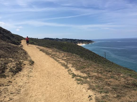
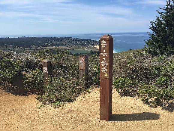
Follow the path south, until it turns inward. Within a half mile the trail will fork into two directions: A steep upward slope to your left (an unofficial “shortcut” that will take 1.5 miles off), or continuing to the right, where the trail makes a slow, windy ascent through some shade on a fire road.

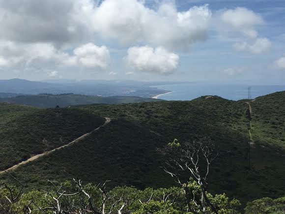
On the fire road, looking up a few miles and about 2,000 vertical feet to the top of Montara Mountain.
At the top of this forested section, the fire road runs into the end of the shortcut before continuing up incredibly steep, exposed, dusty slopes. There’s no shade for the last few miles here, so you’ll want to bring some kind of sun protection.

This dusty, rocky trail continues up a few more miles to the summit. Along the way are cutoffs to other trails, and I ran into a lot of other hikers and runners who had joined up near the top from different directions around the mountain.

At the top, you’ll enjoy valley views as well as a stretched-out look at Pacifica and its popular beaches. Since this was a pretty grueling incline without any place to hide from the sun, I promise you’ll enjoy the way down much more than the ascent!

QUICK STATS
- Length: 9.6 miles
- Elevation gain: ~2,000 ft.
- Time: 2 hours