Cone Peak has been called the most spectacular mountain on the Big Sur coast of California, and rightfully so. It stands as the tallest coastal mountain in the contiguous lower 48 states, with the peak itself is a little less than 3 miles from the coast as the crow flies, but hikers will wind up 11 miles of trail to reach its summit- a demanding 22 miles round-trip. Daunting as that may sound, the changing landscapes made it all worth the while from the grassy coastal hills to the damp redwood forests, up through dry red stretches of dirt and onto the final white rocky ascent.
Beginning right off of Highway 1 at about 100 vertical feet, it’s earned its title the “Sea-to-Sky” trail for the challenging journey up nearly one vertical mile. The Vicente Flat Trail begins on the land side of Highway 1, marked by a small sign, adjacent to a larger one welcoming visitors to “Los Padres National Forest.” There’s decent parking at the trailhead for about 15 cars, which is also directly across the road from Kirk Creek Campground- a site that sits right on the edge of the Pacific Ocean, its users perched on top of bluffs an easy walking distance to the water.

View of Pacific Ocean from Kirk Creek Campground
I had planned to stay at this campground since it was hands-down the most convenient spot for getting an early start, but didn’t realize I had chosen this climb on the same weekend as the Big Sur marathon. The campground takes reservations between 6 months and 8 days in advance, and the rest of the spots are first-come, first-serve. I pulled in at around 6:45pm, feeling shattered when I saw the sign “Campground Full.” I circled the lot and pulled over to ask an older gentleman if there were any other places to camp, and he responded by telling me that him and his wife just had their friend cancel on them, and I could take his spot if I’d liked. So I spent the evening with John and Judy, trading part of my 32 oz. Sierra Nevada for some homemade, stove-cooked chili, before they went to sleep in their tent and I in my car.
My alarm was set for 5:30 a.m., and it felt warmer than I expected- maybe 50 degrees out. I was on foot on the trail at 6:05 a.m. when it was plenty light out to see the stunning views of the Pacific as I followed the trail upwards. The Vicente Flat trail inches north along grassy hills, giving climbers a fresh breeze (stronger wind in the afternoon), and powerful sound of the ocean for the first hour of the climb.

Pacific Ocean after hiking 1 hr / 500 vertical ft.
I wore leggings, thick socks, hiking boots, a long sleeved wicking shirt, a fleece, and a hat for the sun that came blazing later in the day. I packed a rainproof windbreaker and a down jacket just in case, though I didn’t end up needing either. Throughout the course of the day I ate a banana, apple, two granola bars, yogurt-covered pretzels as a nice treat at the top, and my favorite Cliff Blok chews for extra energy. I carried three and a half liters of water and ended up drinking nearly three by the time I had hit the road. I also packed SPF lip balm, ibuprofen for my knees on the way down, sunglasses, extra hair ties, gators and an extra pair of socks that I didn’t end up using. My ski poles saved me- both on the challenging ascent and for bracing myself downhill, the last couple miles being especially painful as my boots wore the skin of my feet thin (and completely off of my heels), precisely the reason I carry an extra pair of flip-flops in my car.
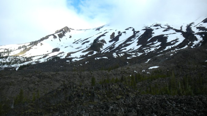
The first 5 miles to the back country campgrounds of Vicente Flat are easy going at 1620 feet. Continue past the campground for 2.5 miles up the steepest stretch that reaches Cone Peak Road at 3600 feet. Coming out of the forest and up onto the service road gives hikers a breath of fresh air- and a brand new view to enjoy. The road sits between the Pacific to your west and the rest of the Los Padres National Forest to your east, a whole new landscape to take in.

Los Padres hills
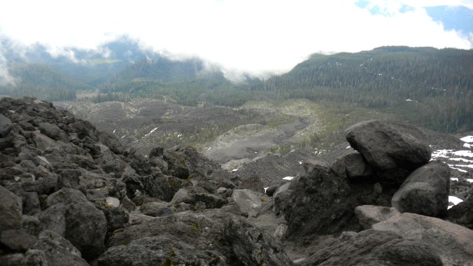
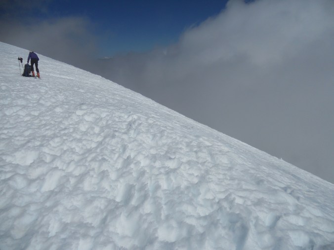
I saw a couple cars on this road and a few runners who use it as a loop- it provides an alternate way down. Leaving from the Vicente Flat trail, you’ll turn left and walk along this service road for about 1.5 miles until you reach the Cone Peak trailhead on your left, marked clearly so you won’t miss it. The final 3 miles up can get chillier and may be cloud-covered. I walked through some fog and was worried it would affect my visibility , but once I got to the top I saw the promised views that stretched from the Pacific ocean, to the windy Highway 1 along the coast, and back east towards the rest of the San Lucia mountain range.

More Pacific views from Vicente Flat trail
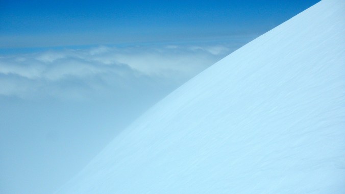
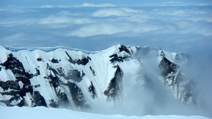
I got to the summit at 10:35 a.m., staying 10 minutes and beginning my descent at 10:45. The summit itself is rocky with what looks like an abandoned ranger station, and trees were lined with snow from weather the night before. While I had seen a couple backpackers at their camp on my way up, it wasn’t until around noon that I ran into my first hikers headed up to the top. I felt lucky- by that time the fog that skirted the mountain expanded into a large cloud and gave no sign of wavering.

Looking back up at Cone Peak following descent
The sun got warmer in the early afternoon, but just as much as the wind picked up, so I stayed in my fleece all day long. I passed dozens of people the closer I got to Highway 1, many walking just up to the Vicente Flat campsite, some only walking a mile or two up the trail to relax on one of the many bluffs overlooking the ocean. I took just as much time on the way down as I did on the ascent; arriving back at my car at 3:15pm. Quick stop at John and Judy’s campsite to thank them again for their kindness with a bag of leftover trail mix, and I took off for the 3.5 hour long drive north to the Bay Area.