3 Passes Everest Trek: Part III

Our trip is winding down. Dad is thankful to retreat to lower elevation where a cough he’s developed can subside, though the next week of downhill will have no mercy on our knees.
We treat ourselves to a couple of very long days, in return for extra total-rest days, trading off our original itinerary of short hikes for grueling all-day excursions. The results are rewarding.

  
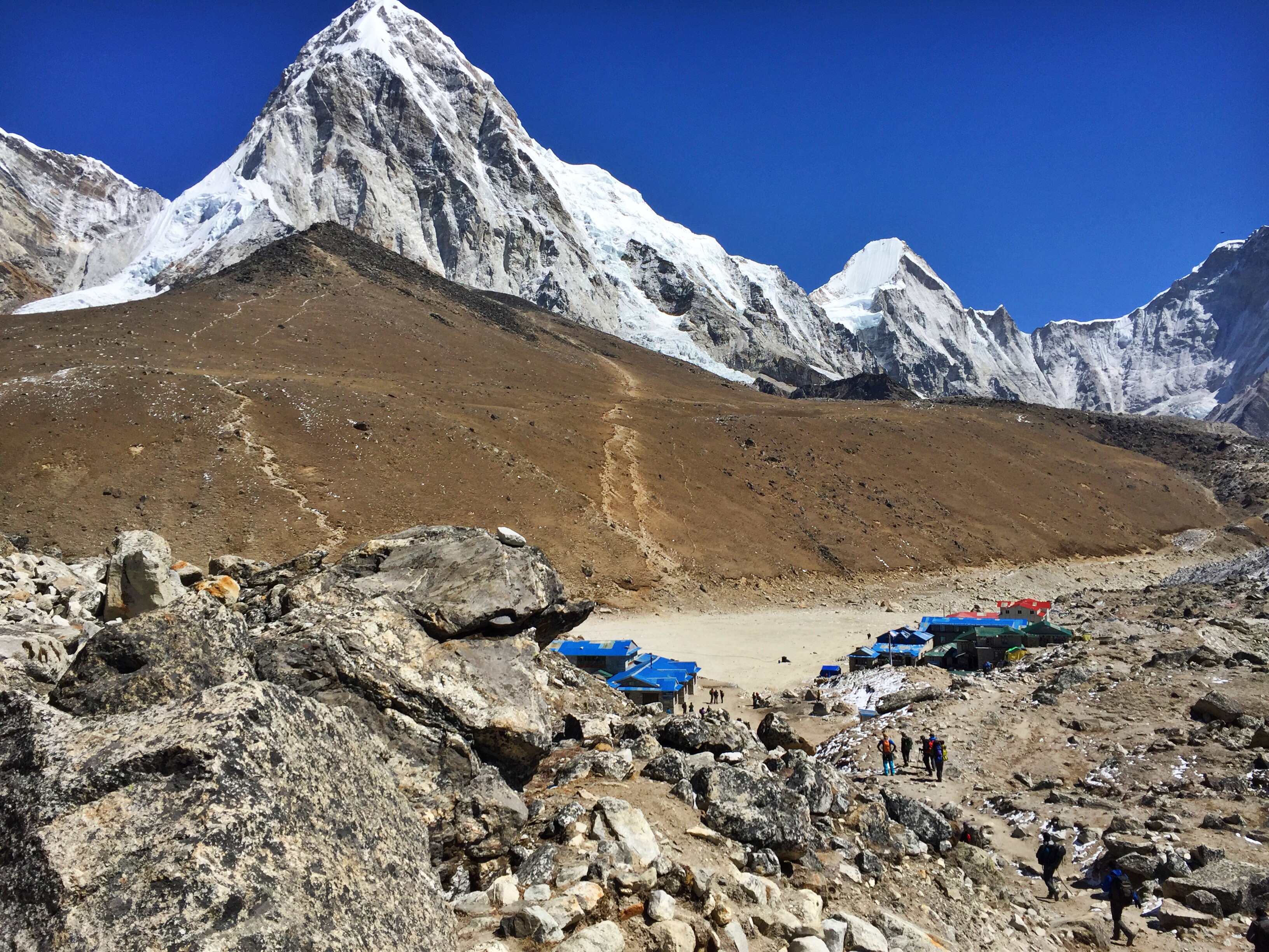
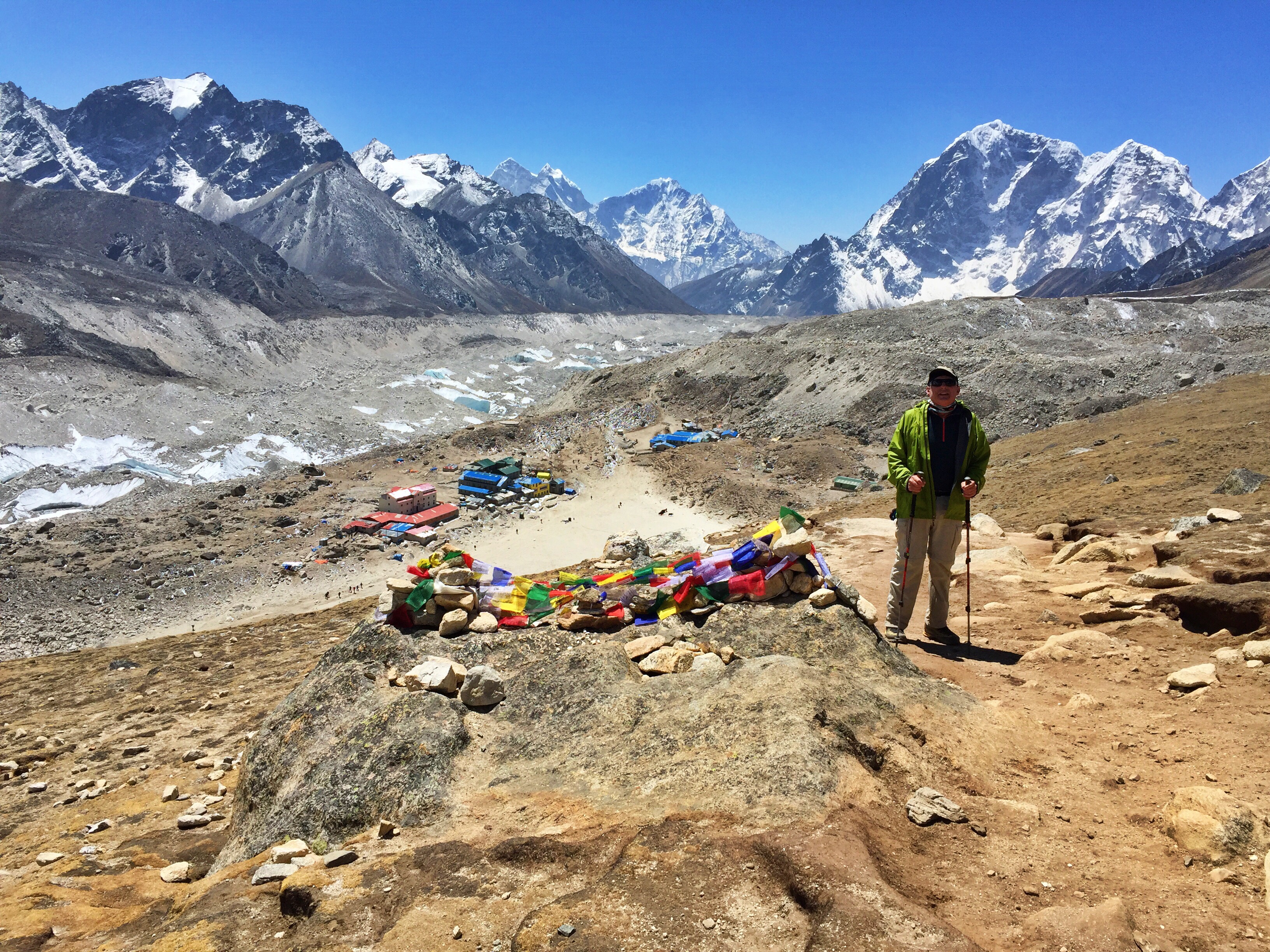
Day 15: Rest day in Gokyo (15,580 ft.) 

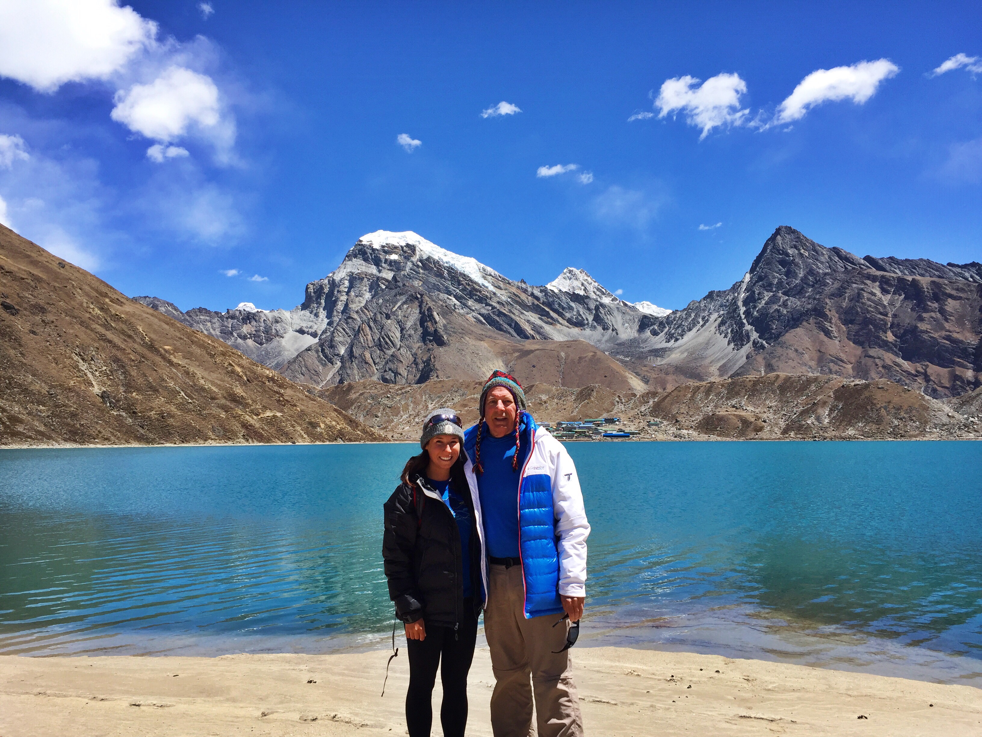
Our first night in Gokyo was not only our best sleep on the trip yet, but it was the longest time we have spent in bed so far, from at least 8:30pm until 7:30am. Because of our perseverance the day before, we are awarded a long, leisurely day with gorgeous weather in this quaint lakeside town.

  
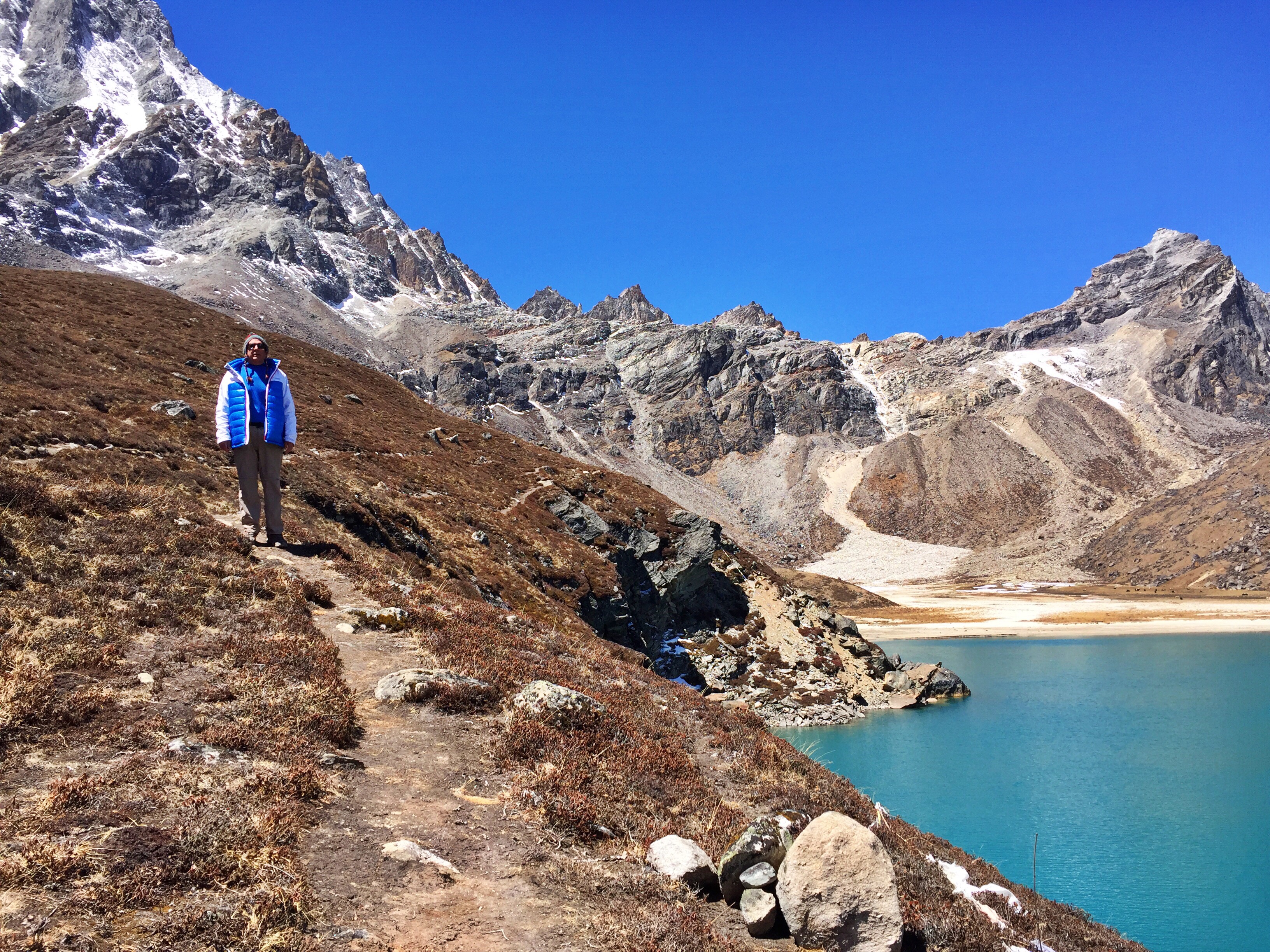
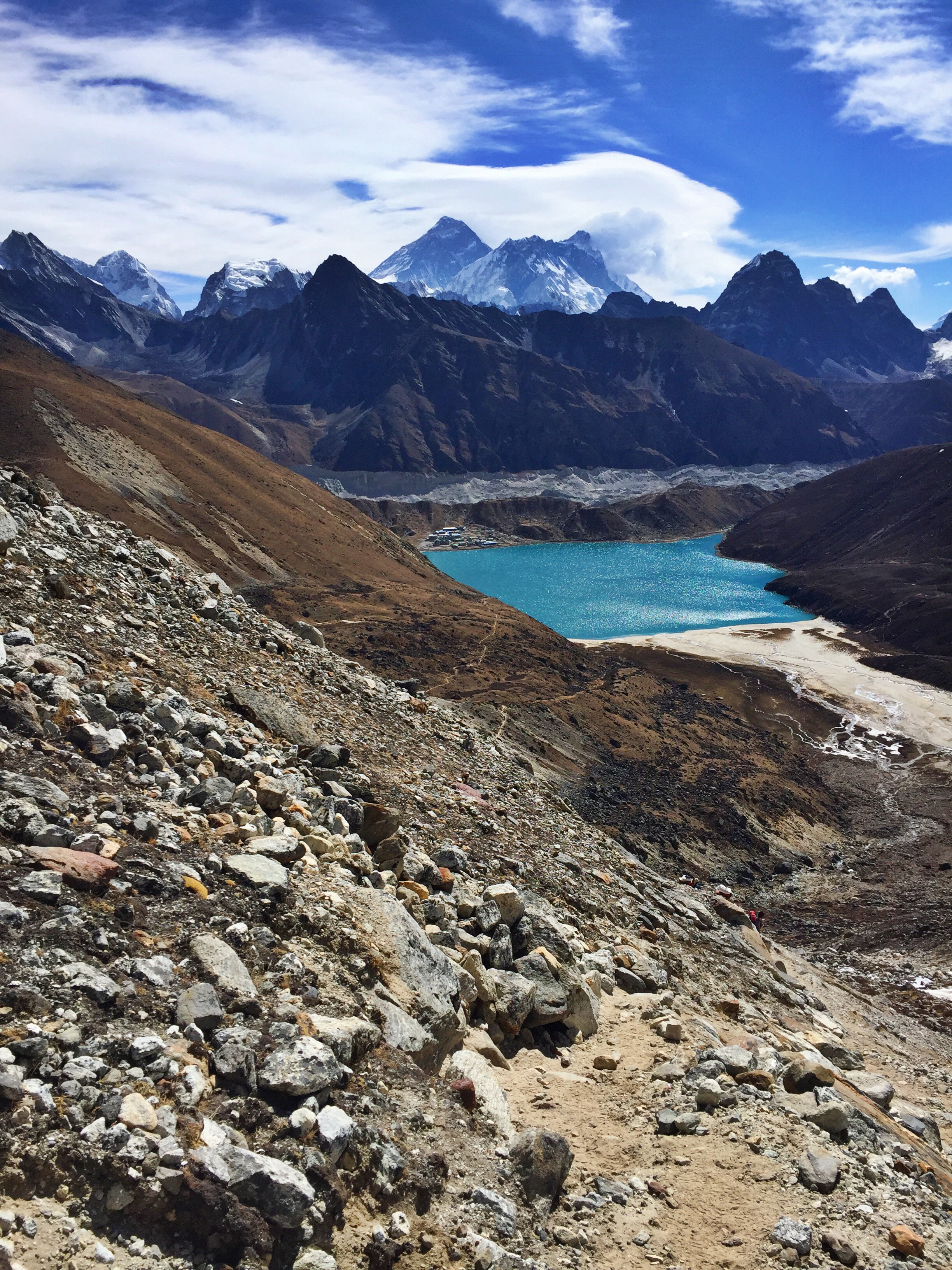
After a late breakfast and relaxing morning warming up to the frigid air outside, the four of us take a walk around the emerald-green lake that makes Gokyo one of the Top-3 trekker’s destinations in Nepal. We take pictures, play in the sand, and jump around rocks underneath the towering razor-like mountains on the opposite end of the lake.


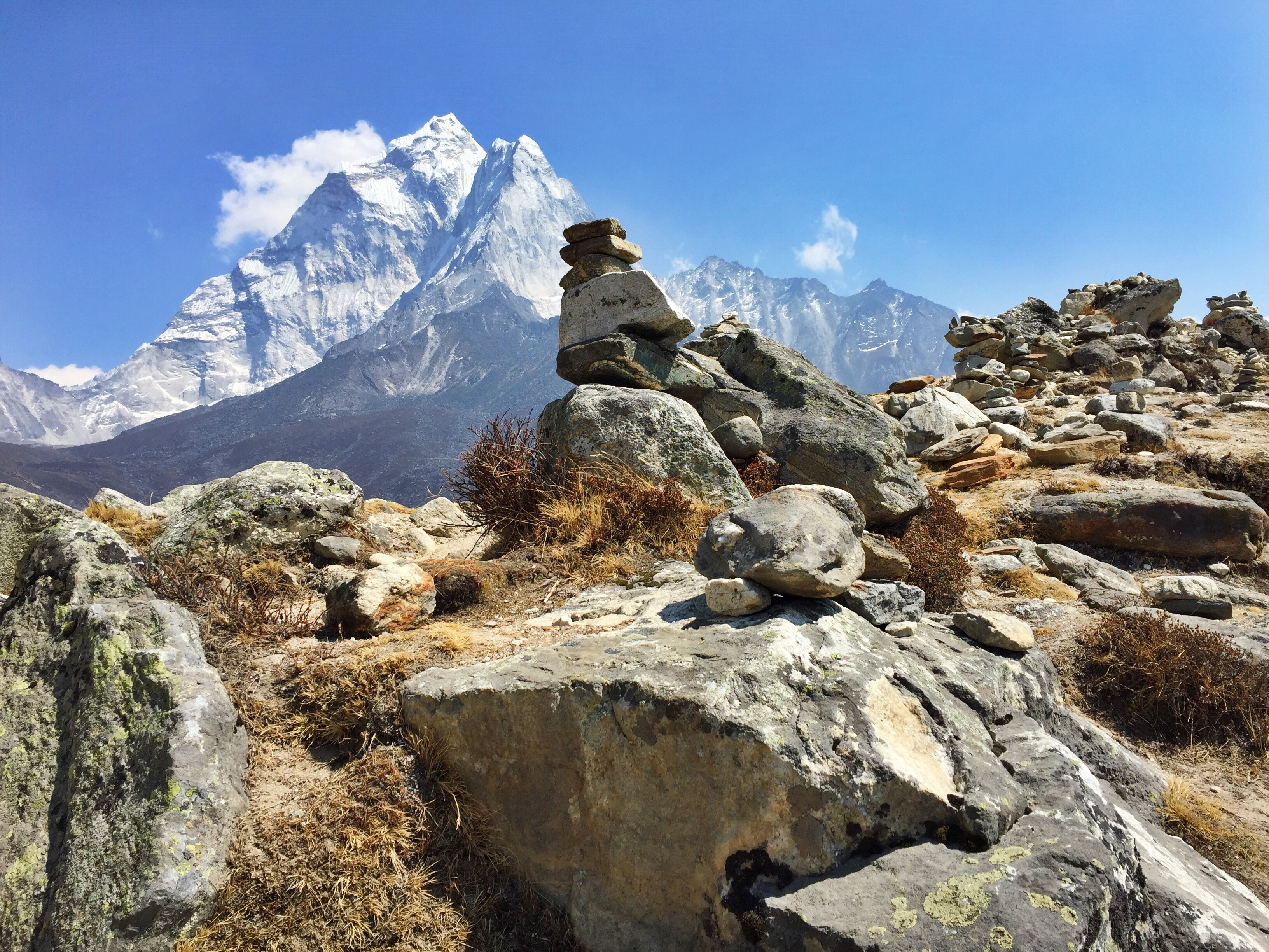
Cho-Oyu towering over the tiny town of Gokyo

 
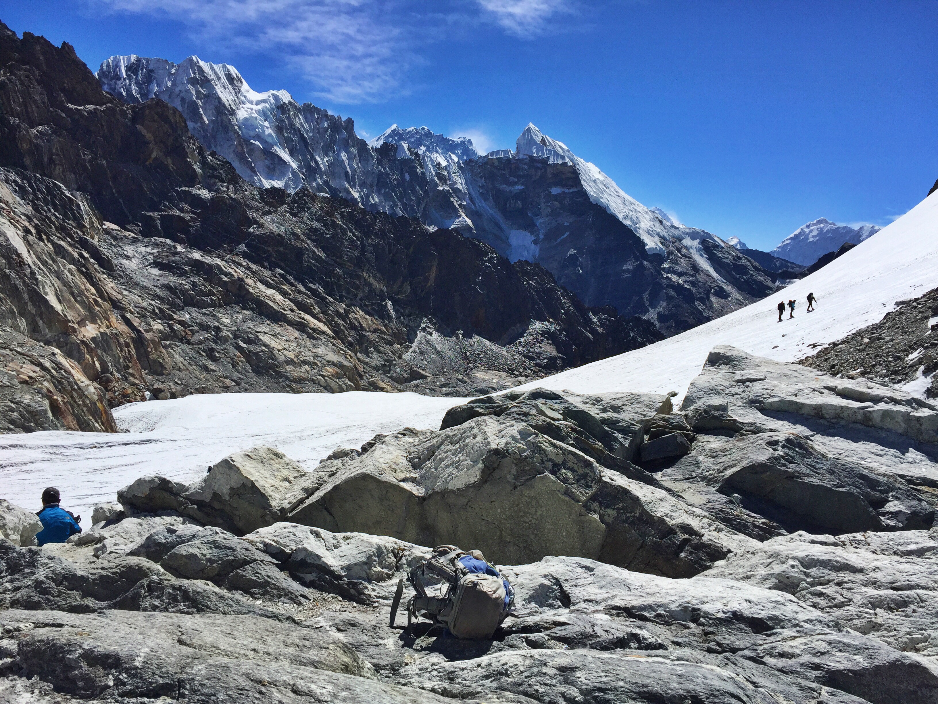
Gokyo also boasts one of the most impressive views of Cho-Oyu, one of the world’s few and far between 8,000 meter peaks. I’d read before that Cho-Oyu is one of the most attainable (avoiding the word “easiest”) of the 14 to summit, though the formidable peak is still not to be underestimated.

 
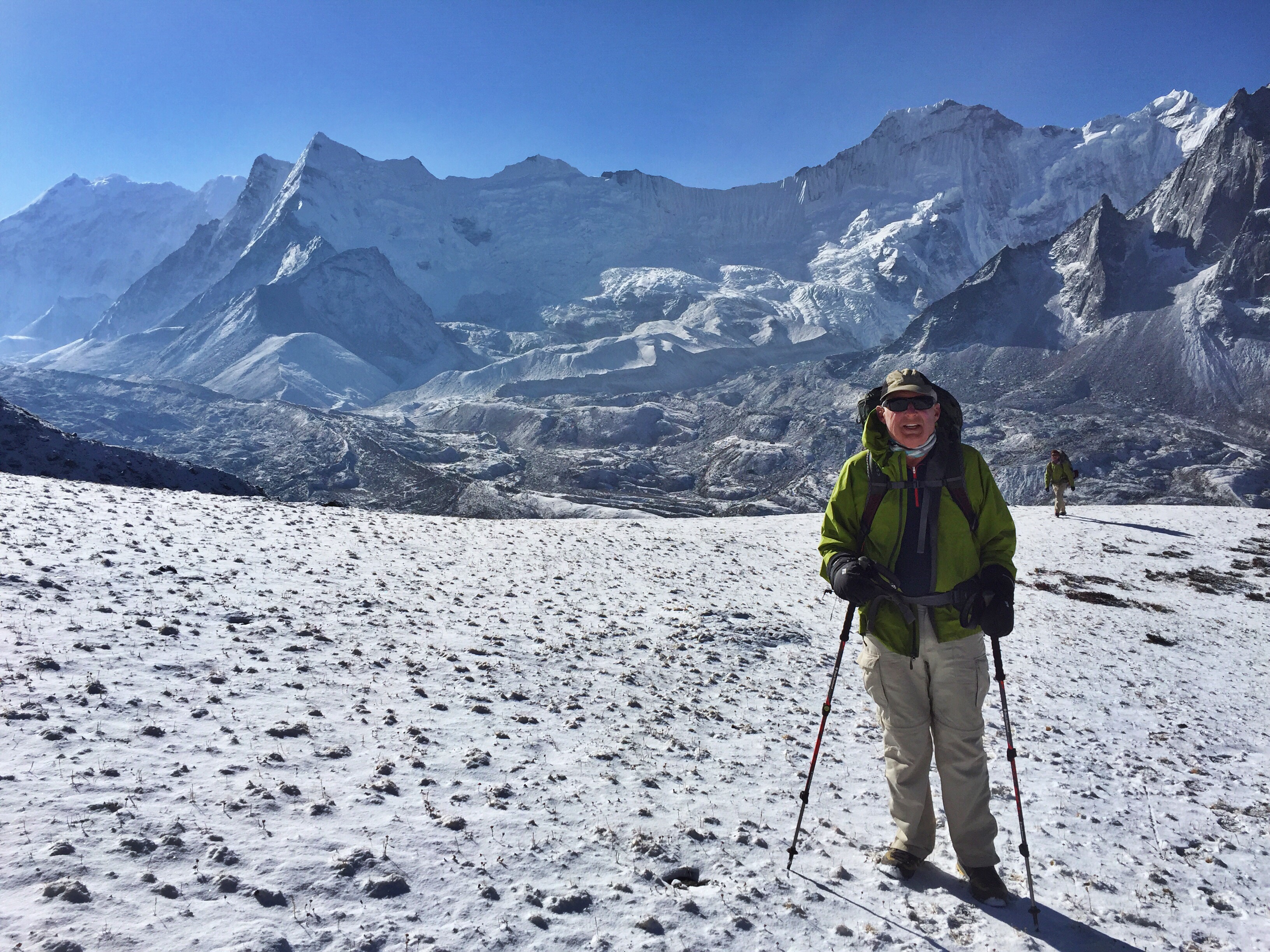
We are still acutely aware of our elevation here. Just walking along the flat trail by the lake, we’re breathing more difficultly and taking more stops than we would at home or in the gym. It’s wild to imagine the time on this trip that we’re spending above the tallest point in America.

  
Our guidebook makes Gokyo sound like an exciting, sprawling town, and we quickly discover that while it deserves the hype for its beautiful landscape, it is no larger or luxurious than the villages we’re used to over the last few weeks. We read for a few hours after lunch and head to a bakery recommended by Lonely Planet. The taste of freshly brewed espresso and shared platters of walnut brownie and banana bread revive us. We sit by the window and strip our jackets, letting the sun warm our thinly-clad backs.

  
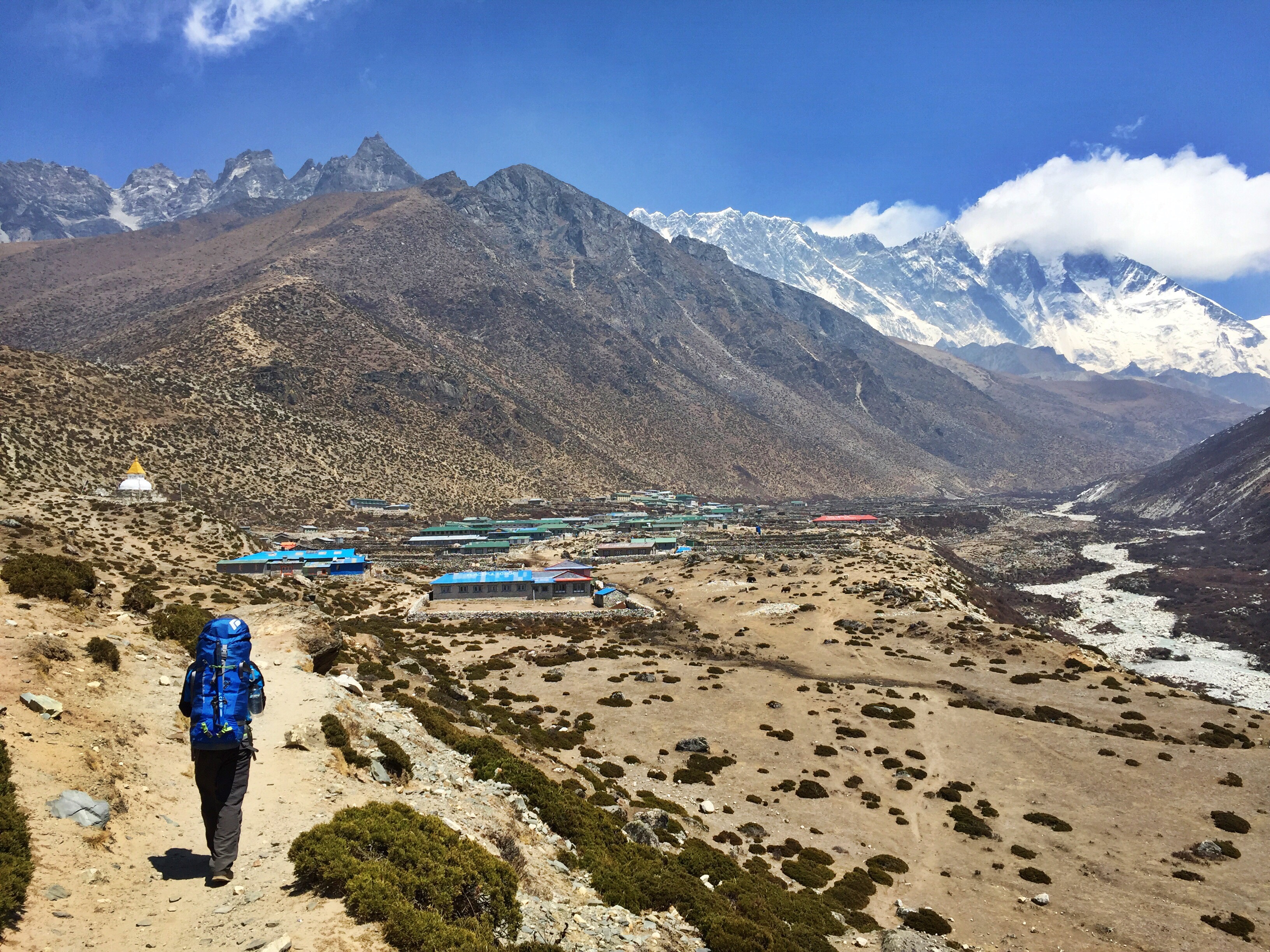
Day 16: Gokyo (15,580 ft.) to Lumde (14,370 ft.) over Renjo-La Pass (17,690 ft.)
Dad delays our typically early-morning start that’s accompanied us on the last two passes. For some reason, even though Gokyo is at a comparable altitude with our other lodges, the village feels much colder and we’re feeling patient enough to let the sun warm the lake and hillsides before setting out on our 8 hour day. We leave at 7:30 instead, which is about as much “sleeping in” as we’ll get.

  
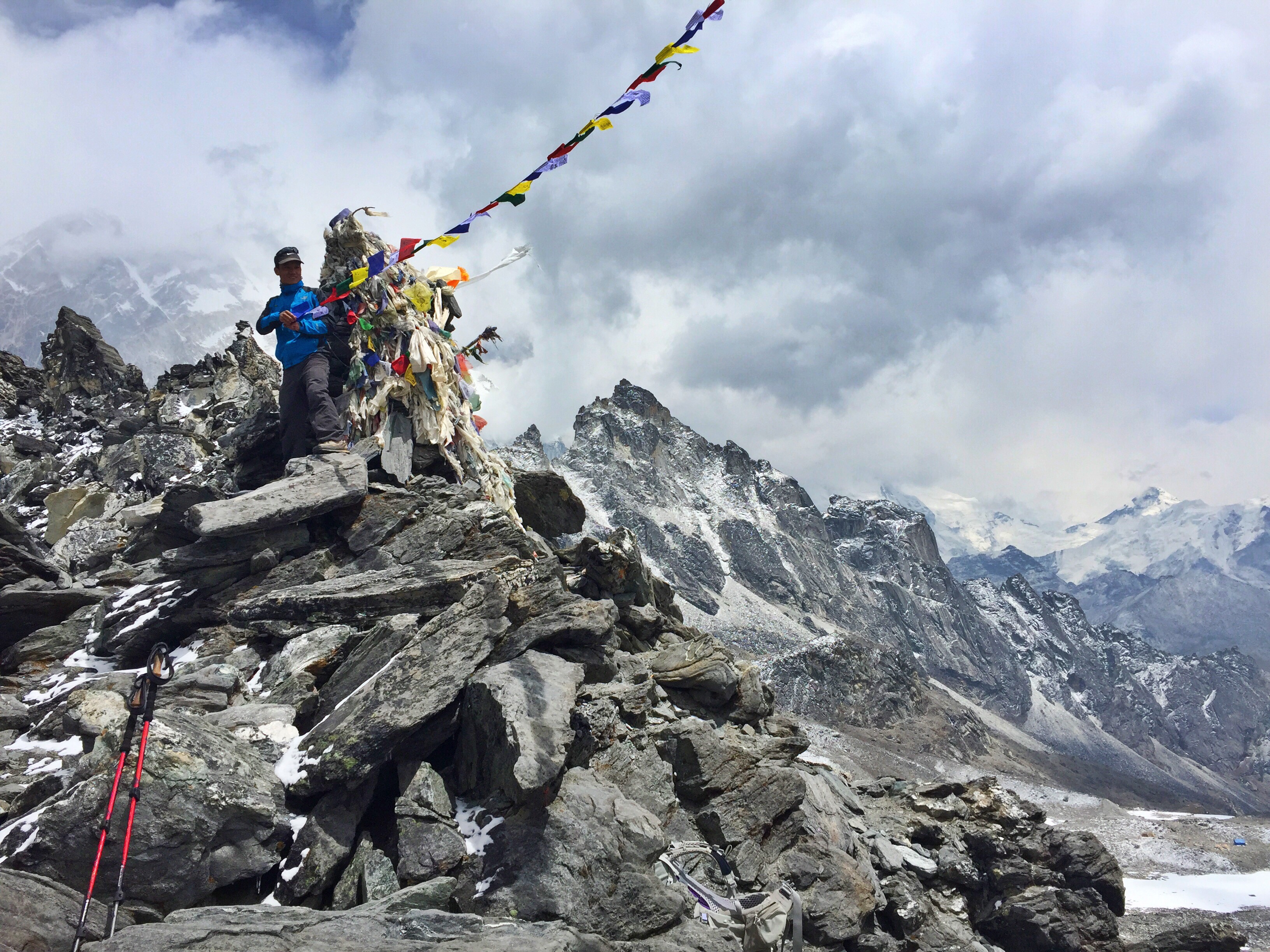
Throughout the entire hike, we have a clear view of the tiny village of Gokyo below us, growing smaller as we climber higher. Our path zig-zags along the hillside up past the alpine lake, growing over a huge ridge of rocks where we scramble with our hands and feet to clamber upwards. It’s such a seemingly short distance, and at sea level it shouldn’t take us too long, but high above the tallest point in America, our lungs are short of breath and our muscles short of oxygen. It takes us three and a half hours to reach the pinnacle of prayer flags and people shouting loud “whoooops” of celebration at the top.


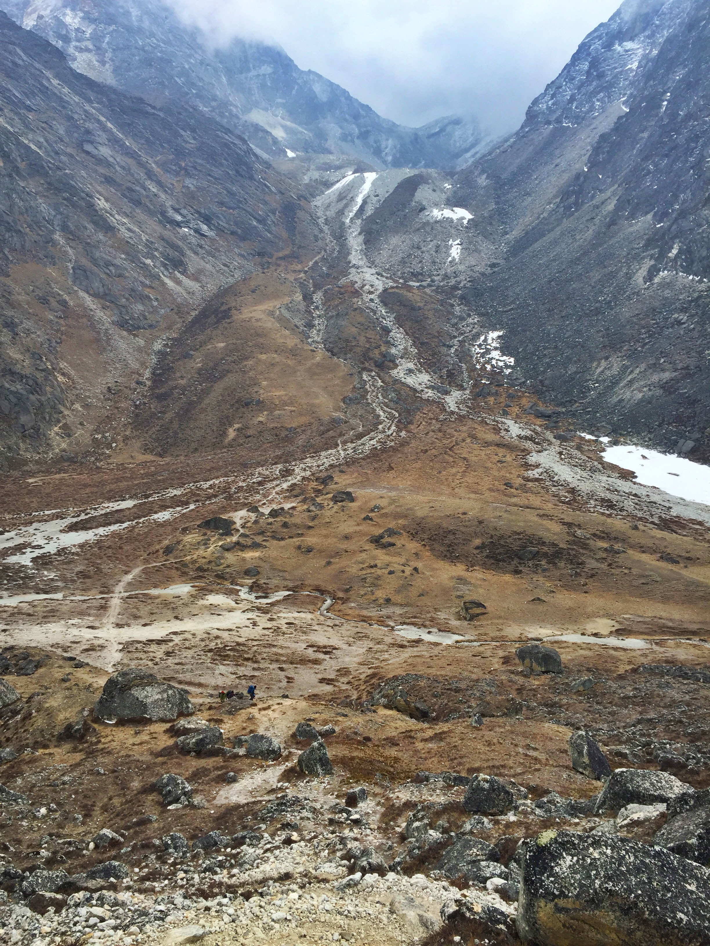
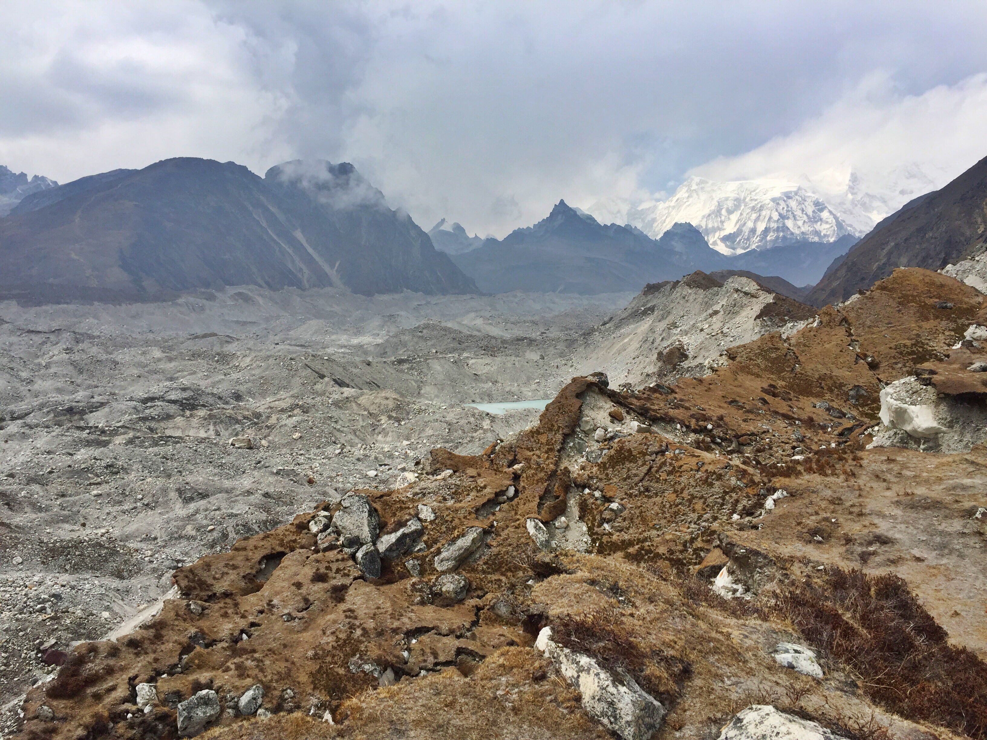
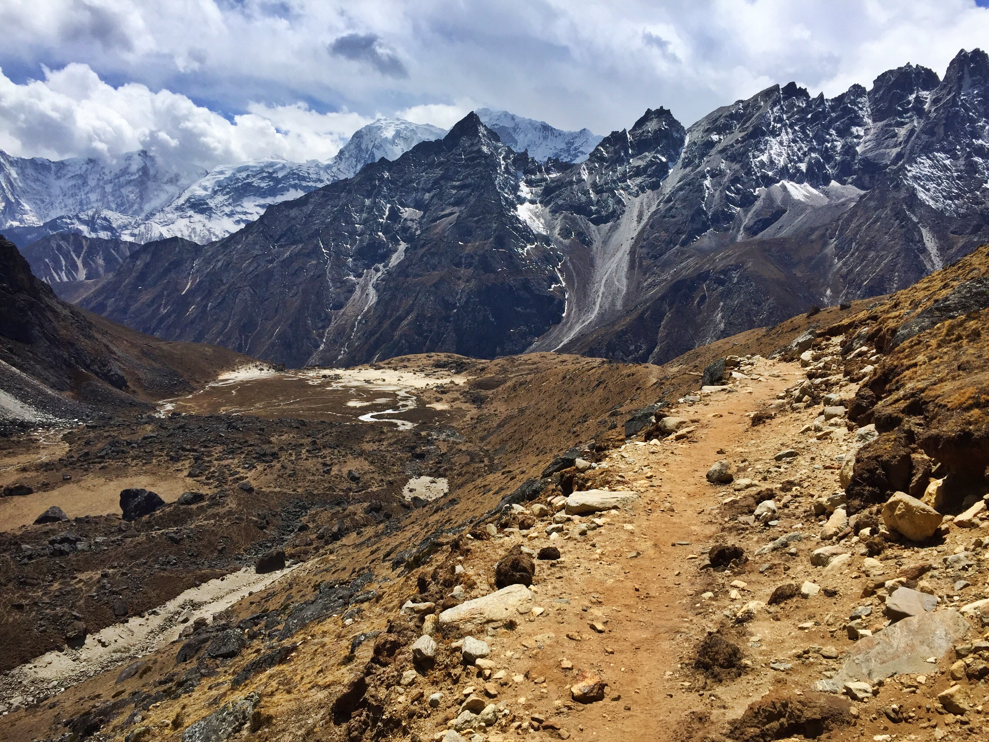
The descent is endless. We’re blessed with good weather which aids our spirits as we wind farther and farther through valleys, hopping over streams, traversing hillsides and kicking up dust until we finally see the tiny dots that mark Lumde below. By the time we reach our lodge flurries of snow are whipping around us, and no more than an hour after we’ve had a cup of hot tea and dug into our books, a whiteout outside blocks all views of the previously stunning mountain backdrops that drape across both sides of town.


So close to the seeming metropolis of Namche Bazaar, and so far from the outer reaches of Gorak Shep, Dad and I are surprised to find our lodge in Lumde to be the most primitive that we’ve stayed at. The one door separating kitchen from dining area swings open every few minutes, letting the billowing cold and weather into our dung-heated common area. While we don’t need to leave the building to access the toilet, the room is lined with sheet metal effectively keeping out any warmth (albeit, smells as well). We also don’t have a light in our room and navigate nighttime by the glow of our headlamps. These aren’t complaints, though; we’re accustomed to simple living by now.

Approaching the tiny town of Lumde just as the storm’s clouds roll in

Day 17: Lumde (14,370 ft.) to Namche Bazaar (11,286 ft.)
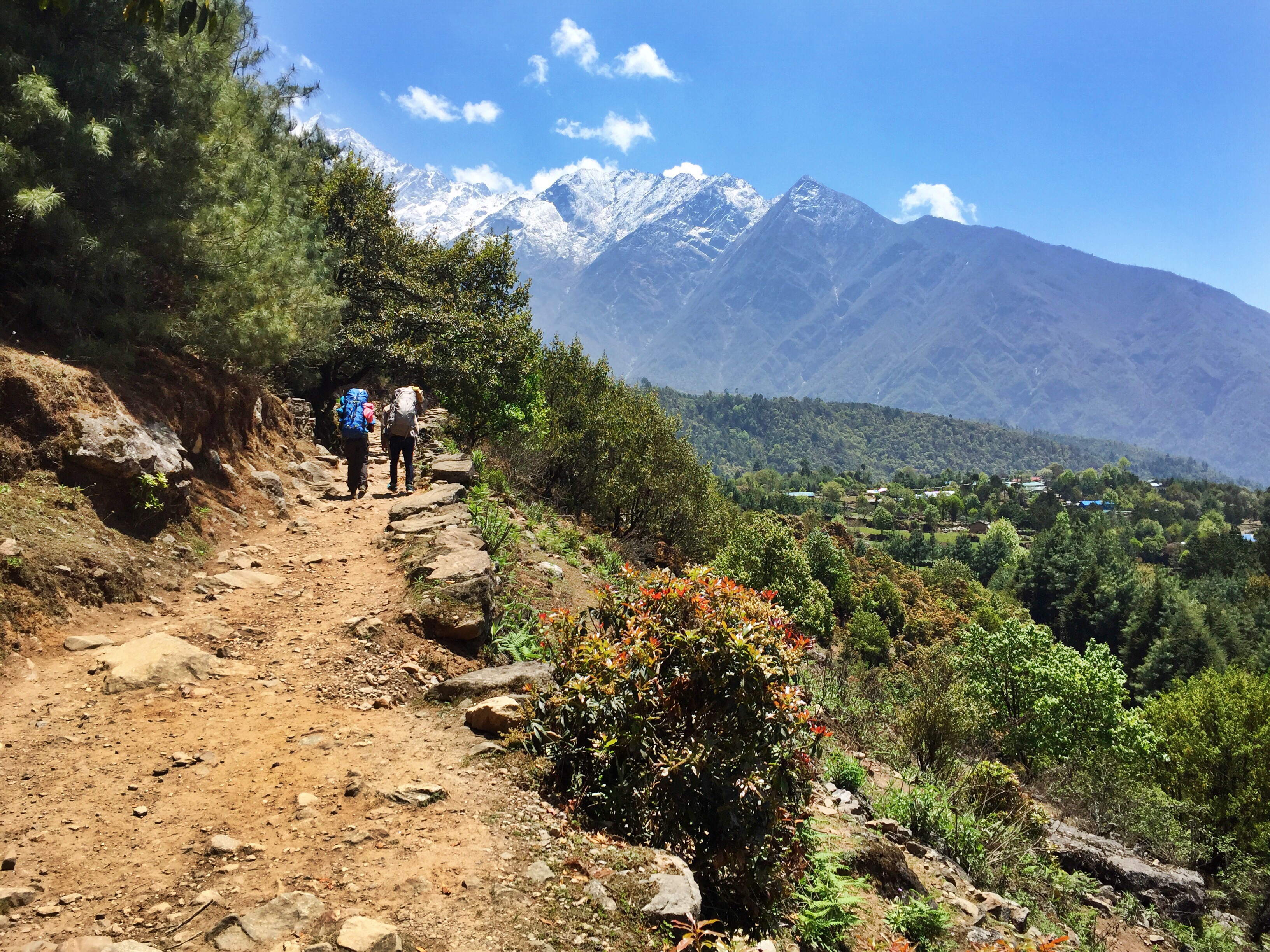
Today we are on the most beautiful trail that we’ve encountered so far. The wide dirt path wanders downhill at a slow grade, making our entire day a leisurely and enjoyable walk along the river and through some of the most famous villages west of Namche.


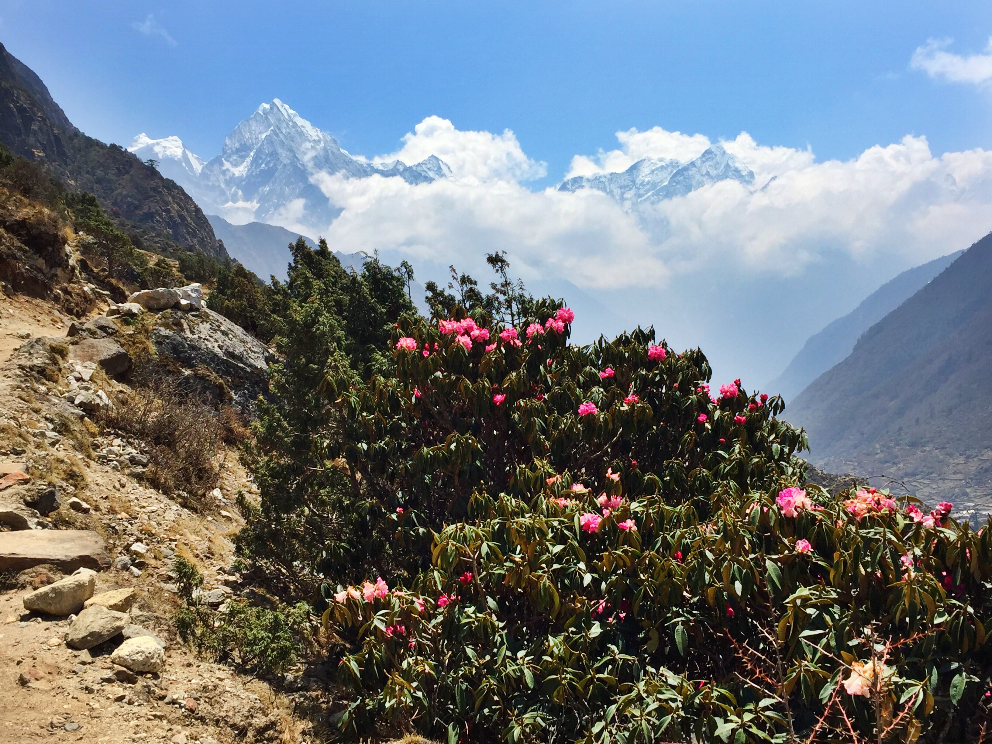
We transition down past the tree level again, trading the harsh mountain environments we’ve adapted to with a lush, colorful countryside. There are signs of life (and tourism) through Thame, which we reach late morning. Our original stopping point of the day, Thame is a sprawling city of a village that boasts endless lodges and restaurants, catering to Gokyo trekkers on their way up. Indeed we pass dozens and dozens of more trekkers than we’d seen in the last day, happily clad in shorts and t-shirts. 


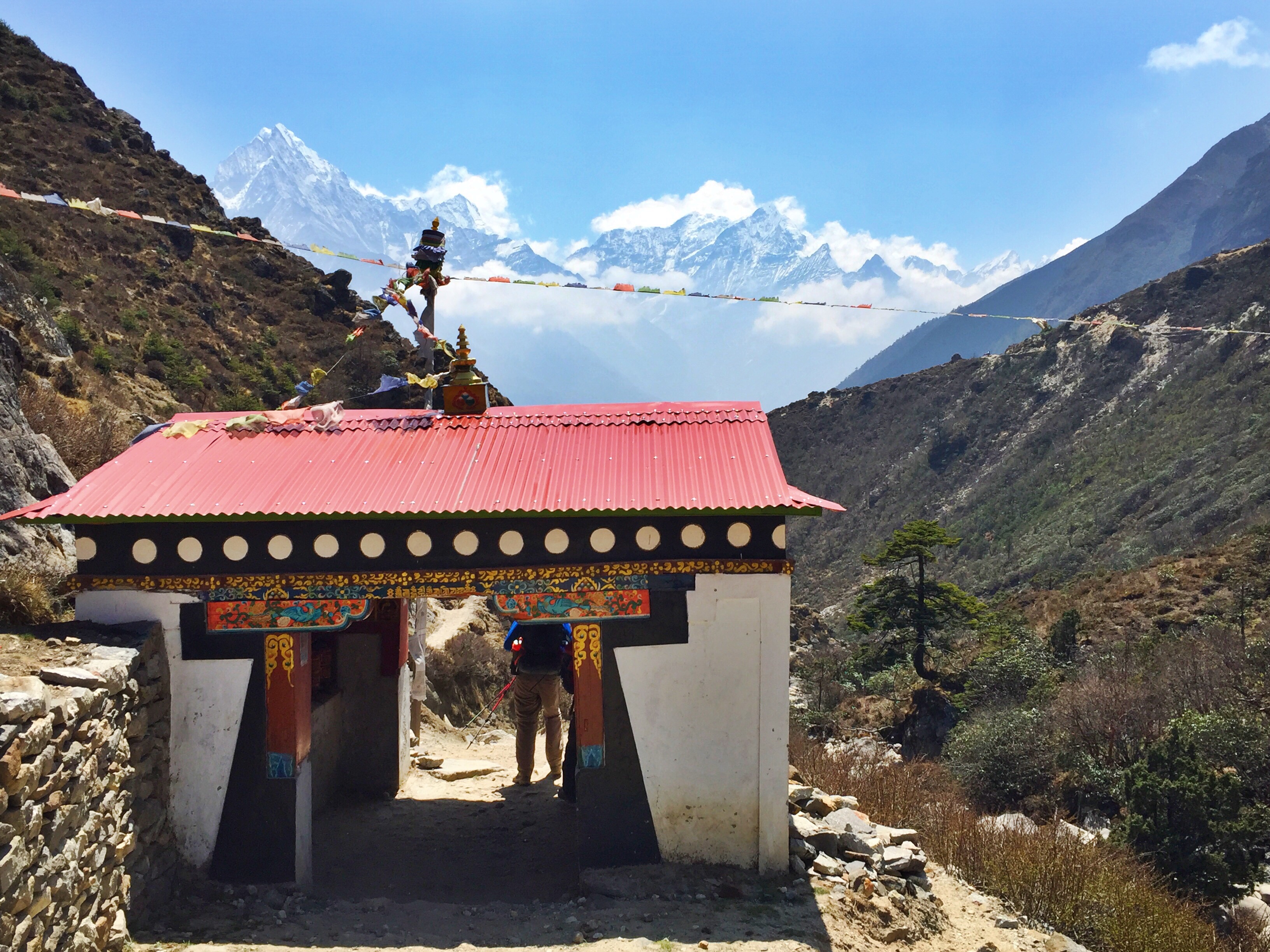
We wind down into Namche over a ridge full of prayer-carved stones scattered across an area the size of a football field, painted with colorful words. Construction workers are digging deep tombs beneath some of the rock slabs which makes me question whether this is a sacred prayer area, or a graveyard.

A gompa off of the trail, overlooking Thame

Day 18: Rest day in Namche Bazaar (11,286 ft.)
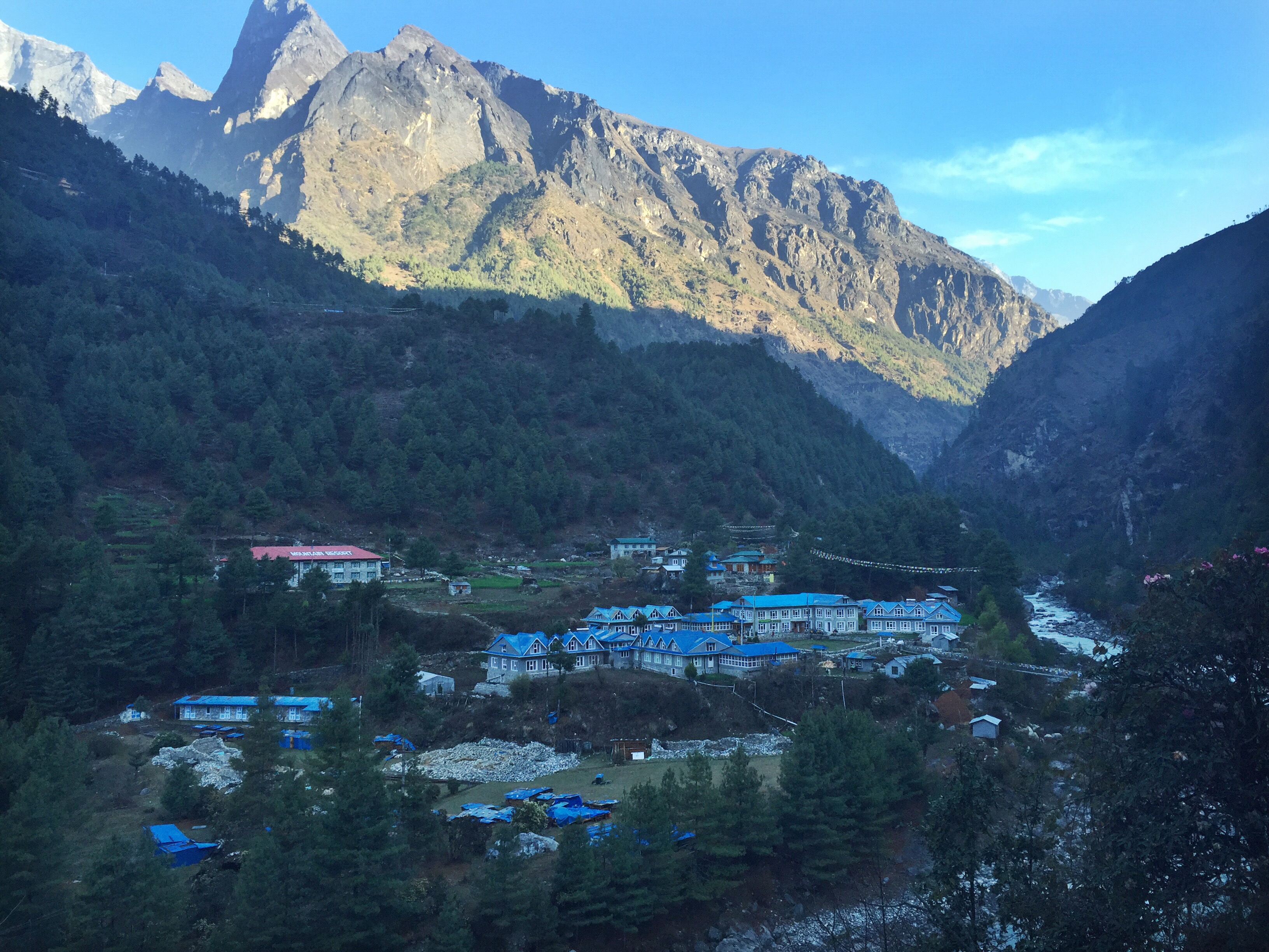
We get to enjoy another full rest day in the village hub of the Everest region. Namche Bazaar is a true trekkers paradise; pubs serving the only cold beers you’ll find on the trail, movie and documentary showings, bakeries with limitless options for sweet tooths, and an abundance of information and cultural tours on local life.

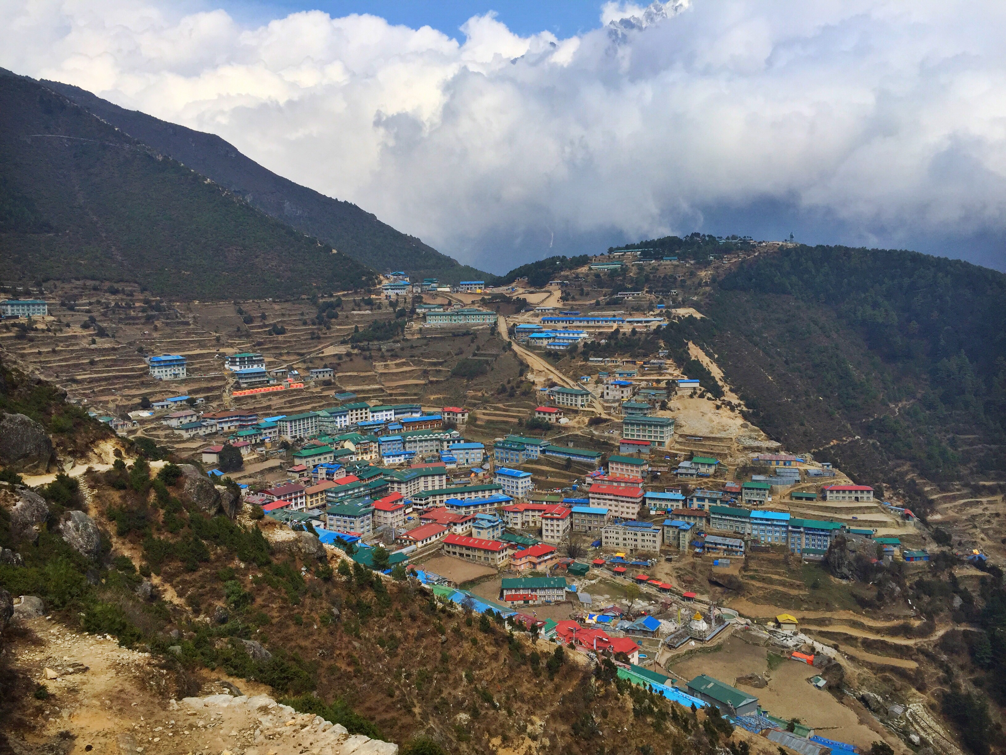
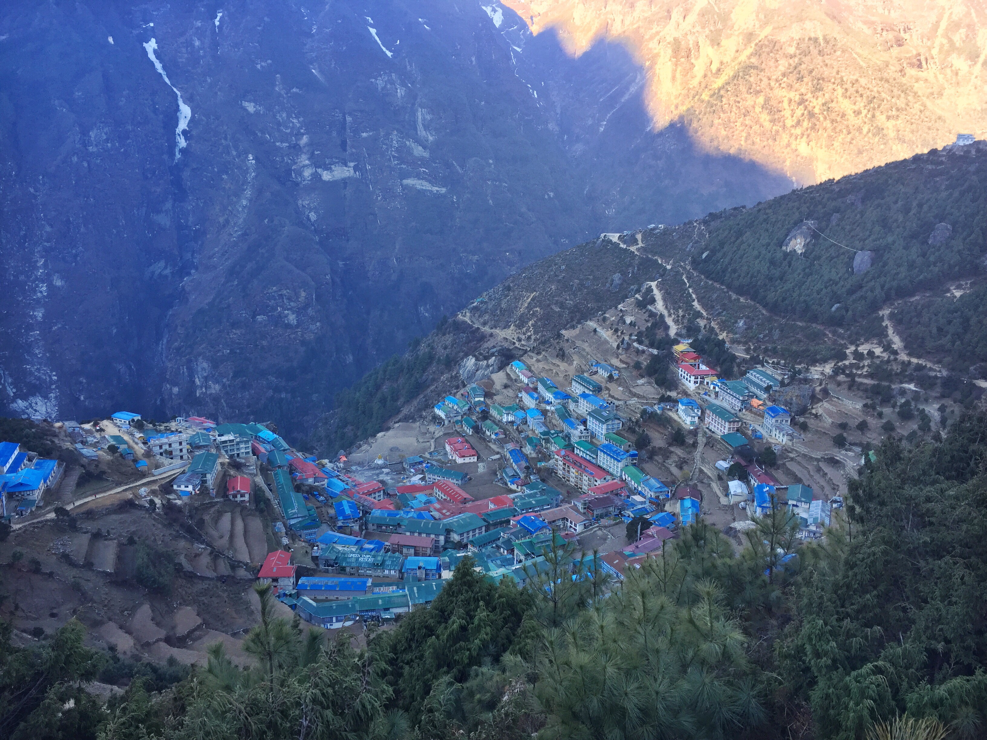
Overlooking Namche Bazar

In the morning we set off for the Sherpa museum, perched on a northeast hill overlooking the town. We see a traditional Sherpa home, stocked with tools, clothes, and decorations from years ago. The truth is that the Sherpa are typically such humble and traditional people whose lives haven’t completely revolutionized with the introduction of modern technology, and so much of what we see is already familiar to us.


The buzzing Saturday market

 
On our way back into town we stop by the famous Namche Market, warming up for weekend traffic. Every Friday hundreds of local people from neighboring villages meet here to trade food and other supplies for the largest market in the Khumbu Valley. We see the seats, tea pots, spices, and other amenities that all of our lodges have been using – most likely originally purchased right here.


Kids play football at a schoolyard overlooking the Khumbu valley

 
Dad and I enjoy pizza, pastries, and coffee for lunch and spend the entire afternoon buried in our new books. We’ve accumulated a small library on this trek of classic non-fiction mountaineering stories. Over the last few weeks it seems we’ve been racing each other to finish a book, trade with the other person, and buy new when we’ve run dry. It is on one hand very fulfilling and appropriate given the climate we’re in, but on the other hand embarrassing to be voluntarily carrying so much extra weight on a trek where we already require the assistance of a guide and porter. I hide the extra books in my backpack and hope Pasang or Ang won’t notice.

  
Day 19: Namche Bazaar (11,286 ft.) to Monju (9,301 ft.) 
I wake up sick in the middle of the night, my body fighting itself, covered in a cold sweat and a hot fever and unable to move until mid-day. My dad, Pasang, and Ang are all very thoughtful and helpful in my agonizing walk down the gentle terrain that leads out of Namche.
Luckily, today consists of almost exclusively downhills. Unfortunately, I am too incapacitated by my pounding headache and seemingly endless supply of sweating pores to take a single photo on our descent to Monju. 
It takes us about three hours in the hot afternoon sun to reach this tiny town perched on a cliff overlooking the river. We are completely in the forest now, breathing in the psychological affects of extra oxygen that the trees bring us.

  
Day 20: Monju (9,301 ft.) to Lukla (9,383 ft.)
Our final day of trekking has arrived. We are both elated and disheartened, sad to be leaving the captivating world of the Khumbu. 

Because of my sickliness (which has totally cleared up today), we have a longer day than originally planned, and it takes us about five hours to reach the tiny airport town of Lukla. Today, it seems, 90% of the trail winds through villages, with short departures up steep hillsides or stretches along the forested side of the river. We’ve come a long way from the few-and-far-between lodges at higher altitude. Here, a bottle of water is sold for the meager price of 80 rupees and snickers bars are down to a manageable 90.


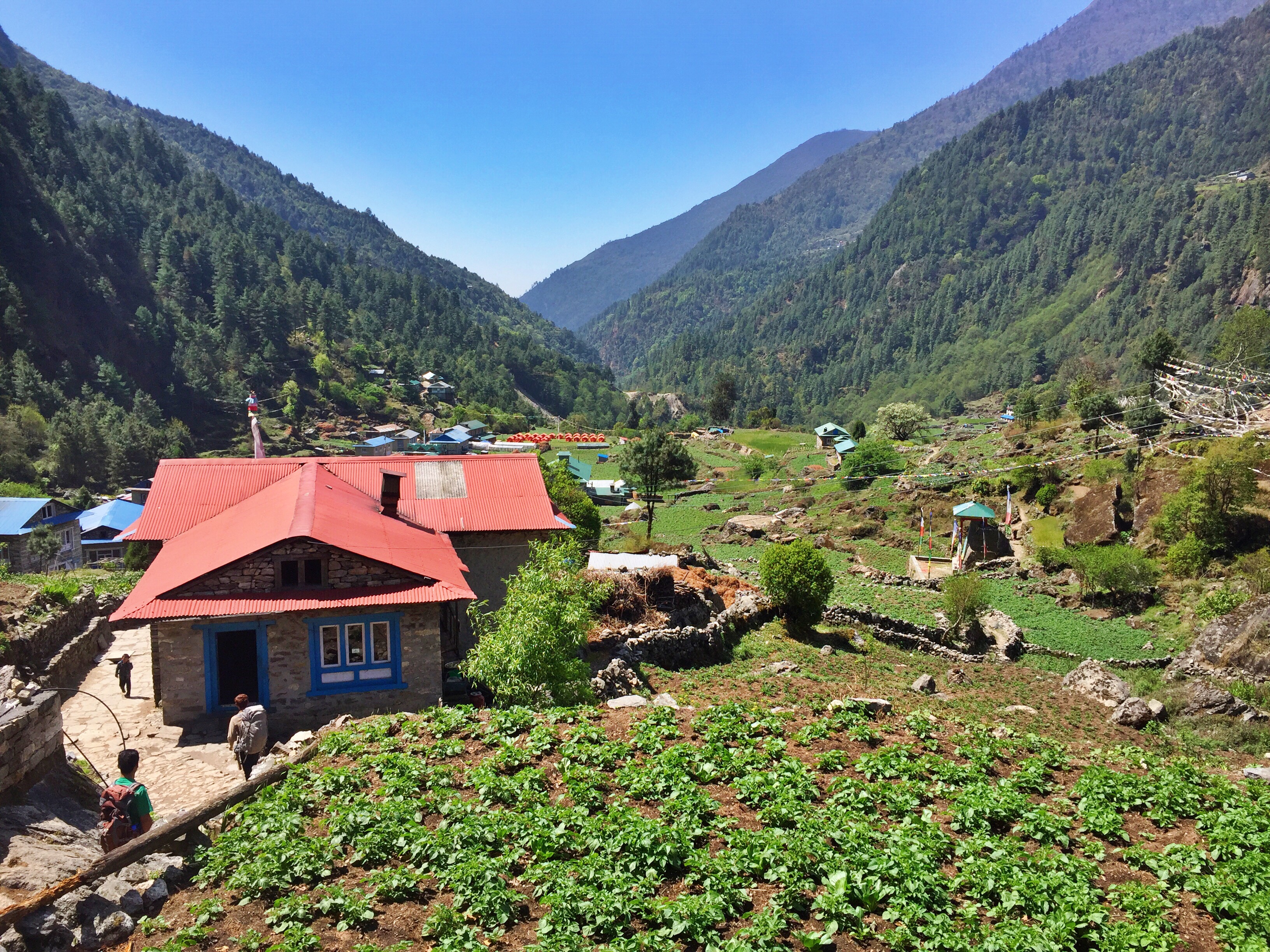
Villages and homes dot the entire trail from Monju to Lukla

 
Dad and I both get our own king-sized beds tonight, sprawling our dirty backpacks and sweat-stained shoes around the room as we settle in. We’ve long run out of “clean” clothes so we don our favorite, somewhat clean and comfortable, outfits for a final celebratory dinner with Pasang and Ang.

  
Six large cold beers, four heaping platters of dal bhat, and endless card games later, we thank our companions for their help on our journey and call it a night. In the morning we’ll all carry our bags to the airport to depart back to Kathmandu, an easy process made headache-inducing with its unavoidable crowds and lines and Dad’s impatience.

  
Leaving Lukla, our friends give us khasi scarves for thanks and good luck on our journey. I know that this will not be the last time I see this beautiful valley and it’s charming villages, so it is easier to say goodbye for now. The flight rewards us with stunning views to the west of the mountains we’d walked between for the last three weeks, reminding us that no matter how long our memories of this place stand, these peaks will stand longer.

3 Passes Everest Trek: Part II

We’re officially done with the easy part. What we thought was “hard walking” was nothing compared to what we were up against. Dad and I were finally entering the high-altitude portion of our trek, which led us through alpine lakes, mountains, and villages seemingly untouched by modernization.
Each evening got colder. Each morning got more difficult to crawl out of bed. The lodges, rooms, and bathrooms got gradually more primitive the higher we got (“rustic” would give some of these facilities too much credit). We wouldn’t retreat below the highest point in the U.S. (Mt. Whitney at 14,505) for over a week. We would challenge ourselves, and we would come out sore, sunburnt and happy.


Day 7: Dingboche (14,245 ft.) to Chukhung (15,514 ft.)


Today is a painstakingly short day; it takes us just two hours to reach our destination in the dusty, windy town of Chukhung. However, this is our only option. In order to safely and properly acclimatize, we don’t want to be sleeping any higher than we will be this evening.
However short the morning really was, it felt longer because of a mission we’d made up the previous few days: Find out if it’d be possible for me to join a climb of Island Peak. Arriving into town before 10am, Ang races to find his connection to talk about permits, groups, and gear rental. Unbelievably lucky, we sort everything out before noon. By that evening I have my permit, guide name, and schedule ready to go for the next morning.
Dad and I spent most of the afternoon talking about my Island Peak climb, reading, trying on rental gear, playing cards, overhearing and talking to other Island Peak climbers, and generally trying to balance the anxiety and excitement of my first attempt on a 20,000er mountain. We drink a lot of tea. We eat filling meals. We sleep (myself, restlessly), eager to begin the day we’d been discussing nonstop. 


The arduous hike to Base Camp, with Island Peak visible to the far left


Day 8: Hike to Island Peak Base Camp (16,690 ft.)


The four of us hike to Base Camp, where I’m united with a team summiting Everest to share food, thoughts, and tents before we all attempt a summit of Imja Tse, more commonly known as Island Peak. I split up from Dad and our guides as they return to Chukhung for the next two evenings.

Dad had encouraged me to find a way up this mountain the entire time, saying that this accomplishment would make Mt. Rainier look like “small potatoes.” Just three months prior we’d both been the highest we’d ever been, at 19,340 ft. on Mt. Kilimanjaro. In addition to topping out that altitude a full thousand feet, Island Peak would bring on greater challenges like relying on a fixed rope, ascending up a vertical ice wall, and donning crampons during multiple ladder crossings similar to those found in Mt. Everest’s Khumbu Ice Fall.

I was excited, I was terrified, and in the end, I was thrillingly successful and stood nearly as high as the tallest point in North America!


Standing on the summit of Imja Tse, Island Peak


Day 9: Island Peak Climb (20,305 ft.)

Read my entire blog post on our successful summit of Imja Tse, Island Peak!


Sunrise over Chukhung


Day 10: Chukhung (15,514 ft.), crossing Kongma-La Pass (18,154 ft.) to Lobuche (16,170 ft.)


We wake up at dawn to prepare for our first pass crossing, considerably the hardest of the three we’ll encounter. I have an insatiable hunger from barely eating the day before during the climb, and clean my breakfast plate while helping myself to Dad’s leftovers.


View from the top of Kongma-La Pass


This is the first time we’re walking on snow, from a tame blizzard the night before. The ground is only blanketed in about an inch of powder, but it does raise questions for us about the trail conditions on our first excursion above 18,000 ft. The going is good however, and we slowly inch our way up the zigzagging trail through stupendous views to what feels like the roof of the world.

Pasang stringing prayer flags across the pass

Pasang and Ang pull out packaged prayer flags that they unravel, inscribe their names on, and hang above the pass – fresh, bright, new colors that rejuvenate the older fading flags already placed there.


The other side of Kongma-La, looking over the glacier


Looking back at the 18k foot Kongma-La Pass


The descent was difficult. We cross over the Khumbu Glacier, the same one that snakes all the way up to Everest Base Camp, but in the last two years since Pasang had guided a group over this terrain, the frozen river had shifted and virtually eliminated the trail. Dad would say this part was just as, if not more, difficult than the ascent up the pass. We spent hours boulder-hopping and navigating our way through the endless moraine, working through a windy snowfall until we reached our warm lodge in Lobuche where we thawed out on popcorn, Oreos, and hot chocolate.

Day 11: Lobuche (16,170 ft.) to Gorak Shep (16,859 ft.) and Kala Patthar climb (18,514 ft.)


Looking down-valley at the hundreds of trekkers on their way to Gorak Shep


We wake up feeling clean and rejuvenated from hot showers the evening before, and set out among at least one hundred hikers headed north. It’s a slow, steady 2.5 hour walk up a long valley from town to town, which we enjoy leisurely, knowing that we will be reaching the highest elevation of our entire trip later that morning.


Like most, we stop at our lodge in Gorak Shep to drop our packs and enjoy lunch before taking off for the day’s excursions. The tiny village of Gorak Shep caters almost exclusively to trekkers; it’s too close to Base Camp to warrant the extra stop for climbers, and with such scarce facilities, little more enjoyable than living out of a tented camp. In fact, Gorak Shep is often described as a dismal town, one where “few people sleep well” because of its steep elevation.

This is the highest altitude that we will sleep at of the entire trip, and Dad and I both request two sleeping quilts each, along with bottles of boiling water, which at the end of the night we’ll stuff into the ends of our sleeping bags to keep our feet warm (a trick I learned on Island Peak).


Halfway up Kala Patthar with stunning Khumbu views behind Dad


Everest in all its glory, scraping the sky like a shark fin, from the top of Kala Patthar


After our standardized late-morning “lunch” around 10am, we venture up the village’s looming neighbor of Kala Patthar. The weather is perfect, and we enjoy crystal clear views of Everest and its surrounding peaks from the top. Many people will climb Kala Patthar for a sunrise summit, but in the cold, and with uncertain weather, we agree it’s best to take our chances while they look good. Sure enough, the following day’s sky was covered in clouds and a steady wind that would have knocked us off our feet at that elevation.
Day 12: Gorak Shep (16,859 ft.) to Everest Base Camp (17,600 ft.), return to Lobuche (16,170 ft.)

The day and its destination that many trekkers have come to Nepal for has arrived. We wake up with our starry-eyed neighbors who are all eager to see the jump-off point for daredevils attempting to climb Earth’s highest peak. After big breakfasts, we set off for the two hours it takes to get to Everest Base Camp alongside yak herders and porters toting loads for expedition teams as large as 150 kilos (I’m not kidding).


The hike itself is smooth, slow, and gradual alongside the seemingly endless Khumbu Glacier, following the age-old frozen river north to where the Ice Fall empties out into it. We see the first cluster of yellow and orange tents from far off, when we hear a helicopter taking flight. Pasang, Ang, Dad and I watch in horror as this chopper floats sideways down the valley, then shoots straight forward to a vertical wall on the Ice Fall, then falls backwards towards camp, practically brushing up against some of the raised prayer flags. It takes us a few minutes to realize half of the copter door is wide open, a cameraman dangling liberally outside to catch the scene on film.


By the time we officially step foot in EBC, it takes us near a full hour to walk from one end to the other. We see climbers, Sherpas, medical volunteers, yak herders, cooks, and people of all skin colors and body types running around as this was any other village. I recognize many of expedition names plastered across mess tents, and don’t recognize others. Pasang and Ang run into friends and family members who offer us cups of tea along our walk.


Alpine stream flowing from Everest’s Khumbu Ice Fall


The air around Everest Base Camp is not only noticeably thin, but it’s thriving, like an energetic field pumping with adrenaline. Some climbers have begun to acclimatize by hiking through the infamous Ice Fall, but they won’t begin ascending any higher or planning any serious summit assaults for another month. The excitement and anxiety in this field full of people is tantalizing.

Compared with our morning excursion, the afternoon is dull. We grab a bite to eat in Gorak Shep before trudging down the trail to return to Lobuche, where it is snowing. Even though our lodge locations will continue to lower in elevation, we still have two passes ahead to tackle that will take us even higher than EBC. For the next few days we won’t skimp on sleep or carbs to fully prepare our bodies for the demands that high altitude will afflict on us, whether we welcome them or not.
Day 13: Lobuche (16,170 ft.) to Dzongla (15,880 ft.)

Today is a short up-and-down hike to roughly the same elevation we’d started at. We’re at our lodge before noon, but the towering Cho-La Pass stands between us the next town, abruptly ending our options of continuing on for the day.


Pasang tells us that Dzongla is the tiniest town we’ll stay in, though we hardly feel a difference. Each stone building seems the same as the next, and there are a row of tents set up outside, presumably for Sherpa guides. Dad complains about the cold in the dining room until he notices these; then we decide to count our blessings. 

Although the nights are very cold, the mornings typically bring strong sun and warm temperatures. However, these good spells don’t last for long – the weather usually deteriorates by mid-afternoon. More times than not, we’ll encounter snow flurries on our final approach into town, or admire the storms behind the comfort of thin walls, our books, and a cup of tea.

View from the small but beautiful Dzongla village

Today, I take advantage of the early afternoon sun and hand-wash three pairs of socks, saving me from any additional laundry needs before Kathmandu. They half-dry in the sun, then quarter-soak in the snow, and finally fully-dry by the heat of our lodge’s dung-powered woodstove (or “shitstove” as Dad would say).  
Day 14: Dzongla (15,880 ft.) crossing Cho-La Pass (17,782 ft.) to Gokyo (15,580 ft.)


We’re crowding along dozens of other hikers at 6:15 am with the same mindset: Start early enough to get up and over the pass to beat the afternoon winds, but not too early that the backside of Cho-La would be covered in ice. This is supposed to be our easiest pass on the trail, but we are met with endless boulder fields and a large glacier crossing that slows us down.


Final glacier walk up to the pass


We reach a tiny town after our pass crossing at 12:30, our designated end point of the day. But even after a long morning, we’re feeling good, and suggest to our guides that we push on to the town of Gokyo, which we’ve read nothing but good things about. We’re looking forward to spending two nights in the same room for the first time in a week, and our very first ever full rest day, a new concept for us.

In the last blog post, Dad made a point that he’d wished he had clarification on what “rest day” entailed. On this day, before leaving the Tashi Friendship Lodge, he’d asked our guide: If we choose to push on to Gokyo, will the weather hold this afternoon? Pasang’s response: Yes, weather will be no problem.

So here comes my father’s query of “What is your definition of ‘no problem’?” We end up walking through a two-hour long blizzard. A few tame snowflakes had us pulling out our gloves and wool hats, and at less than halftime to Gokyo we found ourselves in a complete whiteout, blind but for Pasang’s guidance.


A long traverse to Gokyo in deteriorating weather


Halfway through the day, Dad announces that he’s lost his money clip: It’s gone forever. A few hours later, he’s positive that he knows where it’s ended up: Behind a large rock, 20 minutes into the beginning of our day, presumably on top of, next to, or underneath a pile of shit. Pasang and Ang generously offer to spend the following rest day retracing our steps back (9 hours one-way) to Dzhlonga to retrieve it. 
However convinced Dad is, all three of us are skeptical, and implore him to empty out his fleece and parka. Lo and behold, it’s in the right hand pocket of the jacket he was wearing that morning. I can’t tell if he’s relieved to have found it, or frustrated to have been wrong about its placement. Either way he saved the selfless Pasang and Ang a long (and frankly, disgusting) mission.

3 Passes Everest Trek: Part I

It wasn’t until a month or two before I was leaving for Nepal that my dad officially decided to join me in my quest to hike around the tallest mountains in the world. And here we are, in the thick of the Himalayas, completing the most challenging trek in the Everest region. For the next 20 days we’ll be living off of one of the most popular trails in the world, the trek to Everest Base Camp – with a twist. 

The “Three Passes Trek” takes the long way to and around base camp, adding on three intimidating obstacles that will take us over 18,000 ft. Our Lonely Planet guidebook rates this trek’s difficulty as “hard” and warns us it is “only for the truly adventurous.” Given our climbing resume and years of gear-testing, mistake-making, and navigational-learning, we consider ourselves a tough enough father-daughter team to be up for the challenge. 


Day 0: Kathmandu (4,593 ft.)

I arrive at the Yak and Yeti the morning before I’ll meet Dad and am hit in the face with the stark contrast between the hotel’s lavish courtyard, outdoor swimming pool, tailored garden, and the polluted, crowded streets of Kathmandu right outside its doors. The Yak and Yeti is a haven for newcomers and veterans alike. It’s the home-base to some of the world’s most successful mountaineers as one of Kathmandu’s most popular hotels. For Westerners freshly arrived in the other-worldly culture of Nepal, the Yak and Yeti feels a bit like home. For climbers and trekkers, it’s an energetic hotel whose sprawling backyard caters to the dumping and sorting of expedition goods, as well as hosting large groups.
Dad and I saw and met various people from teams around the world hoping to summit Everest this spring. Some of these groups would become familiar faces on the trail who we’d run into time and time again. Before taking off, we meet our two young and fit compadres Pasang (our official guide) and Ang Dawa (our porter) who will turn out to give us valuable advice and support throughout our next three weeks of sweat, dirt, and discomfort.


Day 1: Lukla (9,315 ft.) to Phakding (8,560 ft.)
We wake up from the Yak & Yeti to begin our first official day with an early breakfast and 7am ride to the Kathmandu airport. 5 hours of delays later, we are en route on a 35 minute journey to Lukla, as popular as it is infamous. Lukla is known as the “world’s most dangerous airport” for its many unfortunate accidents. The runway itself is only 500 meters long, ending sharply at the edge of a cliff. Landing doesn’t seem to be a problem, but we’re already crossing our fingers for a safe departure.


Lukla’s infamous runway, around 500 meters long

 
The other reason Lukla is so well-known is for its unparalleled popularity during trekking and climbing months. Flights only operate in the morning when wind levels are down, so in times of bad weather, people can be stuck either in the mountains or in the city for days awaiting a safe passage. We were flying on the first clear morning after a four or five day long storm, so delayed passengers took precedent and we patiently awaited our turn. Our guide tells us that a few years ago all flights were delayed for an entire month; there were thousands of people at either airport every day waiting morning after morning.

  
We hike downhill through an overcast afternoon to arrive at Phakding, a small and quiet village where our guide finds us a quaint and comfortable lodge. We’re offered gas-heated showers and wifi at a few dollars each, but pass on both.

  
Dad is getting used to his new La Sportiva trekking boots purchased in Kathmandu. One look at his veteran leather Columbia shoes and our guide told him they would not do on the high passes. He was more than happy to replace his tried-and-true hiking boots from home, but still complains about forgetting his gaiters and their expensive replacements. 
Day 2: Phakding (8,560 ft.) to Namche Bazaar (11,302 ft.)

  
Today’s trail takes us up and down, gaining and losing elevation all the way to Namche Bazaar. Our guide instructs us at the beginning of the day that the route will be “Nepali flat,” my dad nods agreeably but I warn him of what I learned on the Annapurna Circuit – nothing in Nepal is truly flat, especially in the Himalayas. Dad would call these sections “substantial and steep.”

 
A huge, long suspension bridge overlooking a thousand feet of thin mountain air marks the beginning of our steep ascent to Namche. We move slowly on a dirt trail through a forest that strangely feels like home in the Northwest. This comparison is quickly nullified when through the trees, at a distance, we see our first view of Mt. Everest.

  
Namche Bazaar is an impressively large village spread out over a corner of the Khumbu Valley. We hear that the entire village was created from the economy generated by Everest climbers, and I believe it. Endless shops dotting the main route sell mountaineering books, high-altitude medications, cold weather gear, and any type of toiletry, snack, or delicacy you could imagine. This is one of, if not the only, village where you’ll find a half a dozen bars with Asian beers, American cocktails, Italian wines, and everything in between.
This is the last stop we’ll order non-vegetarian dishes from. It is illegal to kill animals in the Khumbu Valley, so all meat must be slaughtered in the city, flown up to Lukla, and carried up to town. We’re comfortable with the amenities and level of hygiene in Namche, but watching porters carry up 40, 60, and 80 kilo loads of meat (that’s 176 lbs) all the way to Everest Base Camp in the heat of the day makes our stomach turn and extinguishes our appetite.


Namche Bazar from above

 
We share our lodge with a team of Chileans attempting Everest from the North side. They’ll hike all the way to the Nepali base camp before heading back to Kathmandu, flying to Lhasa, and driving to the Tibetan base camp. Their team consists of ten older gentlemen who don hats and shirts naming themselves “Seniors on the Summit.”
Day 3: Acclimatization day in Namche Bazaar

  
Of this day, Larry would like to say: “In retrospect, it would have been helpful to have obtained clarification as to what ‘rest day’ actually entails. I had envisioned a day of my feet in an elevated position, eating fattening pastries, absorbing the sun with a good book in my hand.”
To his disappointment (and my own delight), today is not a “rest day” – it is an acclimatization day! The goal of the day is to hike high and sleep low, getting our muscles used to the work we’ll look forward to for the next few weeks.

  
Dad sleeps in while I set an alarm for 4:30 to gain 1,500 ft. for a sunrise view of Mt. Everest at the highest hotel in the world, rightly named Hotel Everest View. Pasang and I are the only hikers on the trail, and we enjoy tea on the balcony in the quiet of dawn. We’ll continue walking towards Everest, just out of reach, for the next few days. The trail is easygoing and I wear my town sneakers all day long.


Sunrise tea at Hotel Everest View, which really holds up to its name

 
After joining up with Dad for breakfast and a few hours of leisurely reading, writing, and checking in at home, we set off for a mid-morning hike to Khumjung (3780 meters). It’s warmer and windier than the first few hours of the morning, and we’ve already worked up quite the appetite by the time we climb the 2,000 ft. to reach our lunch destination. I eat the most delicious piece of apple pie I’ve ever encountered in my life, and then we feast on dal bhatt.

   
The afternoon is an easy stroll back into town, a refreshingly hot shower (our first one since Kathmandu), and a few fun shopping trips. There are lots of herders taking their yaks through town, loaded up with expedition supplies on their way to base camp, or packed with mountain goods ready to fly out from Lukla. We don’t pay them much mind until Pasang tell us that they’re incredibly aggressive animals and we need to be sure to step out of their way, preferably closer to the wall, given the alternative option of a cliffside. We agree on both counts, especially after considering their impressively sharp, curved horns.

 
Day 4: Namche Bazaar (11,302 ft.) to Debuche (12,565 ft.)
We set off at 7 and follow a trail that hugs the cliffside for a few hours in the hot morning sun. We’re walking towards Everest, waving at us from just a week’s walk away.

  
Dad is in great spirits until we start to descend about a thousand feet to the riverbed, where we follow the gushing Himalayan runoff waters that remind us all too much of our first shower in Namche. After a carbohydrate and sugar-filled lunch, we ascend close to 2,500 ft. to reach our hilltop destination of Tengboche. This town is home to the oldest monastery in Nepal, perched atop a sloping field of green with 6,000+ meter peaks surrounding us.


Mountain style: Neck buffs protect from wind, dust, sunburn, apart from looking ridiculously cool

 
Unfortunately the hotel we’d planned to stay at is totally booked with an 80-person large movie crew filming a French movie called “Everest.” We walk 15 more minutes downhill through the forest to our new destination, Debuche at the Rivendell Lodge. To our delight we find an attached hot shower and electric-heated mattresses waiting for us. I spend 11 hours enjoying that heated bed tonight.

That tiny little peak above my right shoulder is Everest!

Day 5: Debuche (12,565 ft.) to Dingboche (14,245 ft.)
We have a short hike to our destination today and arrive before noon. Everybody seems wiped, so I spend a few hours of the early afternoon taking a short walk to the neighboring village of Pheriche. We were considering both towns for our second acclimatization stop, but (1) Pheriche is smaller with fewer lodge options, (2) the town experienced more earthquake damage that’s still in repair, and (3) Dingboche wards off the wind a little longer and the sun remains in the valley later than its neighbor.

  
On one of the many hills between the two, I experience my first 360-degree panorama of Himalayan peaks. Everywhere I look, I’m surrounded by these mountains seeming to topple over me, each demanding my attention for their breathtaking heights and seriously intimidating rock pitches.

  
Tonight I convince Dad to order dal bhatt again. I can’t get enough of this mountain-power meal: rice, curried vegetables, lentil soup, and of course, endless servings. I have two full plates of everything. We’re both getting used to the menus here, which are all variations of: rice and vegetables, potatoes and vegetables, noodles and vegetables. Breakfast foods are similar, with the opportunity to douse everything in honey. The one affect of high altitude that I have yet to experience is a lack of appetite. 

  
Day 6: Acclimatization day in Dingboche
Today feels like our first official full rest day. We sleep in and eat breakfast, then walk up the same hill that separates us from Periche to a monastery and lookout point. There are 75 or 100 people walking up the hill, some to the top for a demanding 4,000+ ft. day hike, and some veering west to continue onto Lobuche. Nobody else is cutting the hill in half like we do to enjoy the monastery, so we enjoy the trail to ourselves.

  
Back in town we divert from our standardized “lodge food” (re: rice and vegetables, potatoes and vegetables, noodles and vegetables), and stop by a few bakeries before settling on one with pizza. We each get our own, enjoying the unique flavor of yak cheese and “prosciutto”: canned chunks of ham.


Literal pile of shit: Now that we’re above the treeline, lodges burn yak dung instead of fire wood

 
Walking around town it’s easy to forget that we’re sleeping near the altitude of the tallest point in the contiguous states. Only half a minute of talking while moving slowly uphill and we feel our chests tighten, our breaths shorten, and our paces quicken. The most either of us have experienced from the thin air have been mild headaches and light-headedness. We’re sure to check in on each other (just as our guide is) to make sure we’re pacing ourselves slow enough for success.


Our days are shortening as we gain and adjust to altitude – in just a few short days we’ll be crossing our first formidable obstacle of the trek, the Kongma-La Pass. We are all smiles so far, let’s see how long we can keep this up for!