Summit the tallest peak in Utah at 13,527 ft. on a 2-3 day backpacking trip – or do as we did, and knock it out in a day.
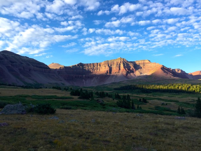
King’s Peak peeking its head out at sunlight towards the left.
Overview: 28.8 miles, 4.1k elevation gain
This hike isn’t overly difficult; it only takes endurance. Between the 3 hour drive to the trailhead from Salt Lake City, to the seemingly endless 12 mile approach to the base of King’s Peak, this hike makes for a hell of a day.
Christina and I set our alarms for 12:30am and were on the road out of SLC by 1am. We arrived at the Henry Fork Trailhead (9,400 ft.) and were on our feet hiking by 4am. We wouldn’t reach the car until after 7pm that evening, making our day a little longer than 15 hours.
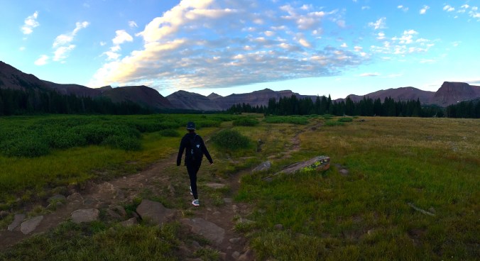
Hiking through Henry’s Fork Basin at sunrise.
The good news is that the elevation here is gradual. In fact, the first half dozen miles seem nearly flat (especially if you’re setting out in the dark and focusing more on not tripping over the rock-and-root-filled trail). The distances I read online were confusing and felt inaccurate once we had hit the trail. Here are the big landmarks we recognized for the first part of our day:
- 3 miles from TH: Sign for Alligator Lake Trail off to the right
- 5 miles from TH: Sign for Elkhorn Stream Crossing, follow this to the left
- 9-10 miles from TH: Crossing Gunsight Pass
The main trail will take you up the left/east side of the valley, where you’ll see Dollar Lake and Henry’s Fork Lake from a distance. Most people camp around these lakes before going for the summit push a day later. Be wary of campfire and human waste restrictions around this area.

For the first 9-10 miles, the main trail is clearly marked and easy to follow. Beyond Gunsight Pass (11,900 ft.), the directions we’d read online are sparse and unspecific. You have two options from the top of this pass:
- Head straight down into Upper Painter Basin and lose around 500 ft. of elevation. Follow the clearly marked, rocky trail around and up Anderson Pass to the base of King’s Peak.
- Turn right at the top of the pass and use a “shortcut” to avoid losing elevation. There’s a faint climber’s trail marked with cairns along this mountainside (which is the base of Gunsight Peak) that leads you straight to Anderson Pass. From here, you can clearly see where you’ll meet up with the main trail and where people start off on the North Ridge Route of King’s Peak.
On both the Anderson Pass shortcut and on King’s Peak itself, there are cairns virtually everywhere, which makes it difficult to decide which markers to follow.

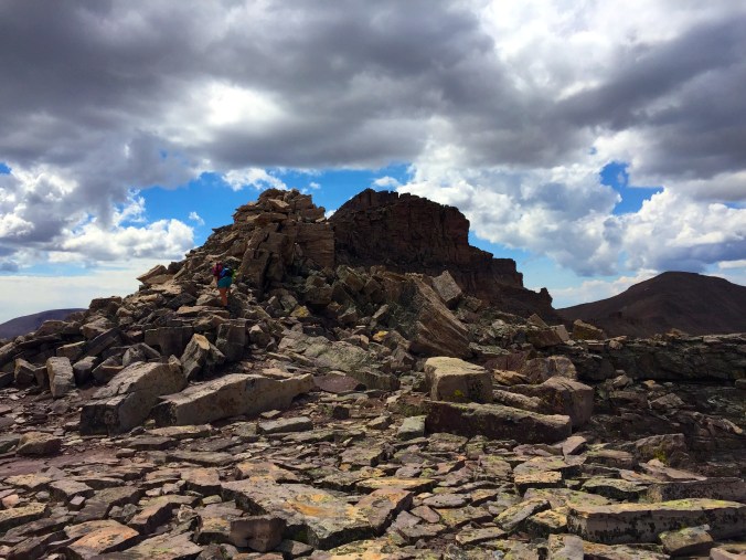
The trail loses itself on the mountain itself as we head towards the summit in the far-off distance.
One clarifying detail about this climb: This route is a 12-mile approach to the base of King’s Peak, where the climb itself turns into a class-2 scramble. There’s a lot of hand-and-foot work involved towards the summit, and we had to warn a couple people with dogs about this on their way up.

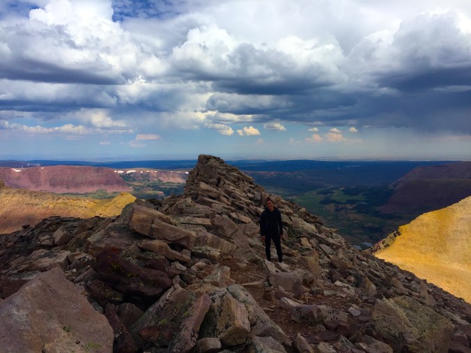
All smiles at the summit plaque!
Standing on the summit of King’s Peak is quite a thrill – you can see for endless miles in every direction, and peer the dozen miles from where you came from. If I was doing this hike over again, I’d begin even earlier to avoid the unpredictable weather patterns I discovered during my brief visit to Utah…
We’d read about a 97-degree, crystal clear weather forecast for the day we chose to hike – and I got my first lesson into the Mountain Time Zone’s frequent and unrelenting thunderstorms. Christina and I were stuck in nearly three hours of pouring rain and scattered snow, with thunderbolts screeching down to the valley below us. And of course, we had left our rain and cold weather gear at home.
Eventually the skies did clear up, and while we may have not made the best navigational decisions in our haste to escape the storm, we finally found ourselves below Gunsight Pass and facing the endless stretch of flatness to the car. Those last five miles were brutal to say the least, and I hope that Christina has forgiven me for the hell I put her through.
Our Fitbits measured a total of over 30 miles and 5,000 ft. of elevation gain when it was all said and done. No doubt this was from the few “interpretations” we took on the trail, but at the end of the day all that really mattered was that we made it back to the car in one piece.
If you’re looking to attempt this one-day’er, bring plenty of water, food, layers, be sure to learn from our mistakes – and have fun!
