Nina and I met in June while climbing Mt. Baker and immediately bonded over this shared ambition to explore the highest peaks of the west coast. Just a month after exchanging contact information we put together a plan to meet halfway between San Francisco and Orange County to hike up the tallest mountain in Nevada, Boundary Peak (13,140′).
And actually, two days before we were meeting, we decided to tack White Mountain Peak (14,252′) onto our travel plans for a 13er and 14er two-fer weekend.
Let’s talk about getting there. You’ll find the beginning of a gravel road 9 miles east of Benton off of Highway 6, on your right (south) side of the road, just across from an abandoned ranch (see Summitpost for more detailed directions). I realize now that many of the sites I was using as a reference were as many as a dozen years old, and the 6.2 mile gravel road between Highway 6 and Queen Mine has severely deteriorated since then. I drive a 4WD Jeep Liberty Sports Edition, and sincerely doubted my car’s ability to get through the ruts and deep gouges that tore up this washed-out road. Maybe the conditions have worsened in just the last two years – a trip report I read from 2013 said this road was “easy peasy” in a 4×4 pickup.
In comparison, the following day we drove up the arduous 17-mile White Mountain Peak gravel path, which is labeled as a 4WD-only road by the National Forest Service, and we found this much more passable than the Queen Mine route. Either way, we were happy to get out of the car to start our climb.
We left my car at Queen Mine proper, an obviously large flat area next to a couple of open mine shafts. There was about 700 vertical feet, 1 mile, of road walking until we reached the trailhead register at Kennedy Point and our real hike began.

The Queen Mine trailhead register.
This first part of the hike was steep, and I could feel the altitude at 10,000 ft. sucking at my lungs. It didn’t take too long to ascend this first ridge, which flattens out after just a thousand feet into a nice sloping meadow where you can see wild horses, deer, and marmots. The Trail Canyon saddle slopes down to the left of this ridge and is unofficially “marked” with a pile of rocks and logs that created a perfect morning break spot to fuel up and hydrate before tackling the peak.
Here’s an overall breakdown of our timing:
- 7:00am: Left Queen Mine trailhead
- 8:30am: Took a break at the Trail Canyon saddle
- 10:15am: Reached the summit of Boundary Peak
- 11:00am: Departed the summit
- 12:30pm: Took a second break at the Trail Canyon saddle
- 1:45pm: Arrived back at the car
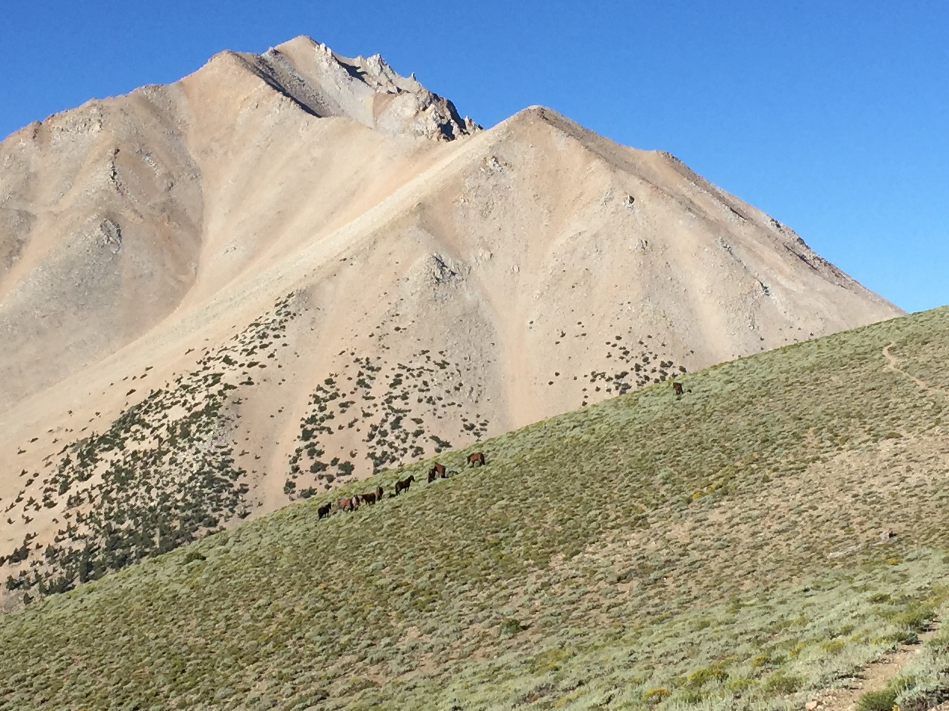
Our first views of Boundary Peak, a little less than a thousand feet above the trailhead… with wild horses!
These first views were quite intimidating, but it was really only from this point that we could see the entire mountain. As soon as we descended to the Trail Canyon saddle, we could only see that first false-summit on the right. In fact, we’d forgotten about this image and believed that we were walking up to this first (much shorter) peak, to the actual summit.
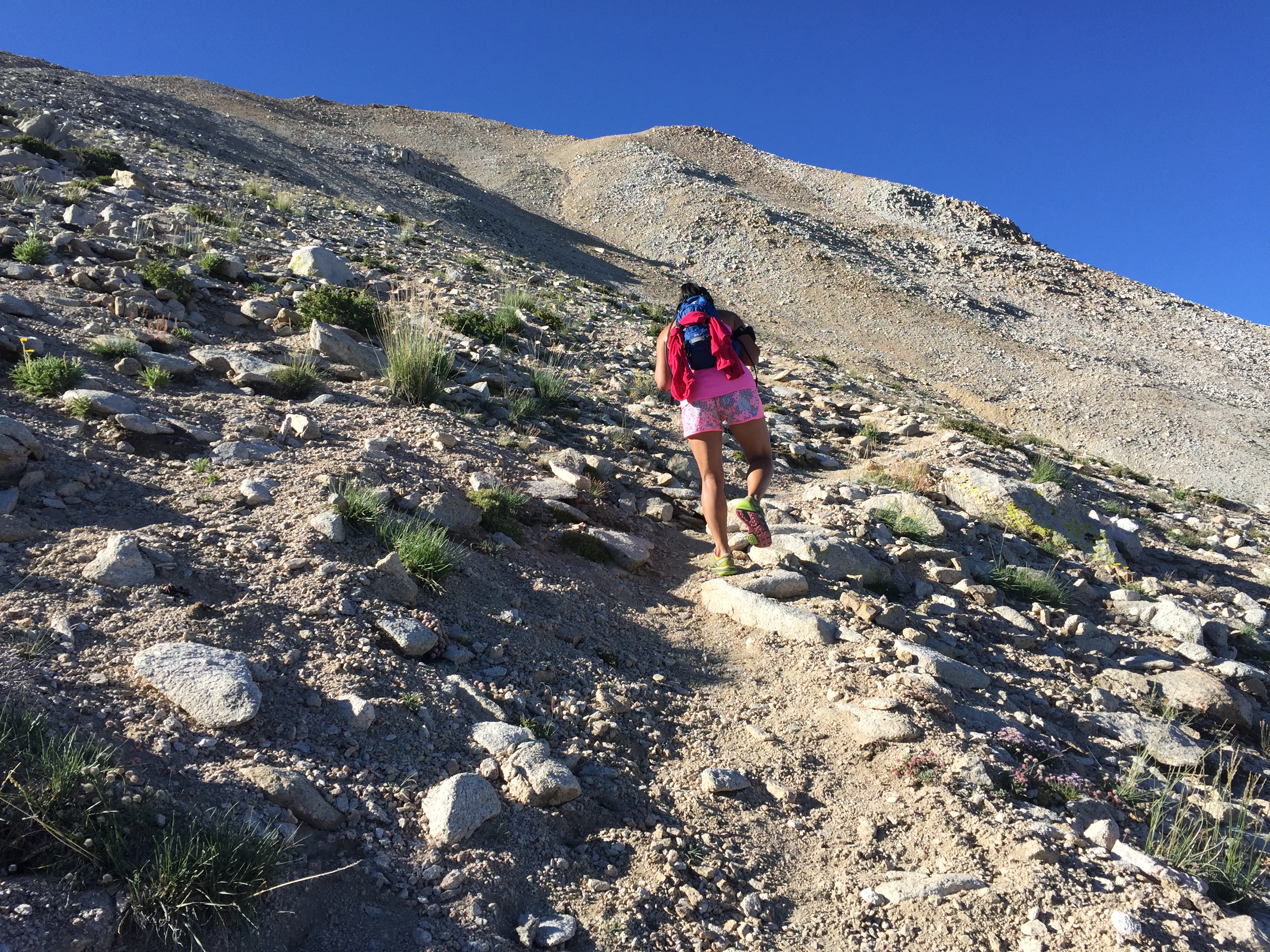
Finally heading up Boundary Peak.
You can see what we thought was the true summit here, when we really had an extra 1.5 hours and near a thousand vertical feet to gain still. The trail was reasonably sloped, covered in rocks and scree. It might’ve taken us just as much time to go up as it did to return since we were constantly slipping on the unstable conditions.

Looking down at Trail Canyon saddle. Farther to the right you can see the slightly uphill path that leads to Queen Mine.
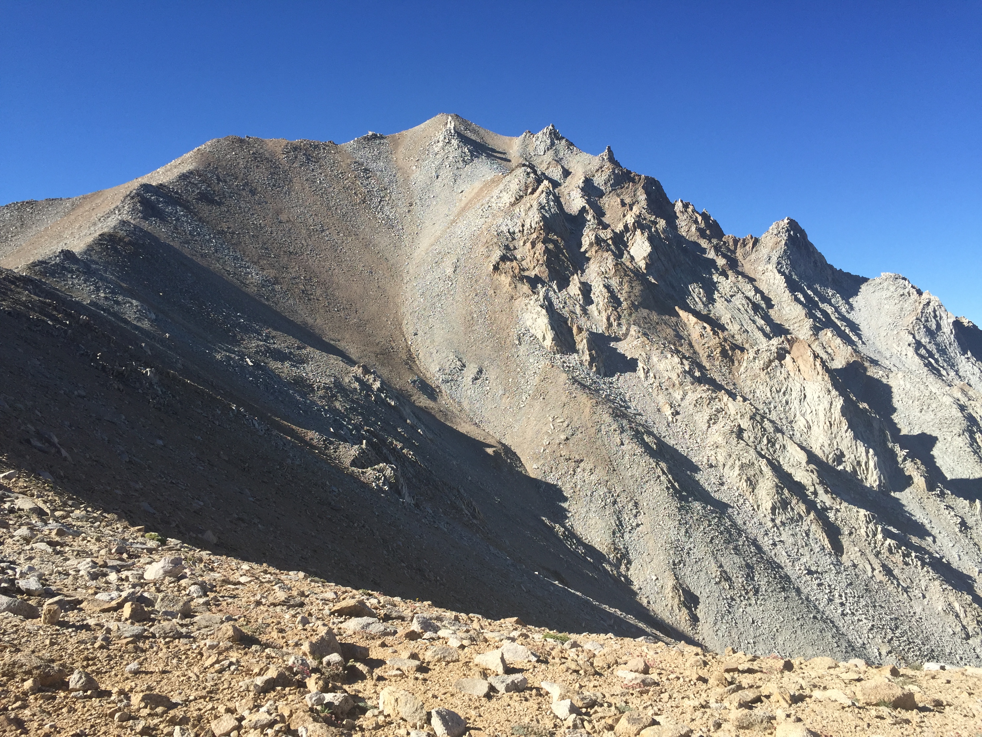
Our favorite view of Boundary Peak.
This was the “ah-hah” moment where we realized we were very, very miscalculated in our summit estimating. Overall, the trail was well-defined, and we never had too much of a problem finding the path once we’d wandered off. There were parts we chose to follow rock paths and bouldered up to avoid unnecessary elevation gain or loss, but the ridge was relatively easy to follow.

Looking across Nevada at the summit.
Reaching the summit felt like quite the accomplishment! We could see across Nevada and over to the Sierras and Yosemite region of California. On the top, Montgomery Peak (13,442′) loomed back at us from California. We speculated where the state border actually laid, and contemplated a second summit, but couldn’t spot a good trail and noted that the final 800 or so feet looked a little too sketchy.

Summit of Boundary Peak, looking across to Montgomery Peak, a few hundred feet higher.

Looking down the ridge we ascended from the summit.
Returning down the way we came, we used the ridge above as a natural handrail and made our own path until we met with the Trail Canyon saddle again. We had run into 3 other groups during the day, and all 3 had also come from Queen Mine. Notably – we were also the only women we saw on the mountain that day (girl power!)
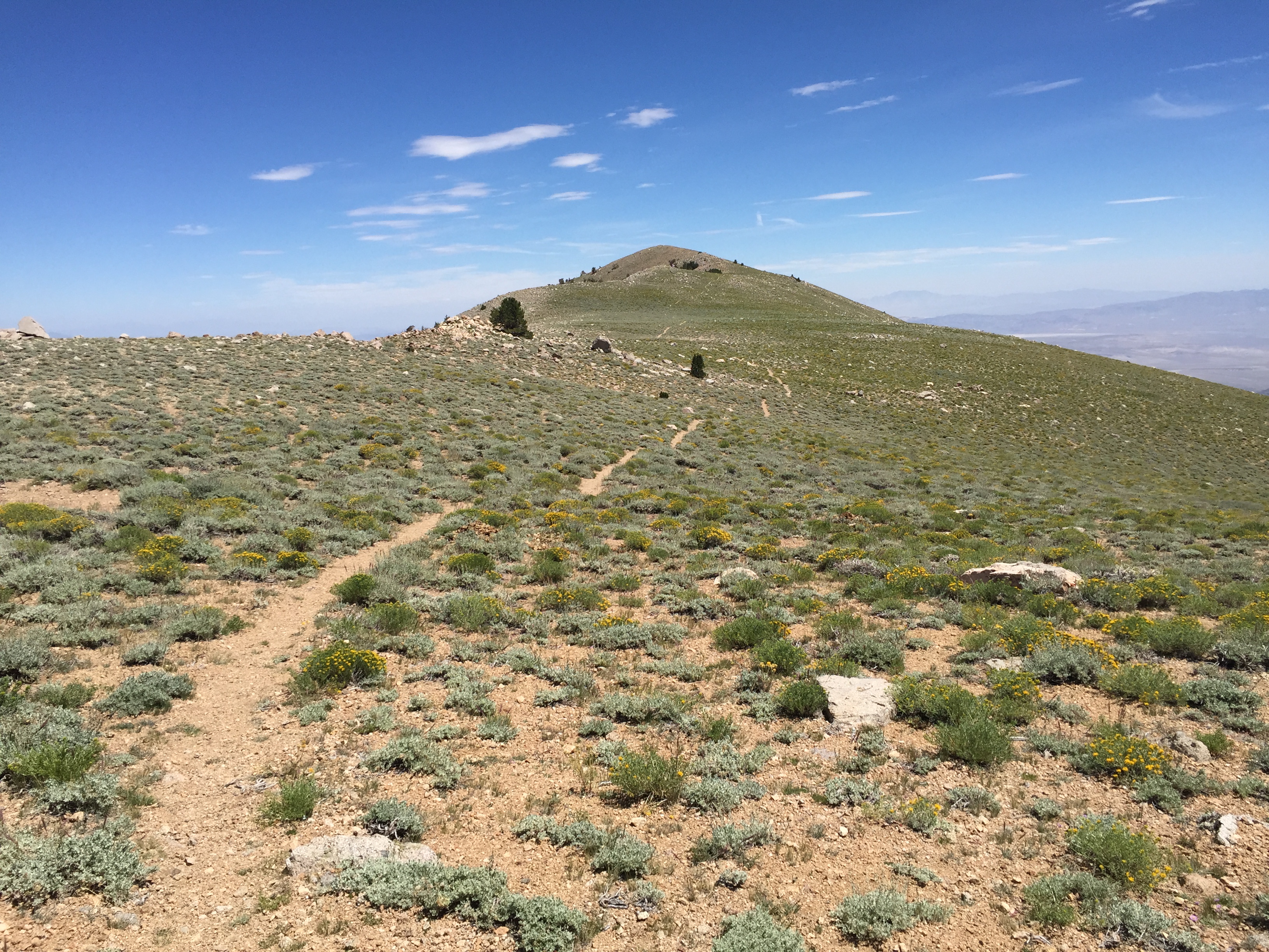
Returning through the meadow until dipping down to the left to Queen Mine.

Looking down the valley from Queen Mine.
Below you can see where we chose to park – at the entrance to the abandoned Queen Mine. You can faintly see the road continuing up the ridge on steep switchbacks that take you 700′ up to Kennedy Point and the official trailhead. I never got a shot in the morning, but there was enough room for a few cars and tents with a firepit just to the right of my Jeep. By the time we arrived back at the car in the early afternoon, it was hot. The cool breeze that had kept us company at altitude disappeared once we’d reached the valley. Since this is one of the most remote desert hikes, and there are no sources of water along the trail, I’d highly recommend bringing three liters of water.
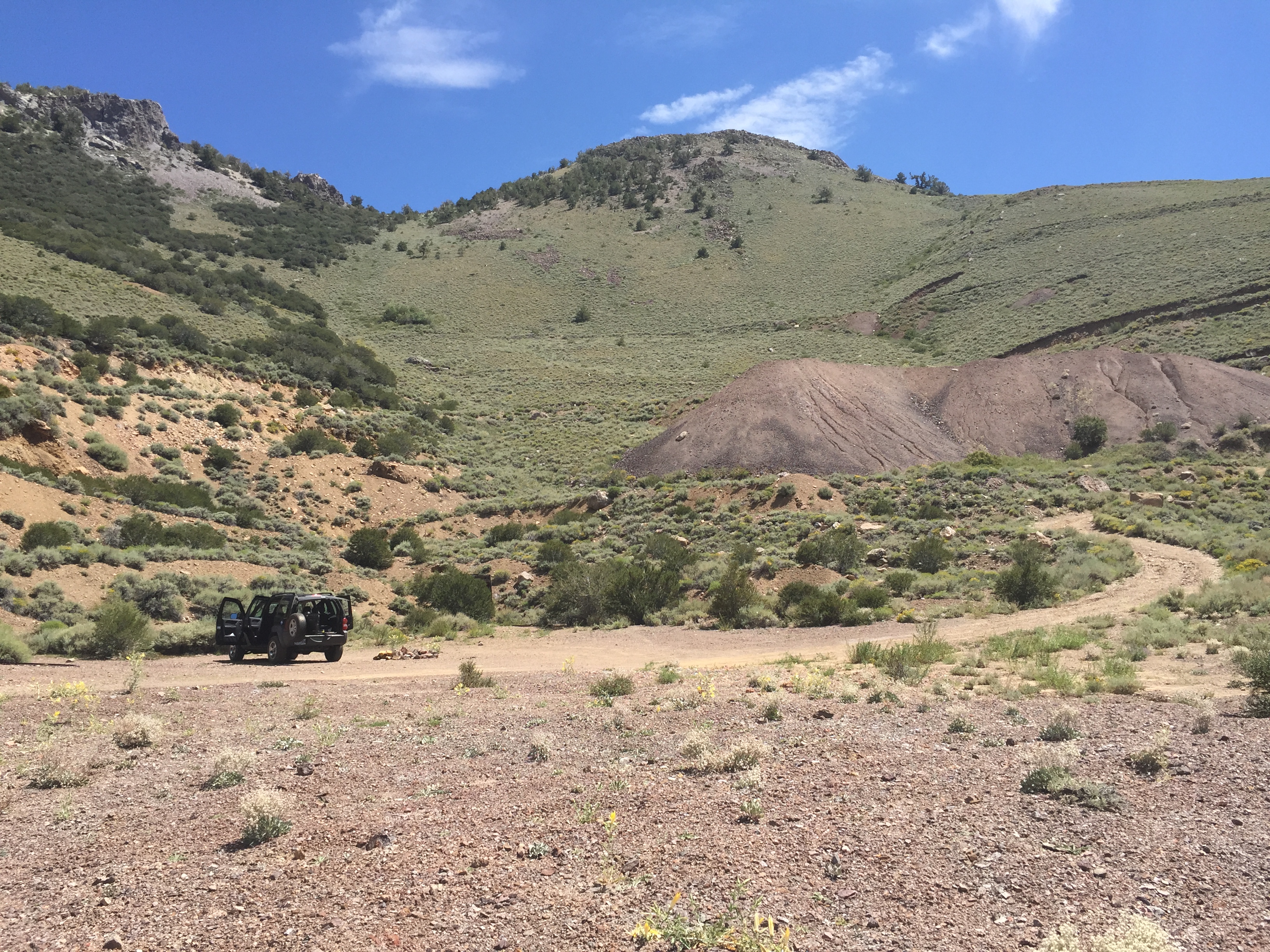
This is my recommended parking spot, next to the Queen Mine, before the super-rugged road conditions start to the traditional trailhead.
Leaving the trailhead, we were back in Bishop by 3:00pm… With just enough time to feed our hiker hunger and get ready for our ascent of White Mountain Peak in the morning.
QUICK STATS
- Length: 10.4 miles
- Trailhead: 9,200 ft.
- Summit: 13,146 ft.
- Elevation gain: 4,000 ft.
- Time: 6:45 total, 6:00 moving
A few resources I found really helpful before this climb…
- Boundary Peak on Peakbagger.com
- Step-by-step of Queen Mine route by Calipidder
- Queen Mine route on Summitpost
- A second Queen Mine report on Summitpost

These are some of the best shots of these peaks that I have seen. Awesome!
LikeLike
Thanks! 🙂
LikeLike