It’s difficult to have a car in San Francisco. But it’s oh-so worth it when it comes to weekend getaways, especially with all the Bay Area has to offer. I’ve been to Muir Woods, Mt. Tamalpais, and Stinson Beach more times than I can count, so a few weeks ago I decided to check out what’s hiding in the East Bay, and found the perfect day trip less than 30 minutes outside of the city.
Redwood Regional Park, part of the East Bay Regional Park District, is a huge open space that’s super accessible, tucked away in the East Bay hills just a short drive from Oakland. From San Francisco, take 580 East off of the Bay Bridge and turn left off of the 35th Ave exit. This road turns into Redwood Road, which will take you to the main entrance of the park. There’s plenty of parking for a $5 fee, or you can squeeze in between other cars on the side of the main road just outside the entrance, which is how I entered the park today.
I created my own loop based on recommendations I’d read and convenience to my car location, but you can view each trail and loop more closely on Mappery.
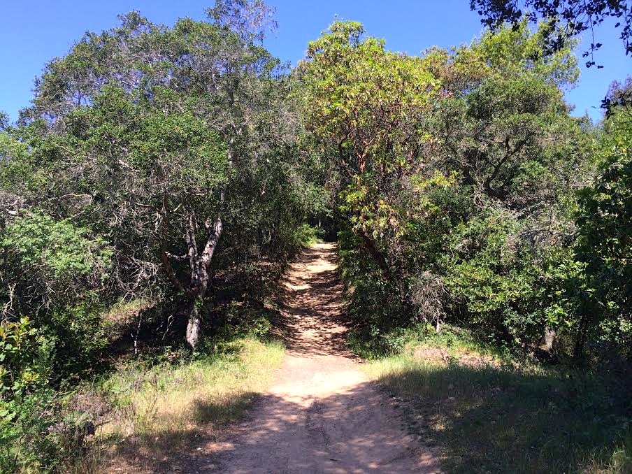
When I first entered the park on foot, I found a couple of ways to jump up on a trail to my left that ran along a creek bed. This area of the park is lush with green plants and glows under a canopy of trees, with a very small one-track trail lined with rocks and roots. I managed to fall flat on my face within the first five minutes of my day.

Winding up towards the West Ridge Trail
I followed this trail up the left-side ridge and hit my destination, the West Ridge Trail, and continued on higher up. The path widens here to accommodate equestrians, bikers, and more hikers, and goes for miles and miles – and steeper and steeper. The West Ridge Trail narrows and widens again, snaking through thick forests and leveling out at look points with stunning views. I passed through so many ecosystems, from the thick green forest you see above through tall redwoods and up above dusty pastures covered in wildflowers.
More uphill on the West Ridge Trail
These first few miles were the steepest of the day, and I was regularly alternating between trail running on flat surfaces to cutting my pace in half up hills. The bulk of my elevation gain was condensed into just the first third of this hike, which means ending the day at 1.6k total gain made a strenuous beginning. At the highest point of the West Ridge Trail, the path crosses a road that leads to Chabot Space & Science Center, and from then on, it’s pretty much all downhill.

Looking back up the West Ridge Trail, winding through the redwoods.
Just about halfway through my hike, the windy trail through the redwoods evened out to a gaping valley on my right, and a parking lot up emerged ahead on the left. This is where the West Ridge Trail becomes the East Ridge Trail, and where I found many more people either starting or ending their day. There are a lot of leisurely trails that fork off of the main one and many people wander down these for shorter hikes or picnic spots. It’s easy to get stuck here, enjoying the views.

View from the East Ridge Trailhead. Naturally, the photo does not capture the beauty of this spot.
The last half of the hike was easy, and mostly downhill. The East Ridge is unlike its other half in that it’s largely exposed, dusty, and out of the redwoods. But both of these things also mean that I was able to see farther because of the lower tree line, and I paid more attention to the hills on the horizon since I was looking their direction, heading down. There’s something about a view like this, when I’ve stopped long enough to feel the blood in my limbs slow and my lungs open and I feel like I’m seeing this distance for the first time. It’s like taking that first breath of air when you come up from an ocean dive.
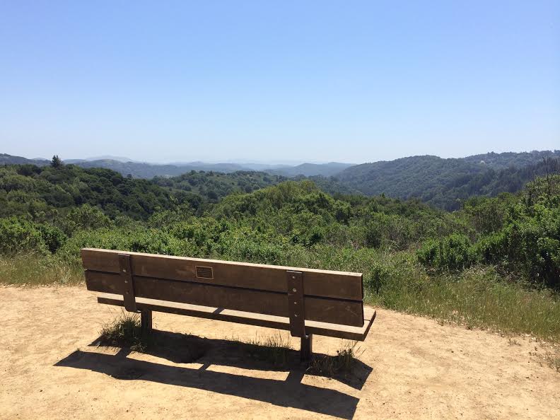
Afternoon rest spot on the East Ridge Trail, Redwood Regional Park.
It was a beautiful, easy day that wasn’t completely inundated with crowds (unlike other Bay Area hiking options), and it reminded me of how lucky San Franciscans are to have so many options in this area.
QUICK STATS
- Length: 7.5 miles
- Elevation gain: 1.6k
- Time: 2.25 hours
